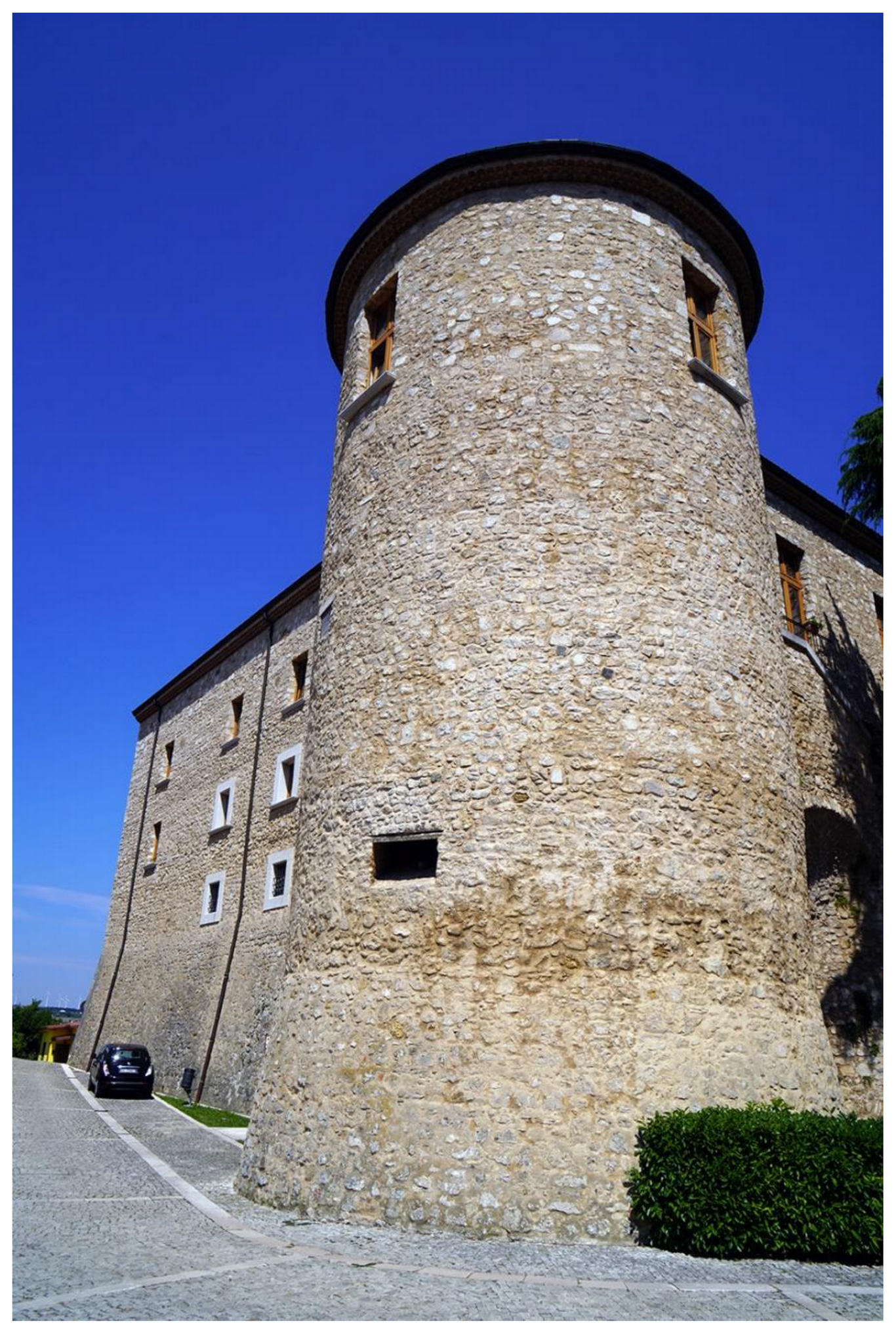
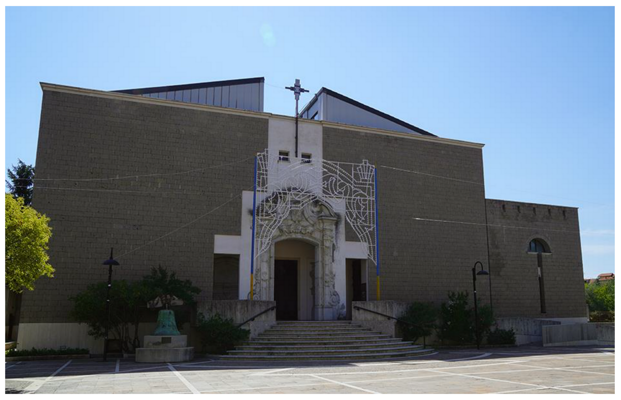
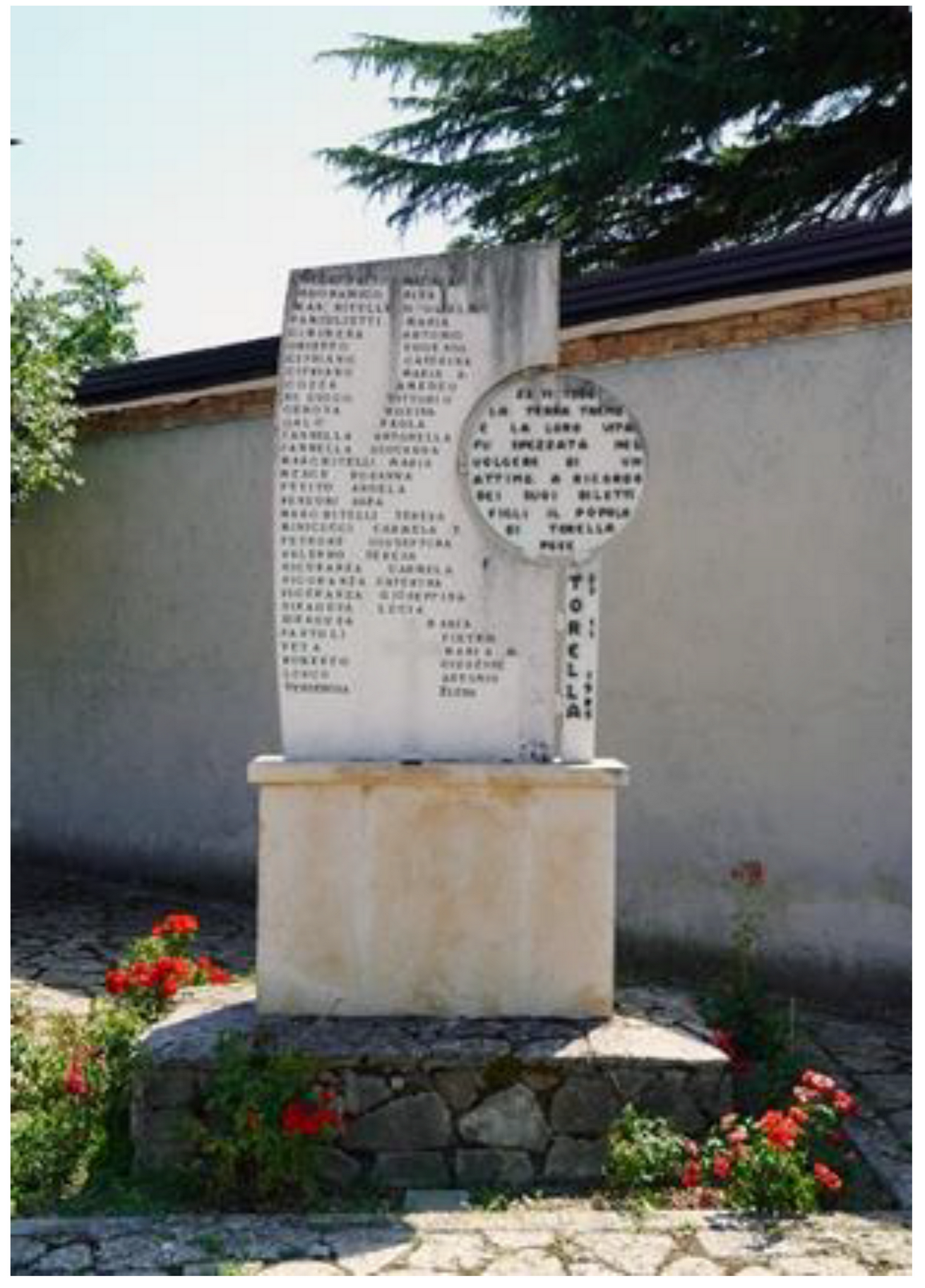
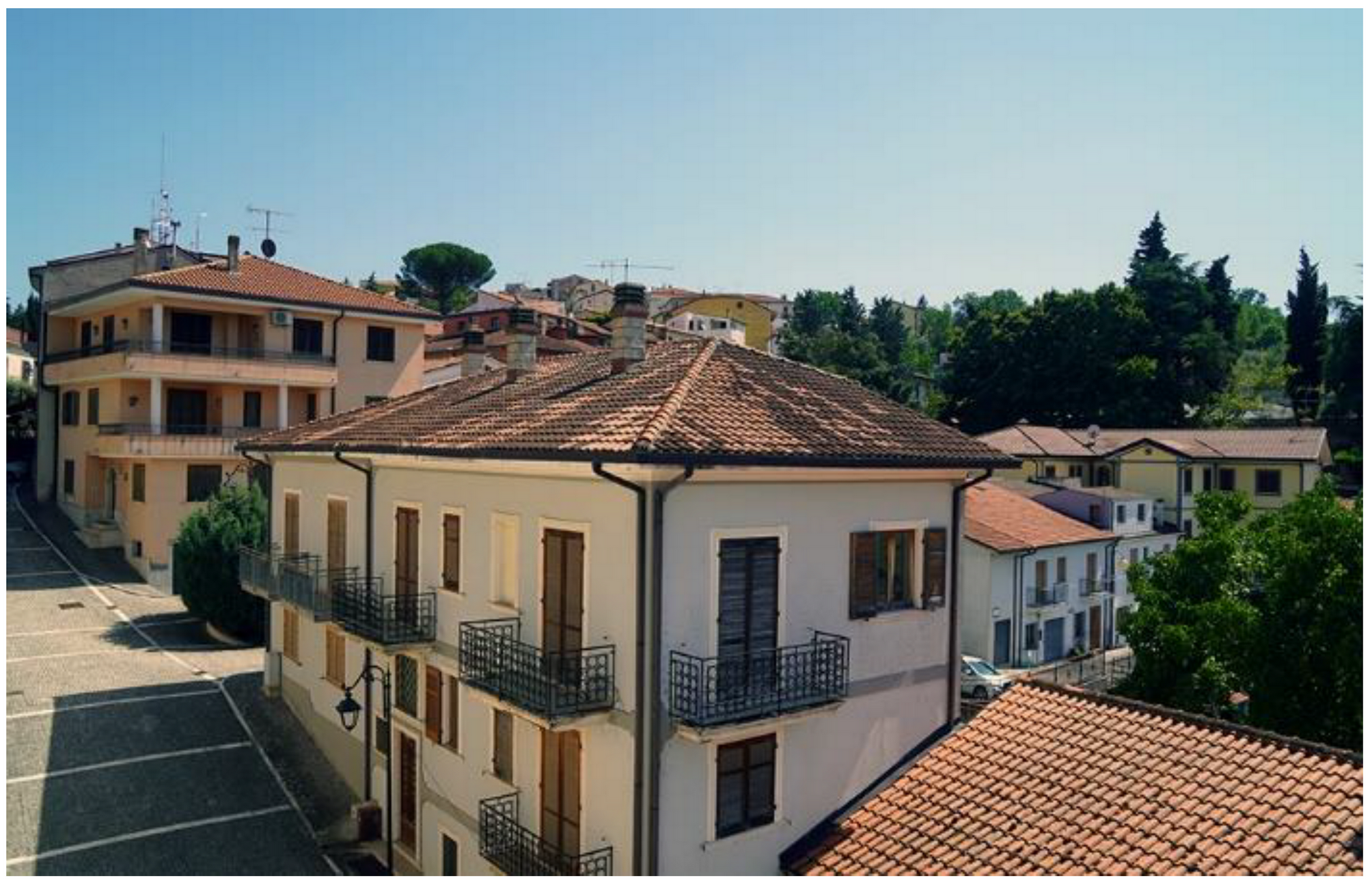
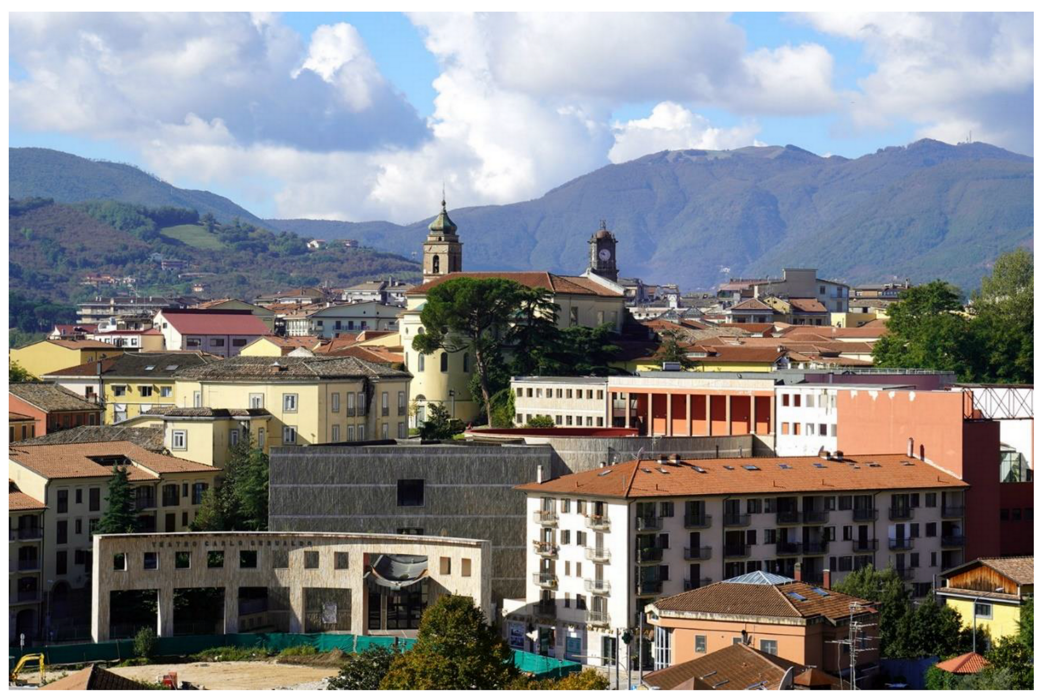
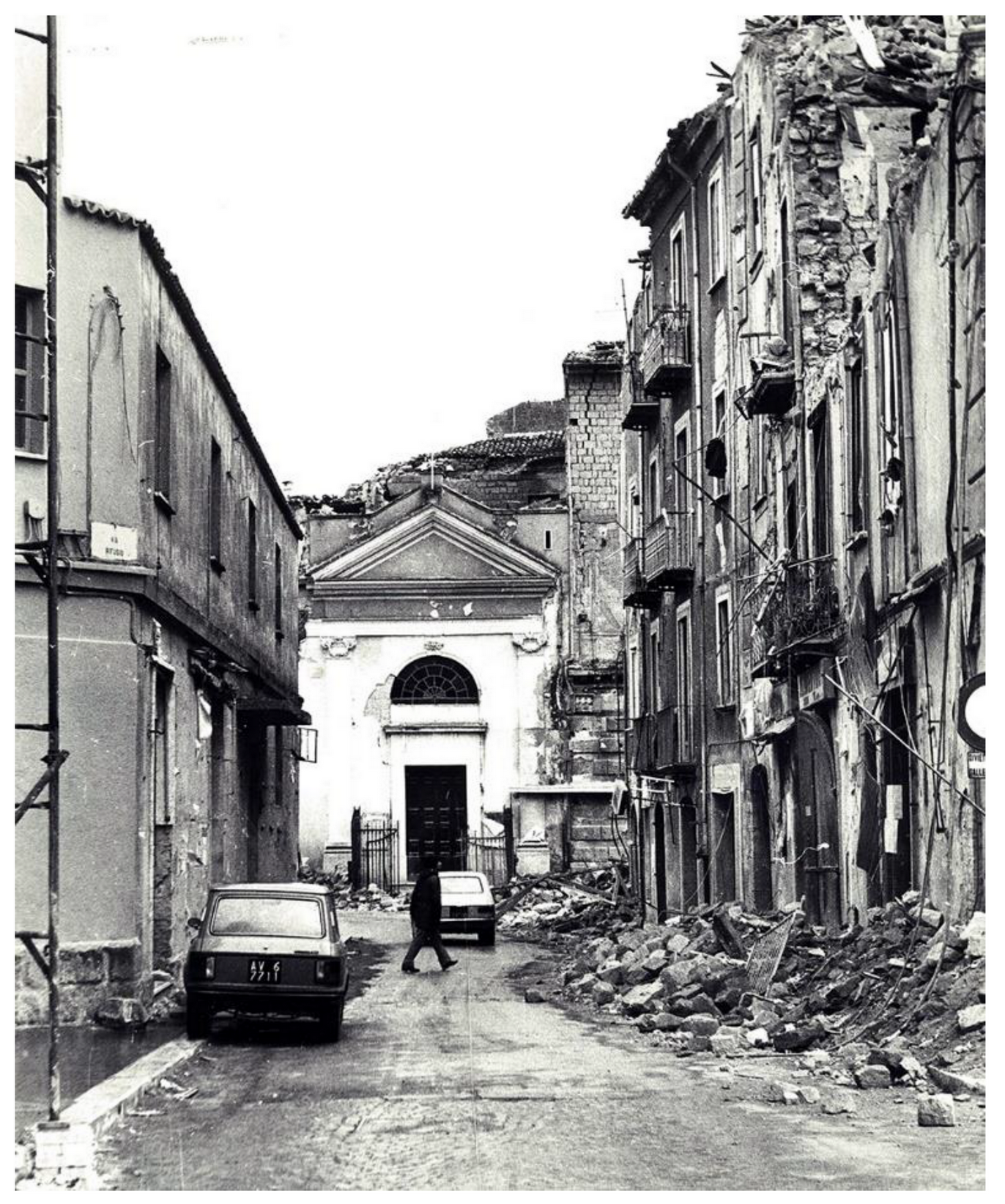
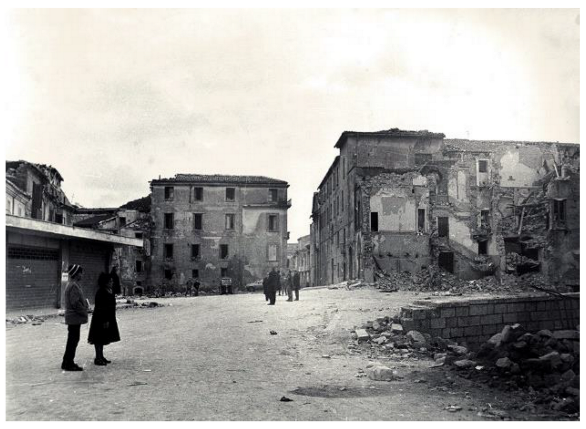
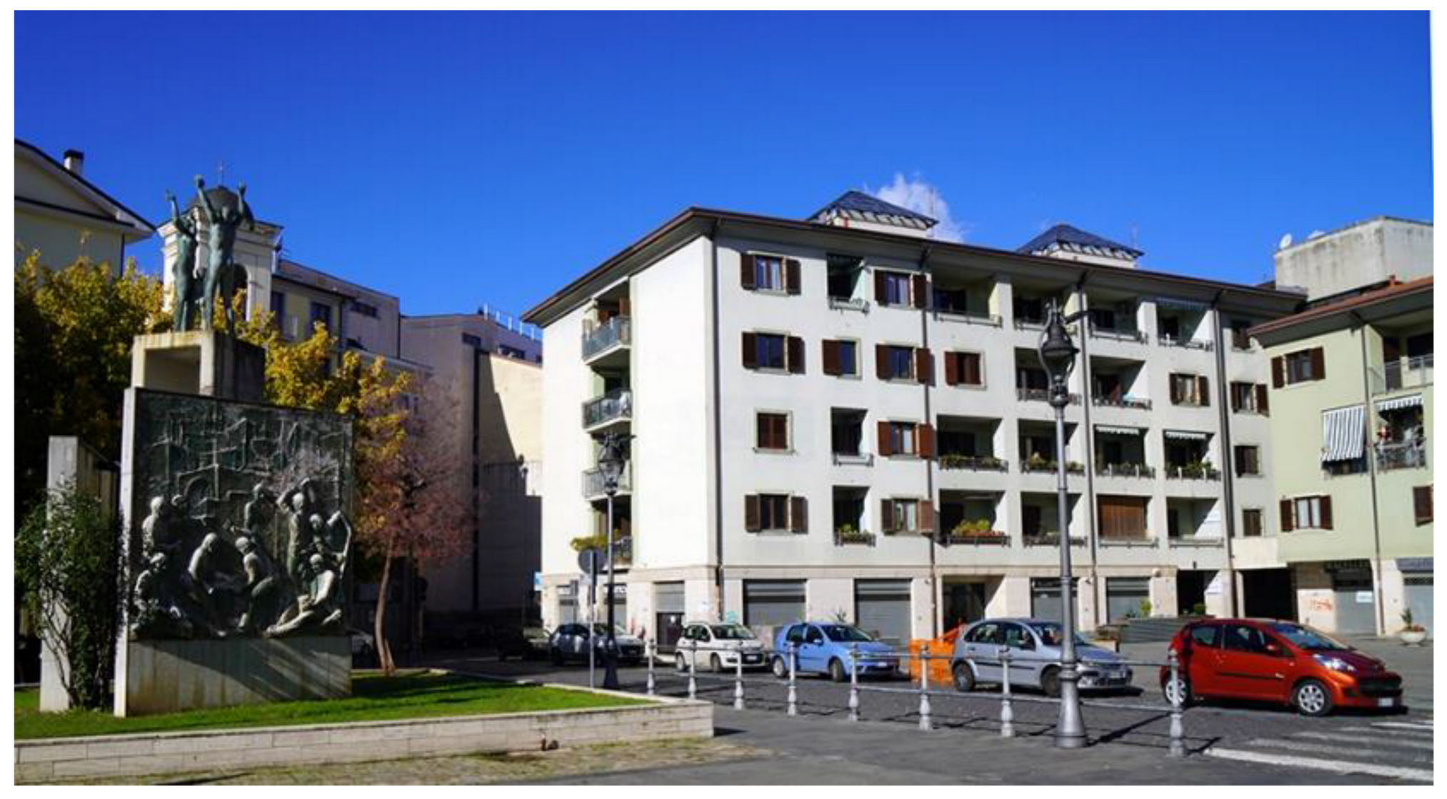
Photographic Reportage on the Rebuilding after the Irpinia-Basilicata 1980 Earthquake (Southern Italy)

 ,
,  ,
,  , and
, and
Abstract
:1. Introduction
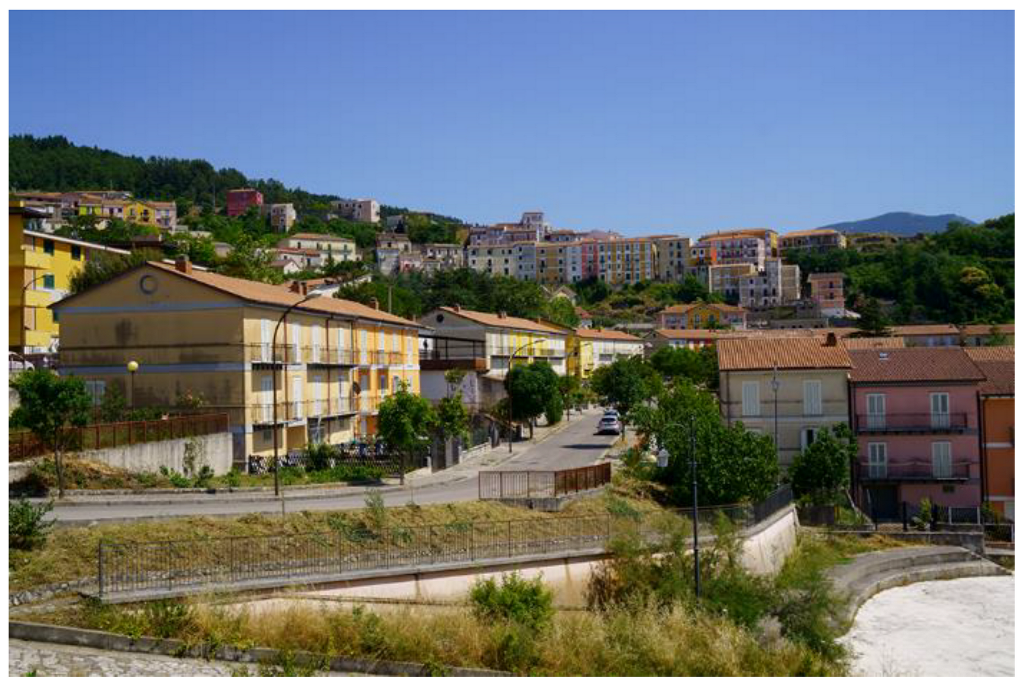
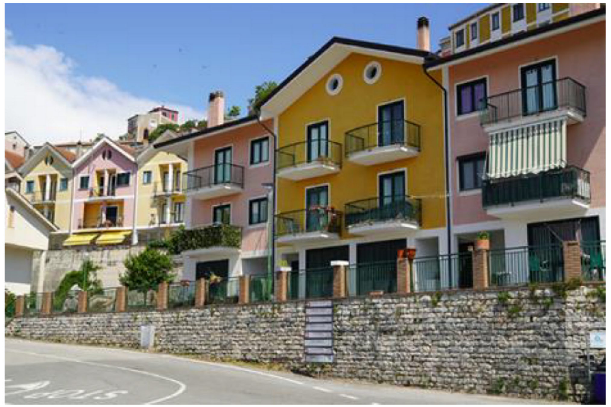
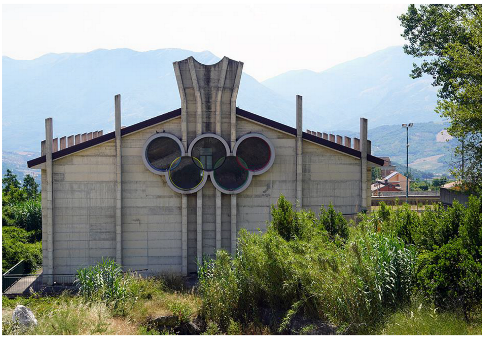
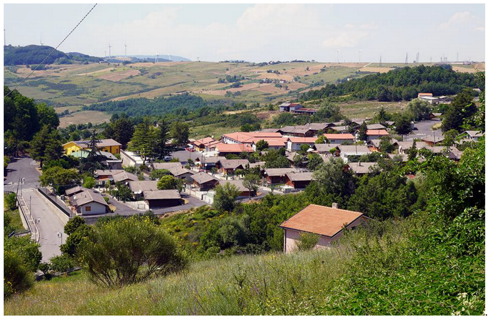
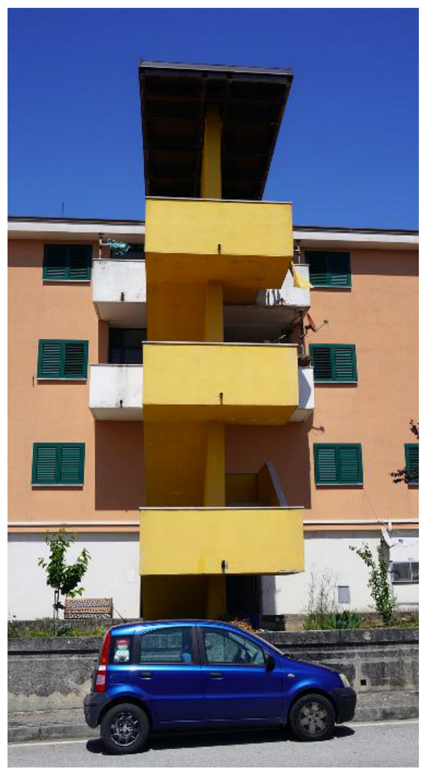
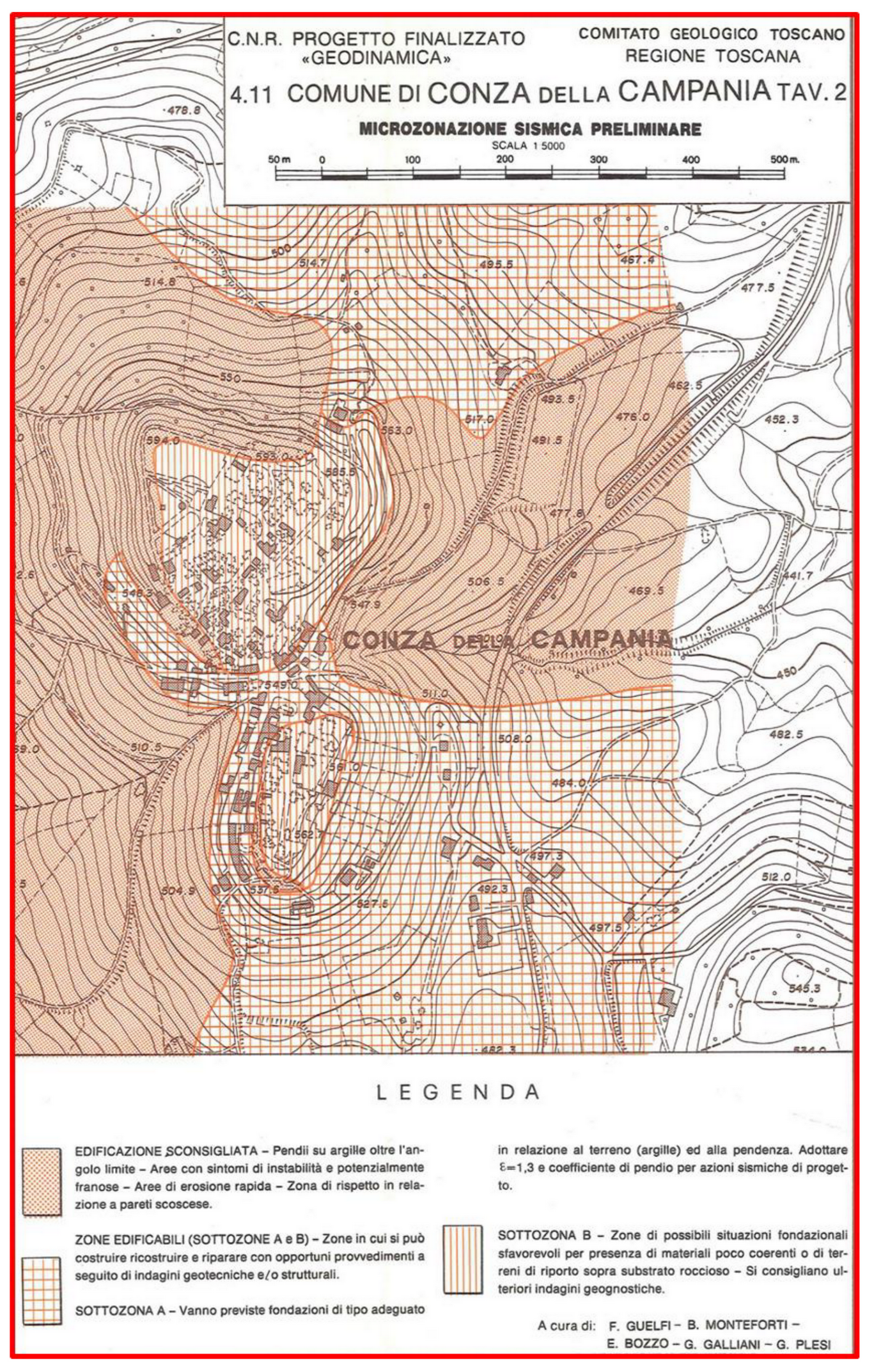
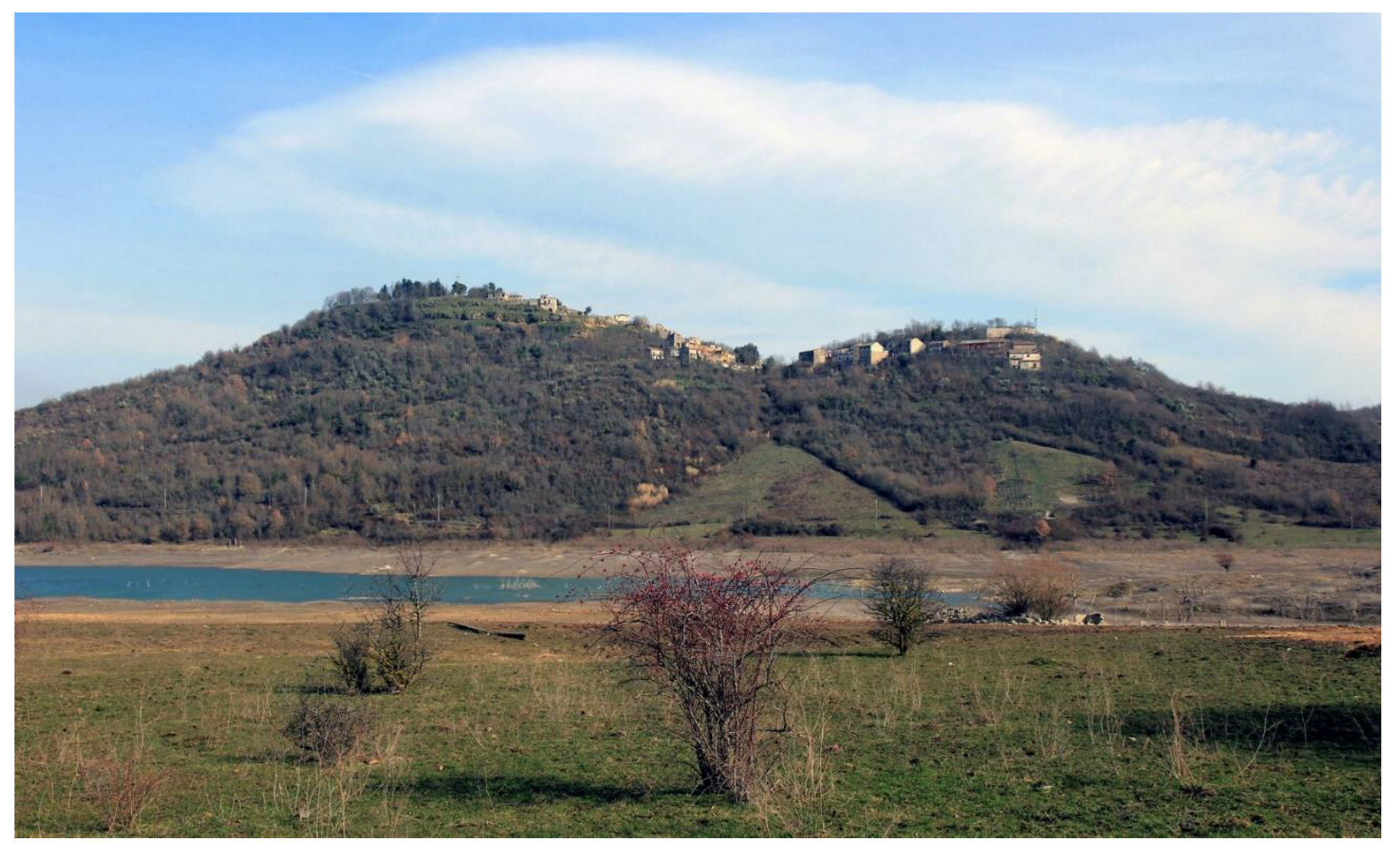
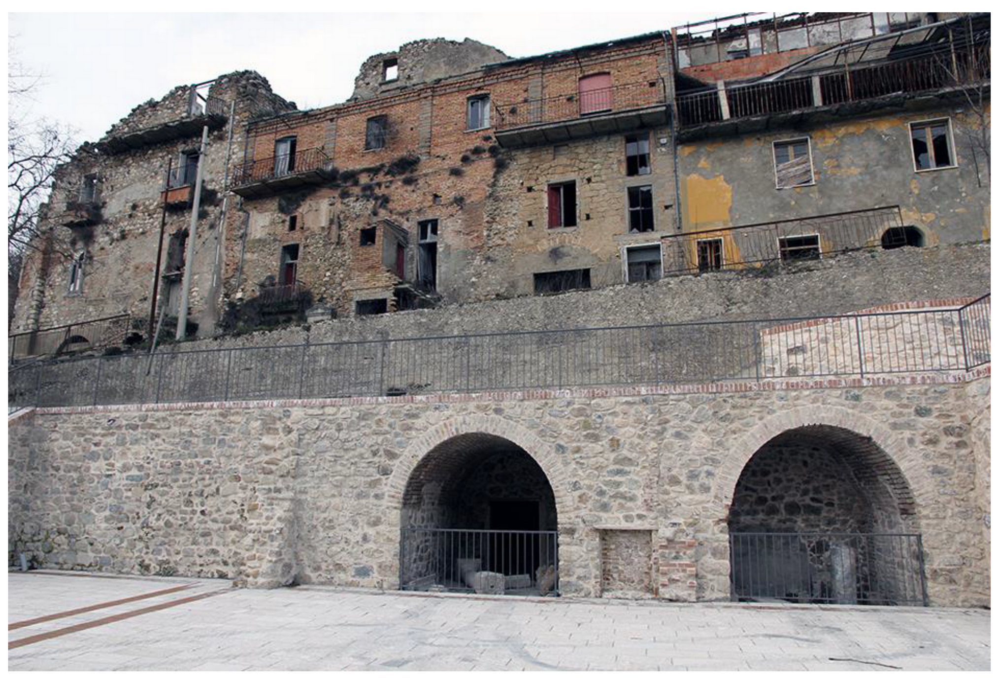
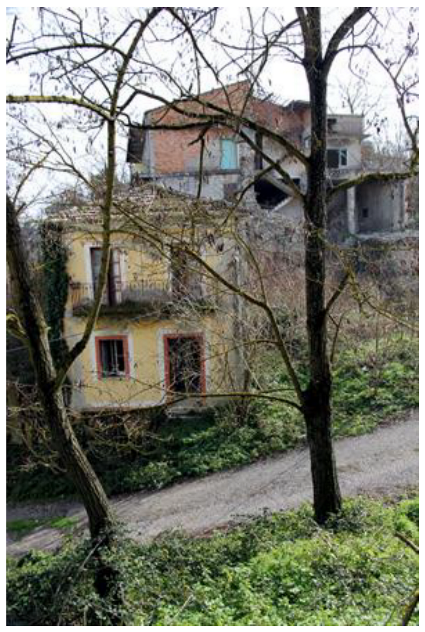
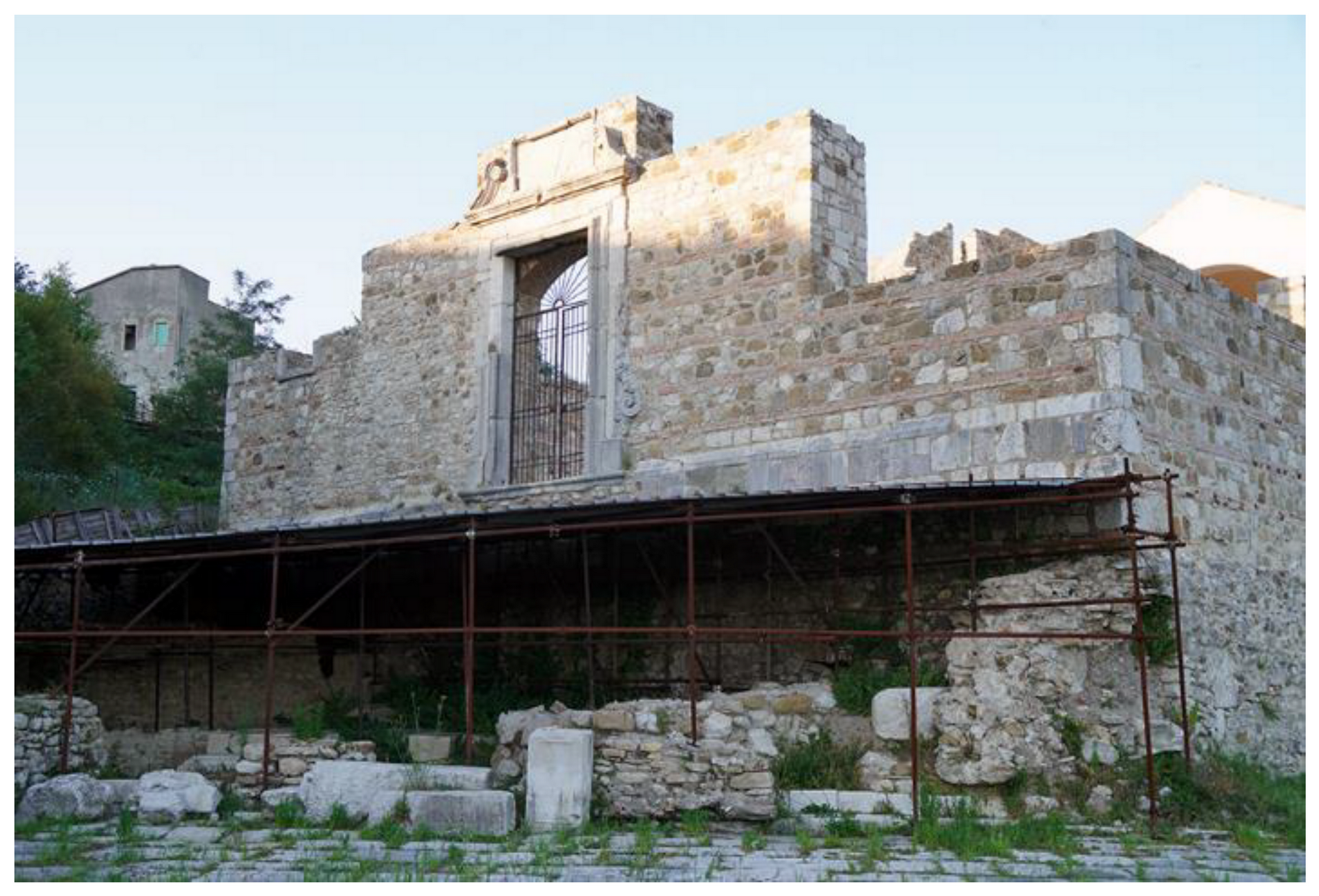
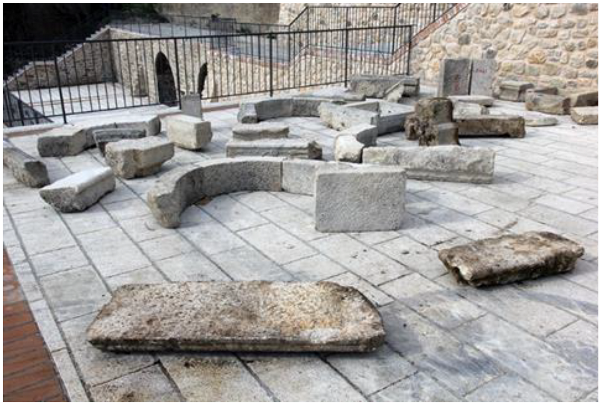
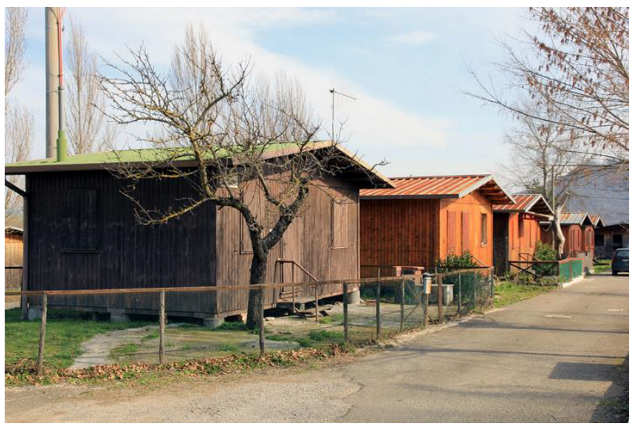
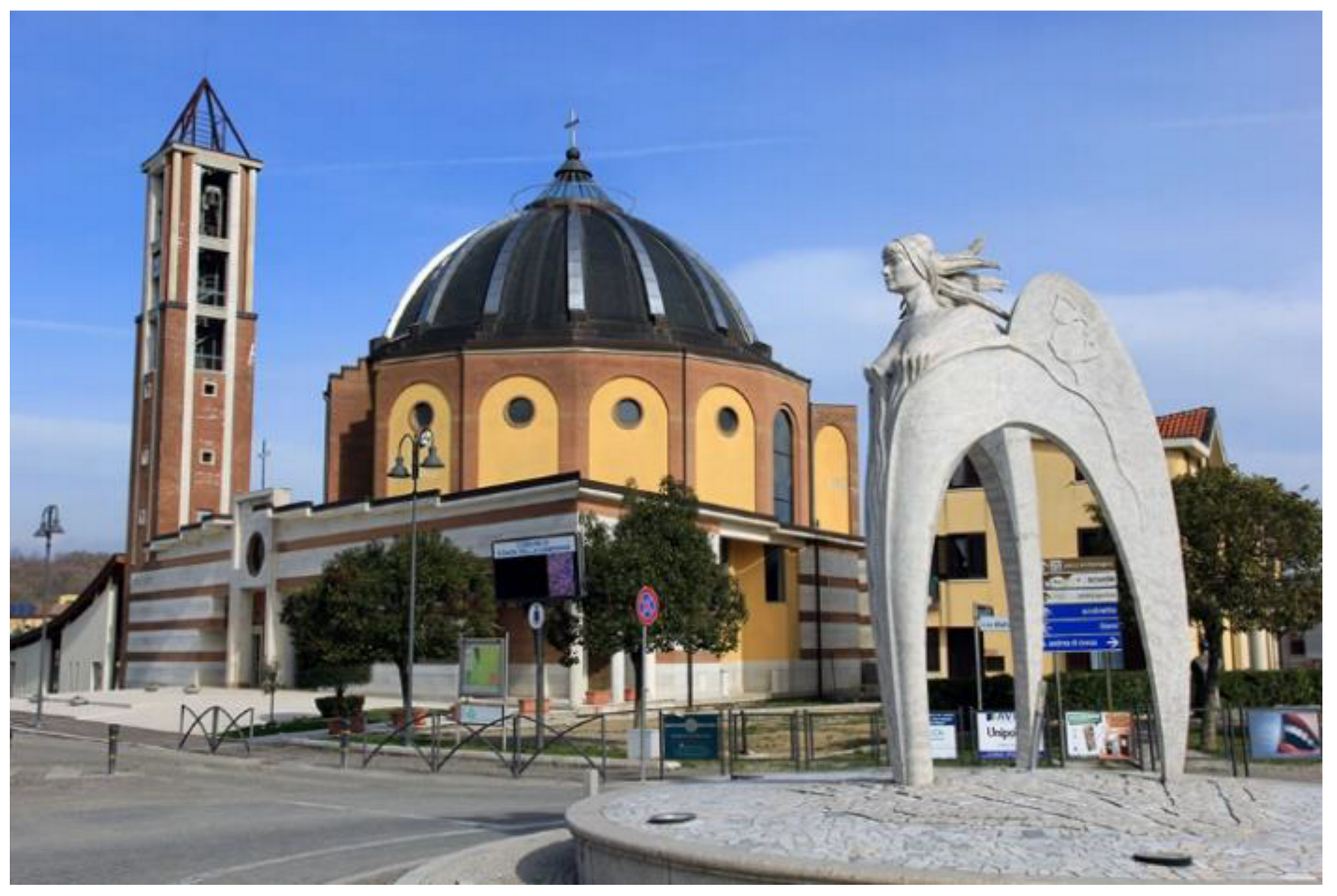
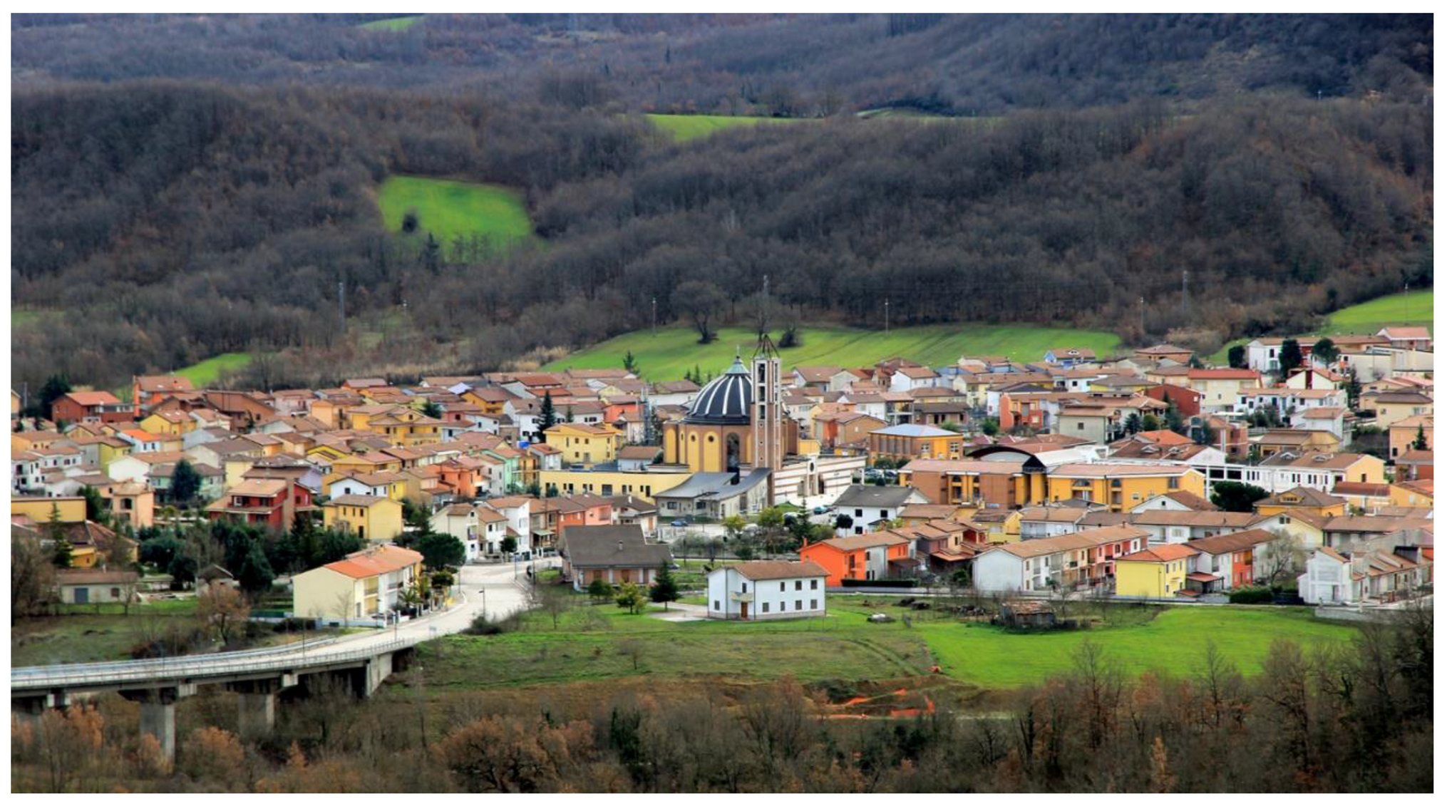
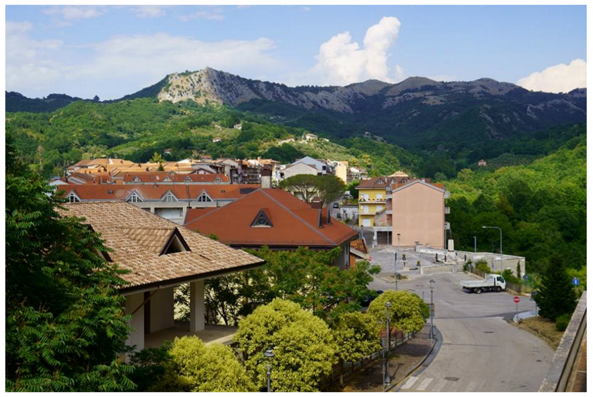
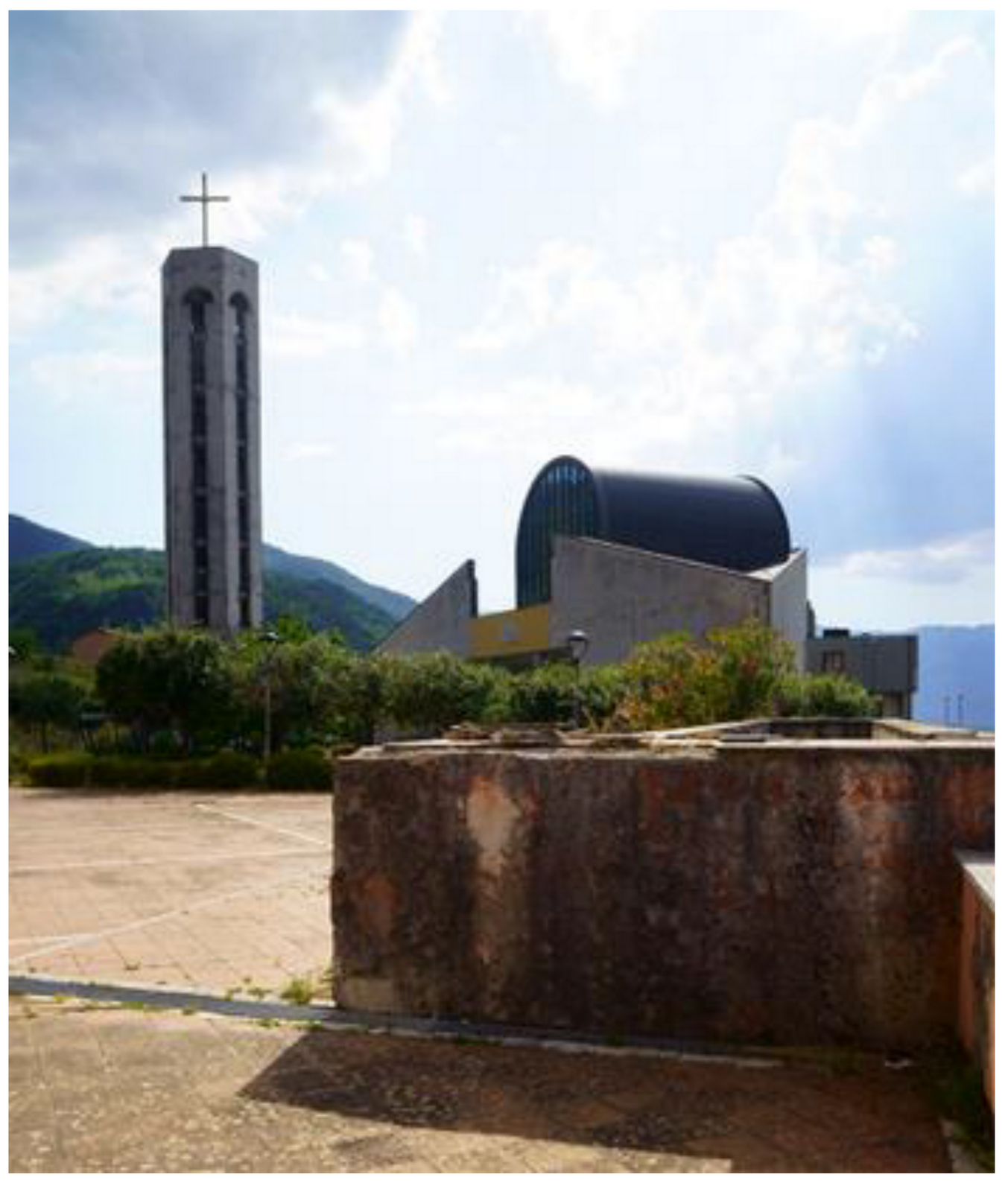
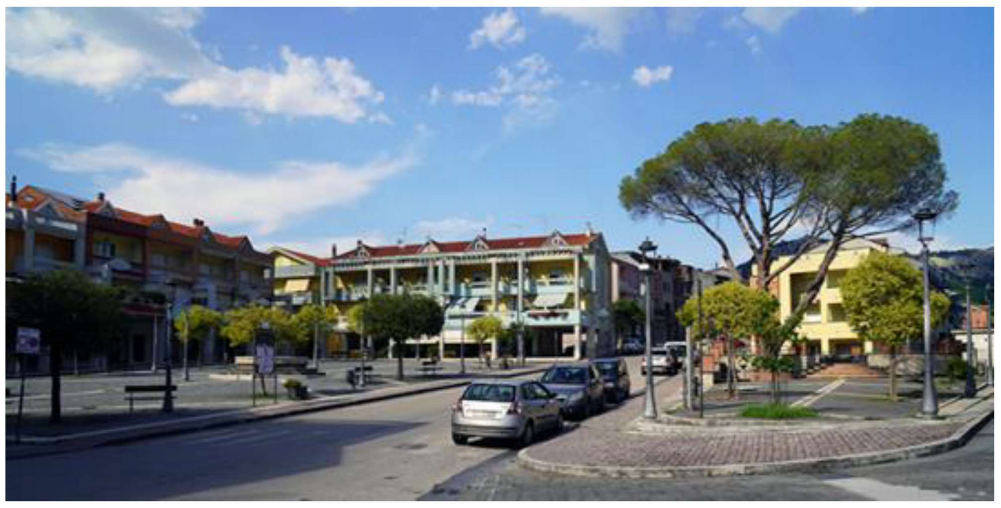
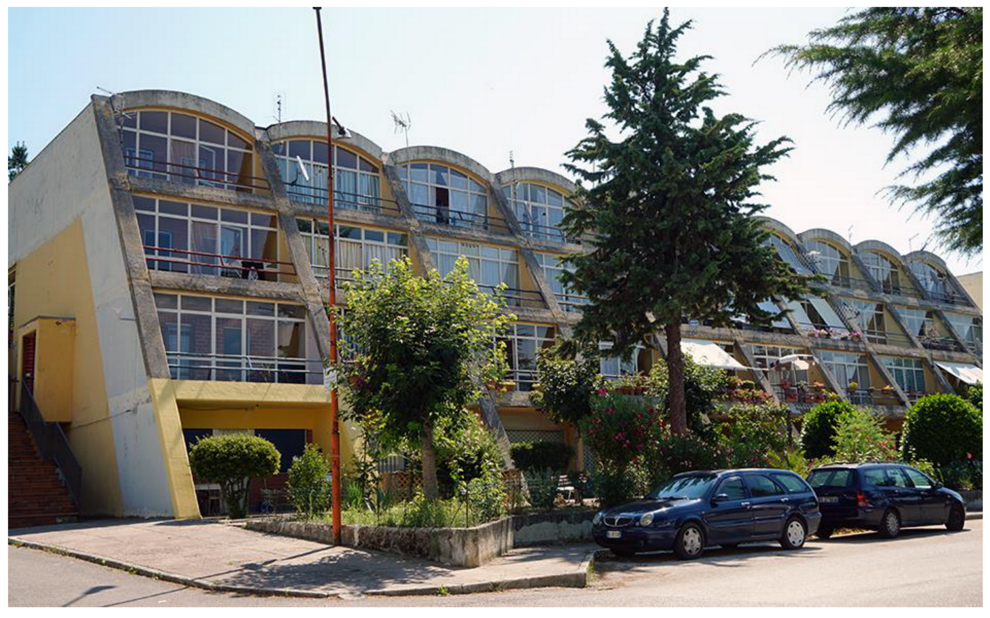
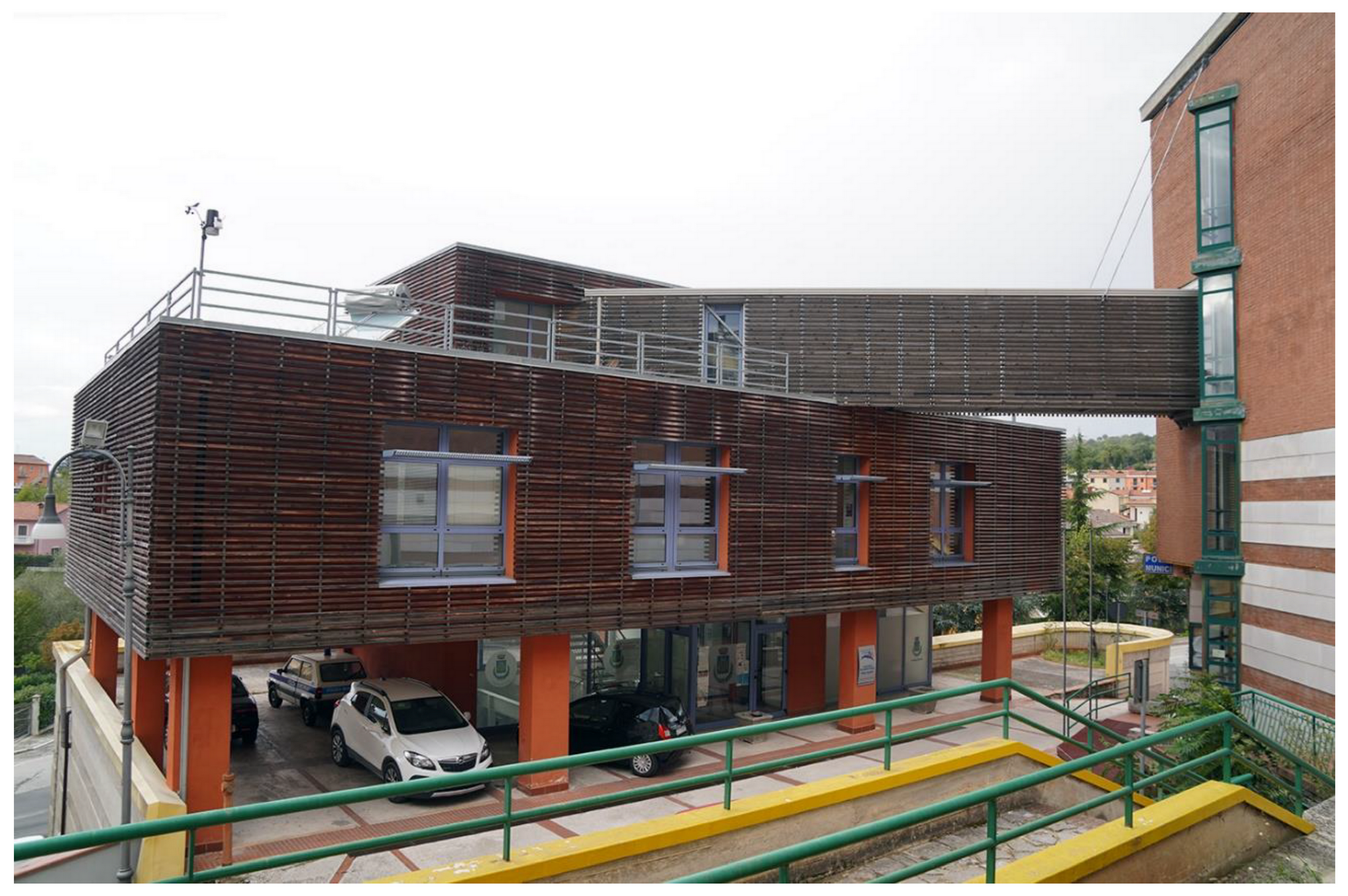
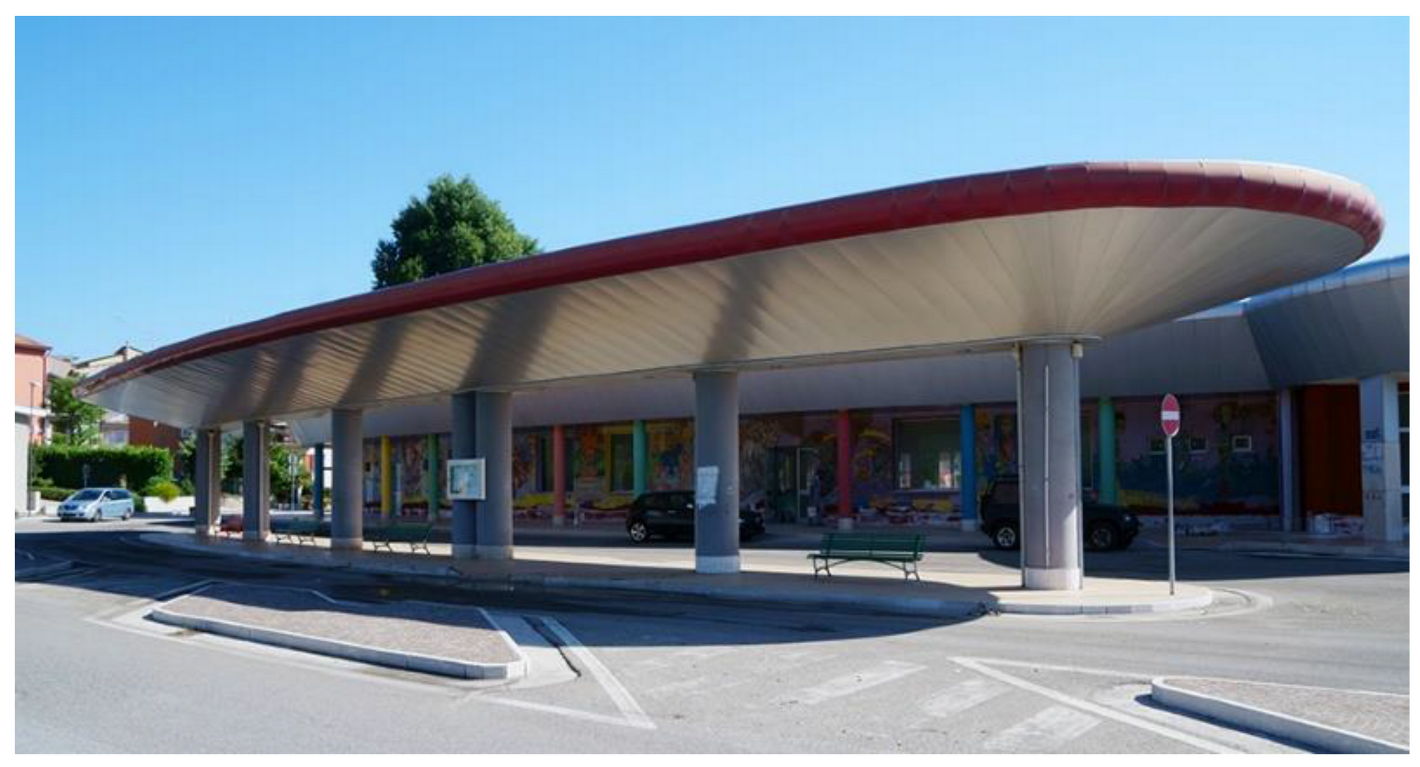
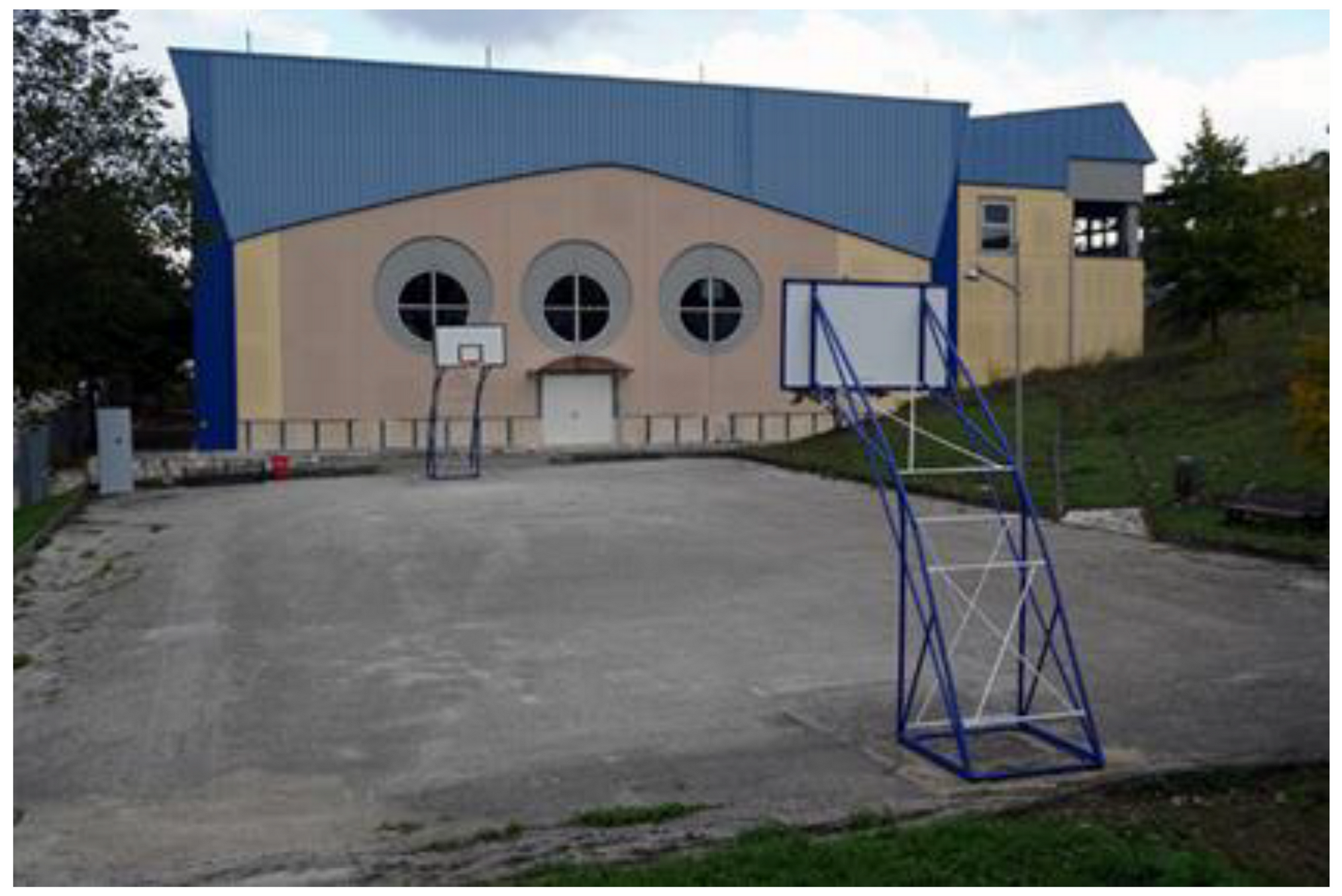
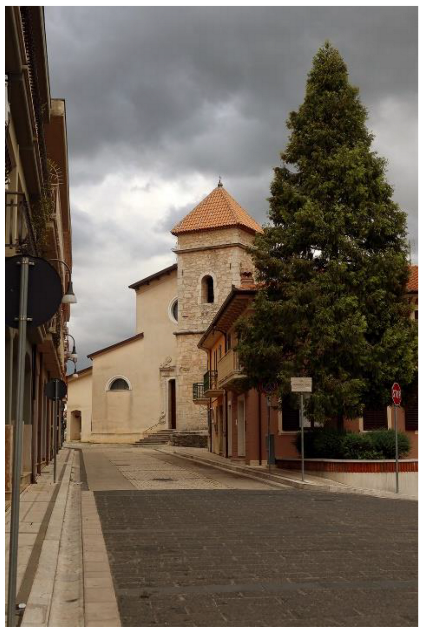
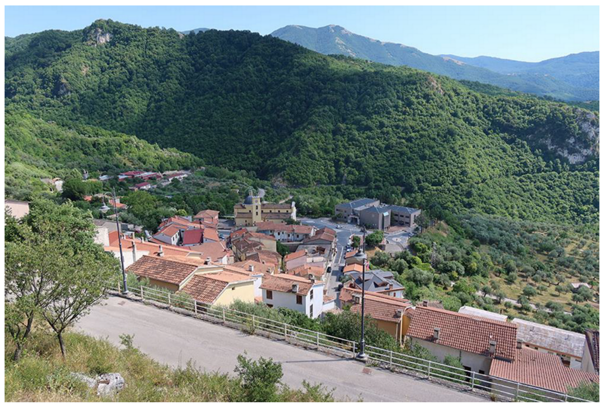
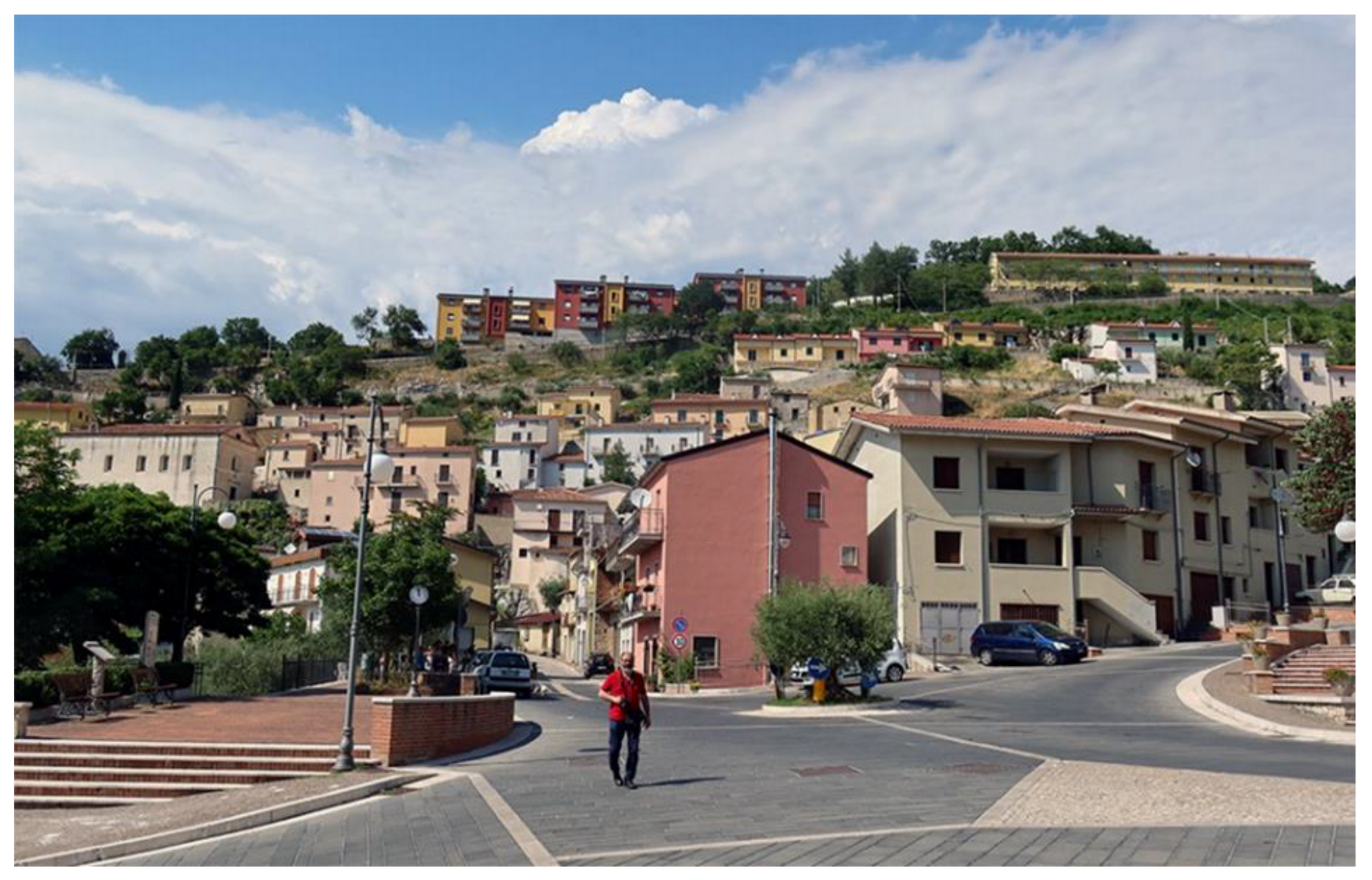
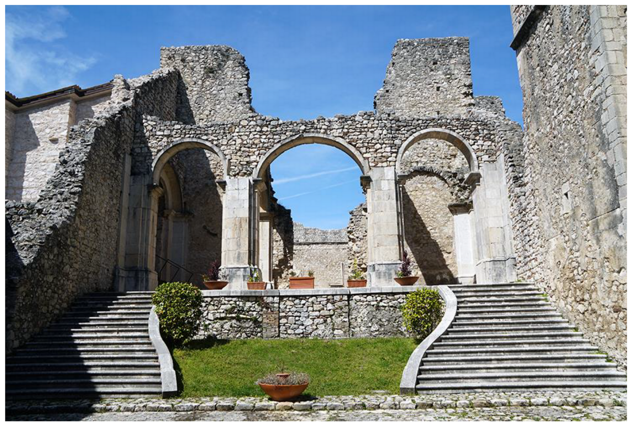
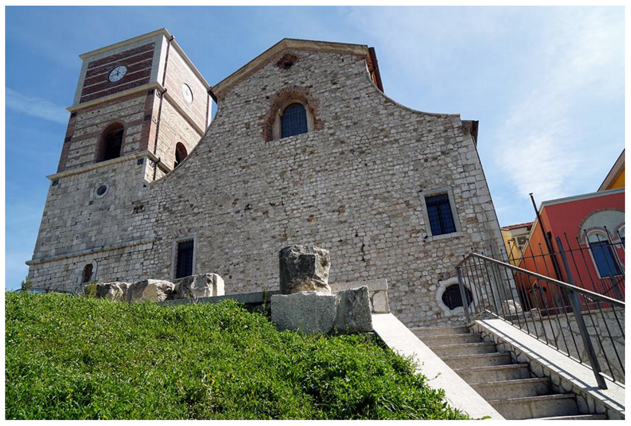
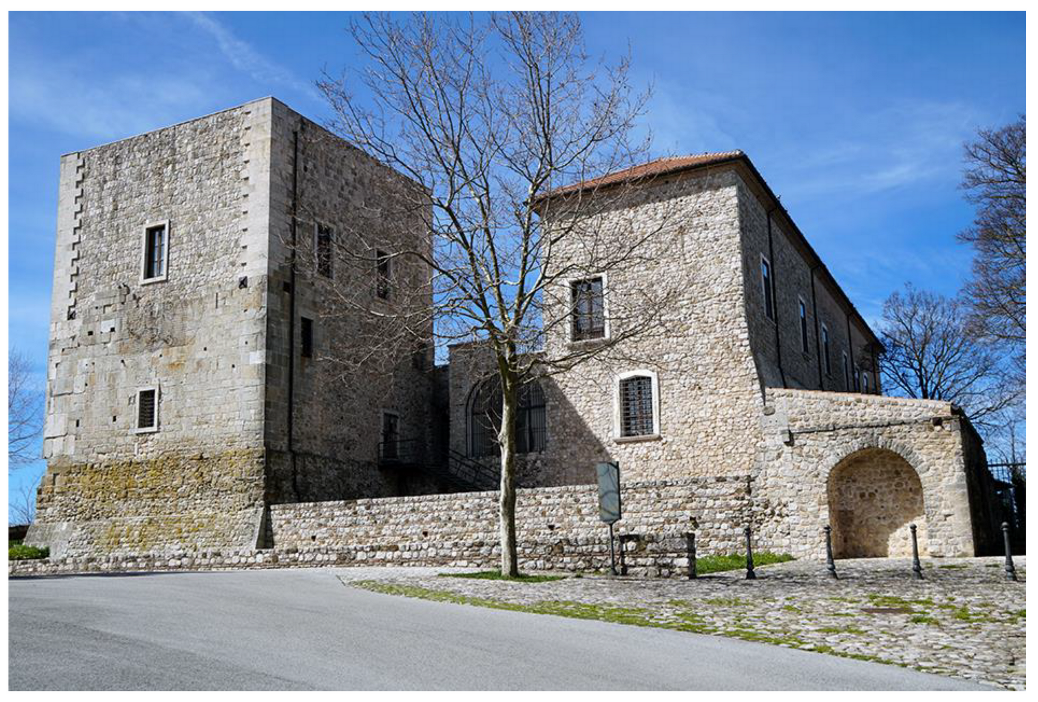
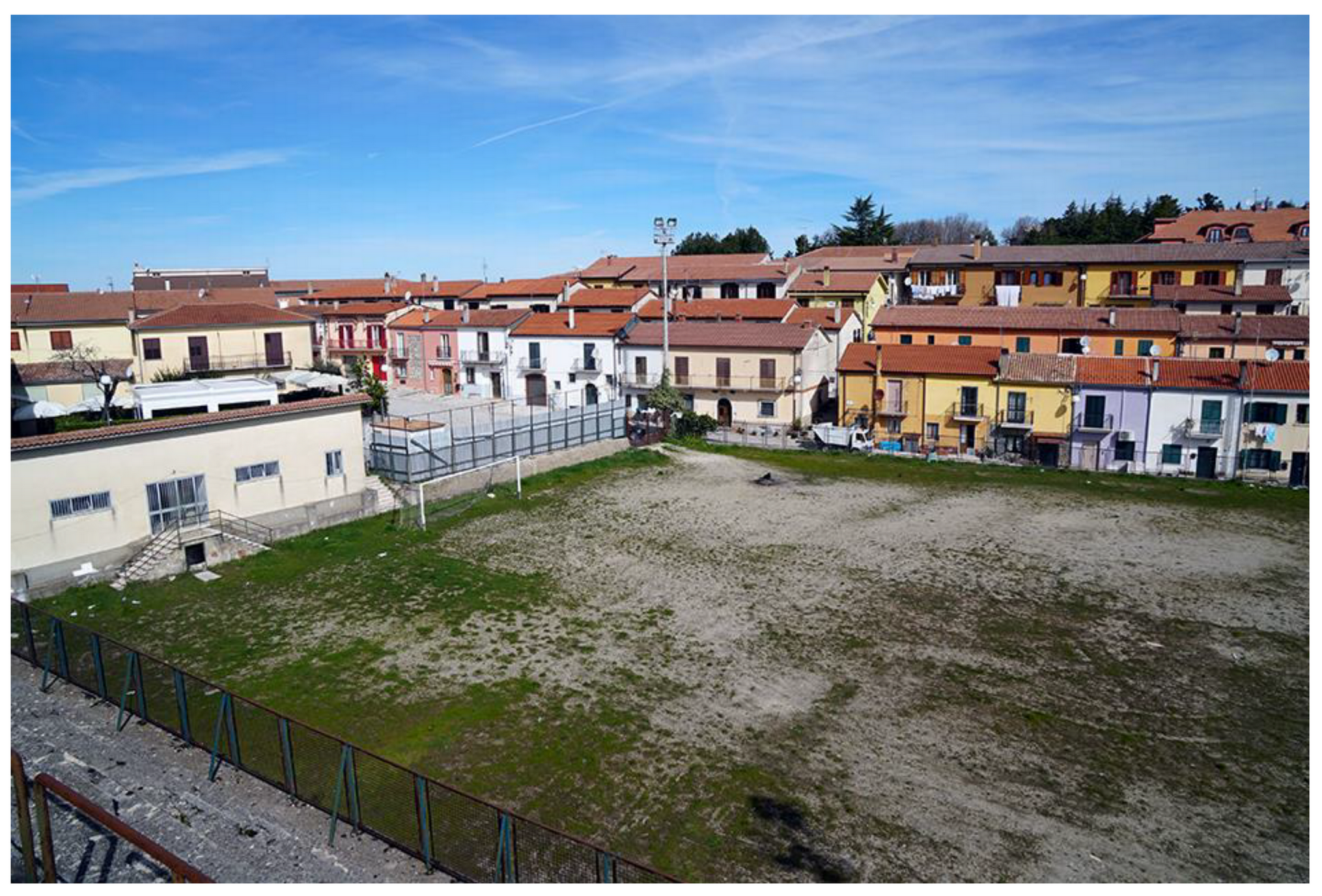
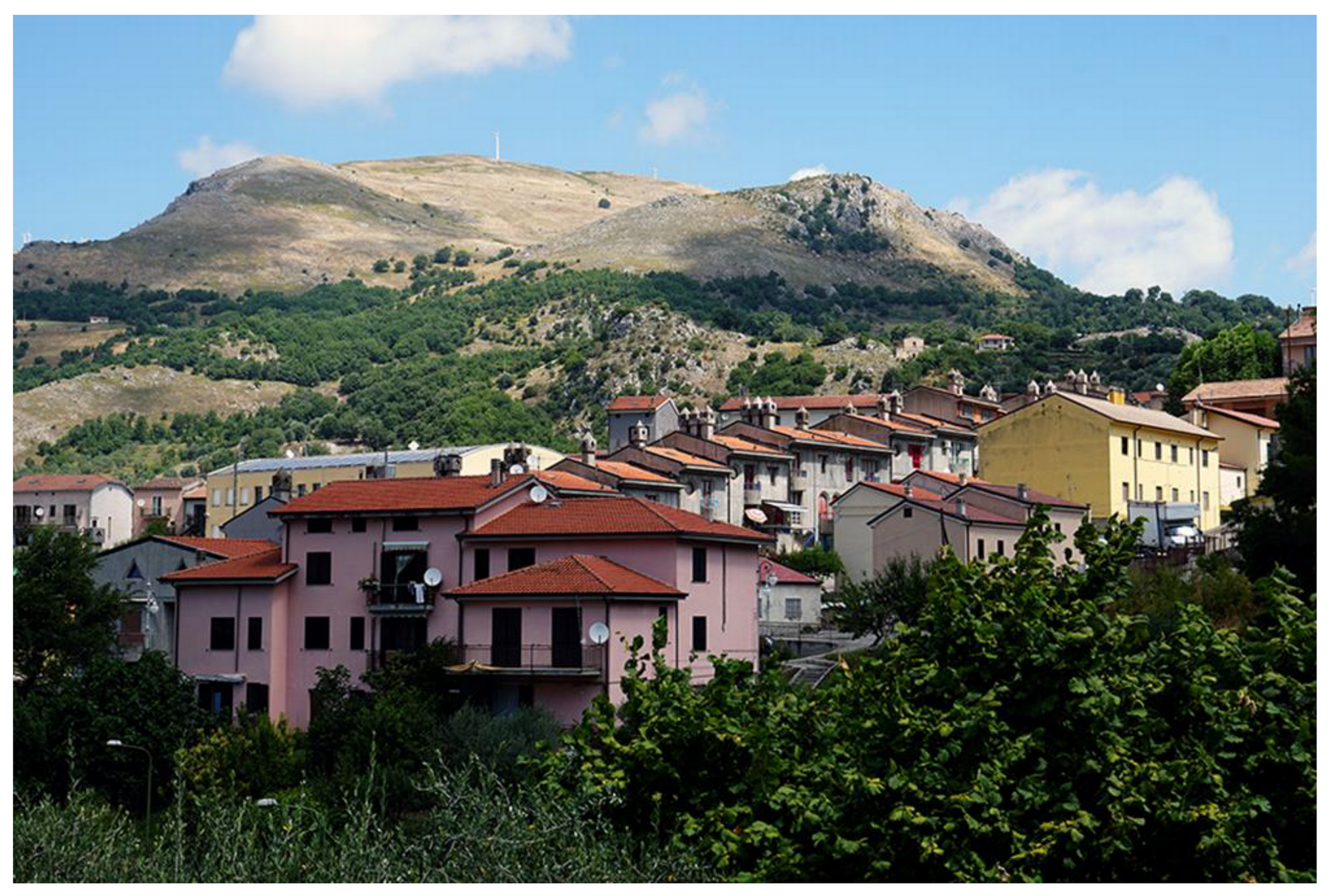
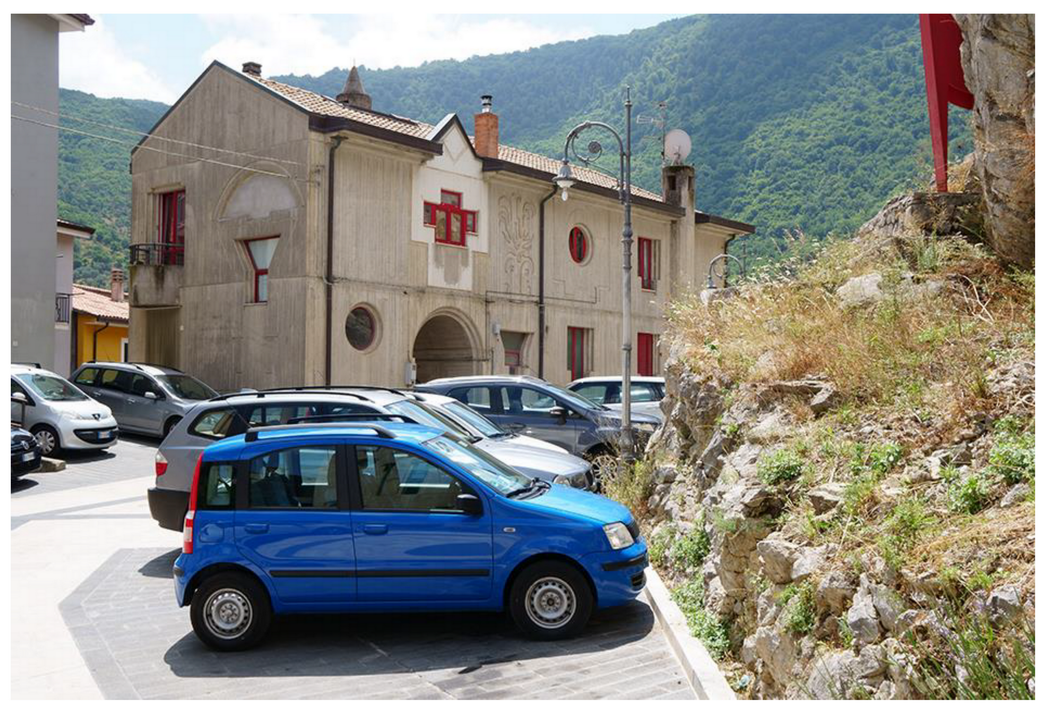
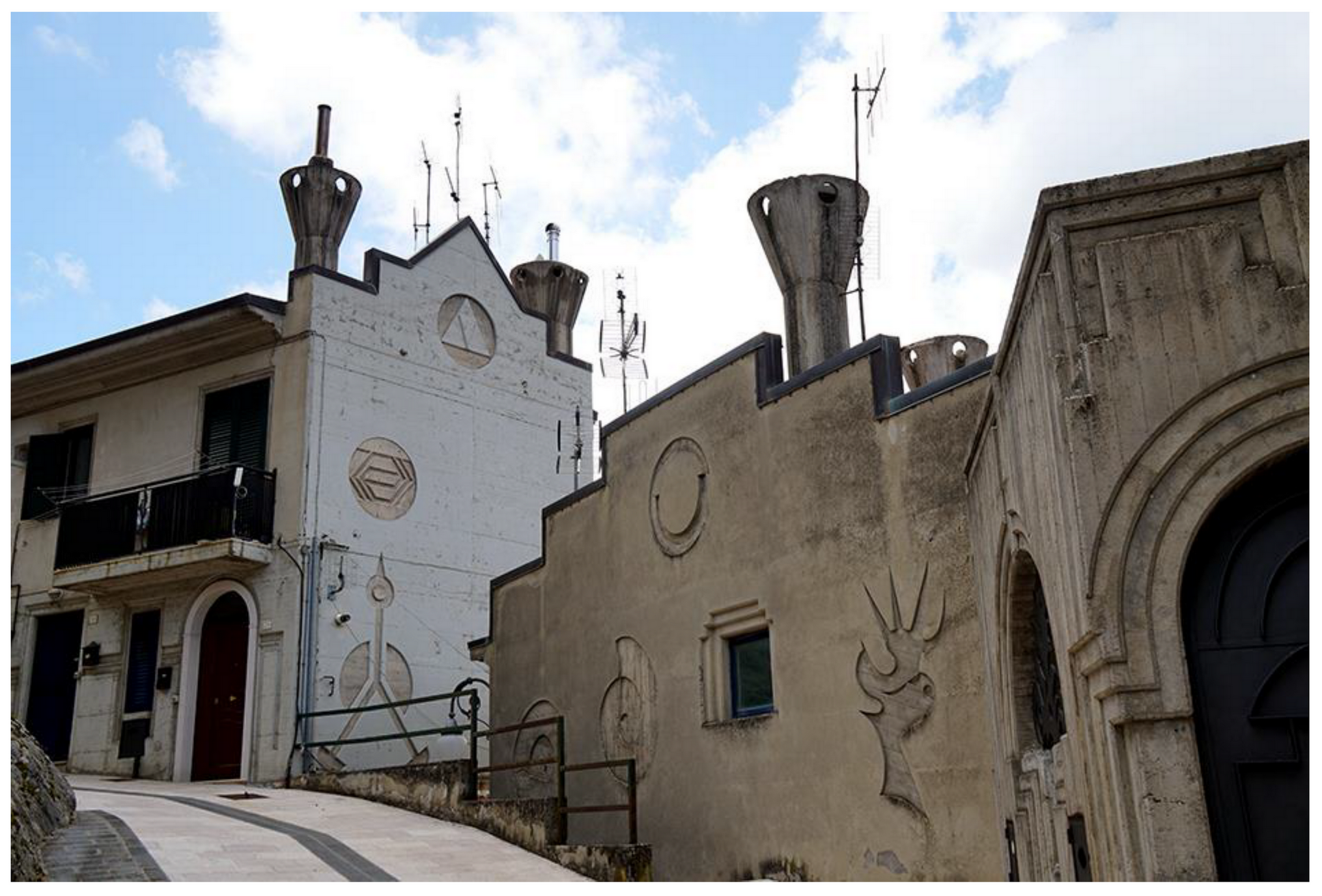
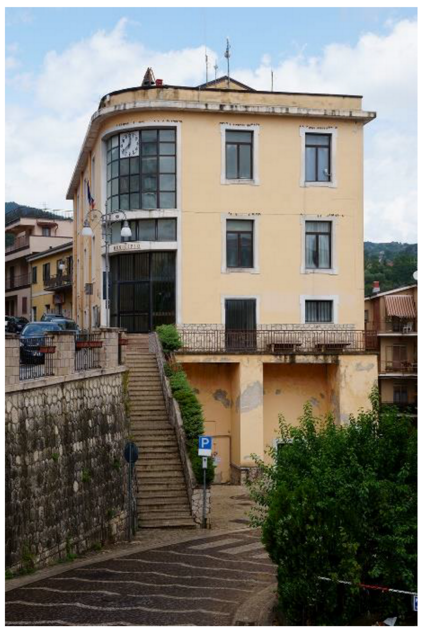
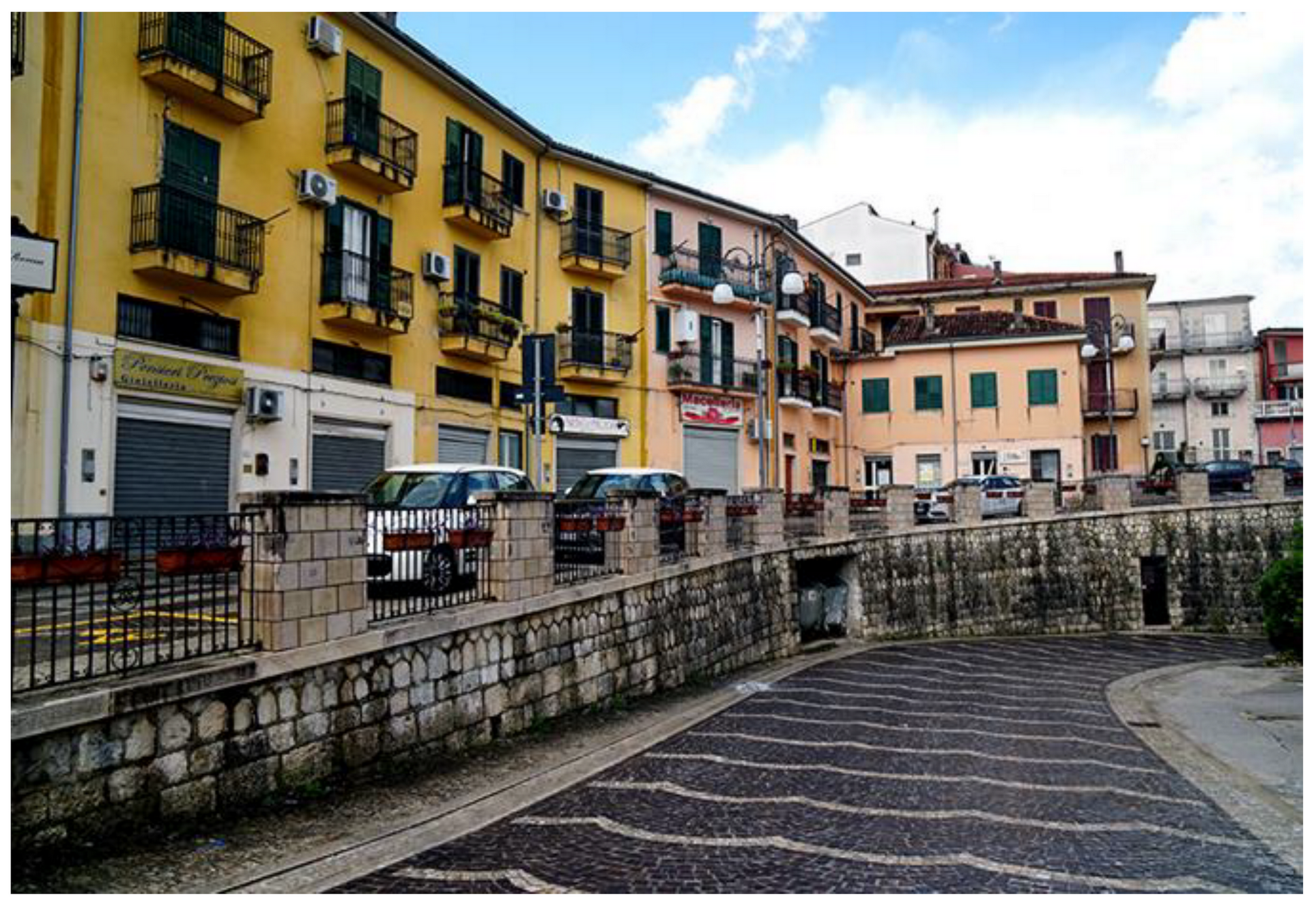
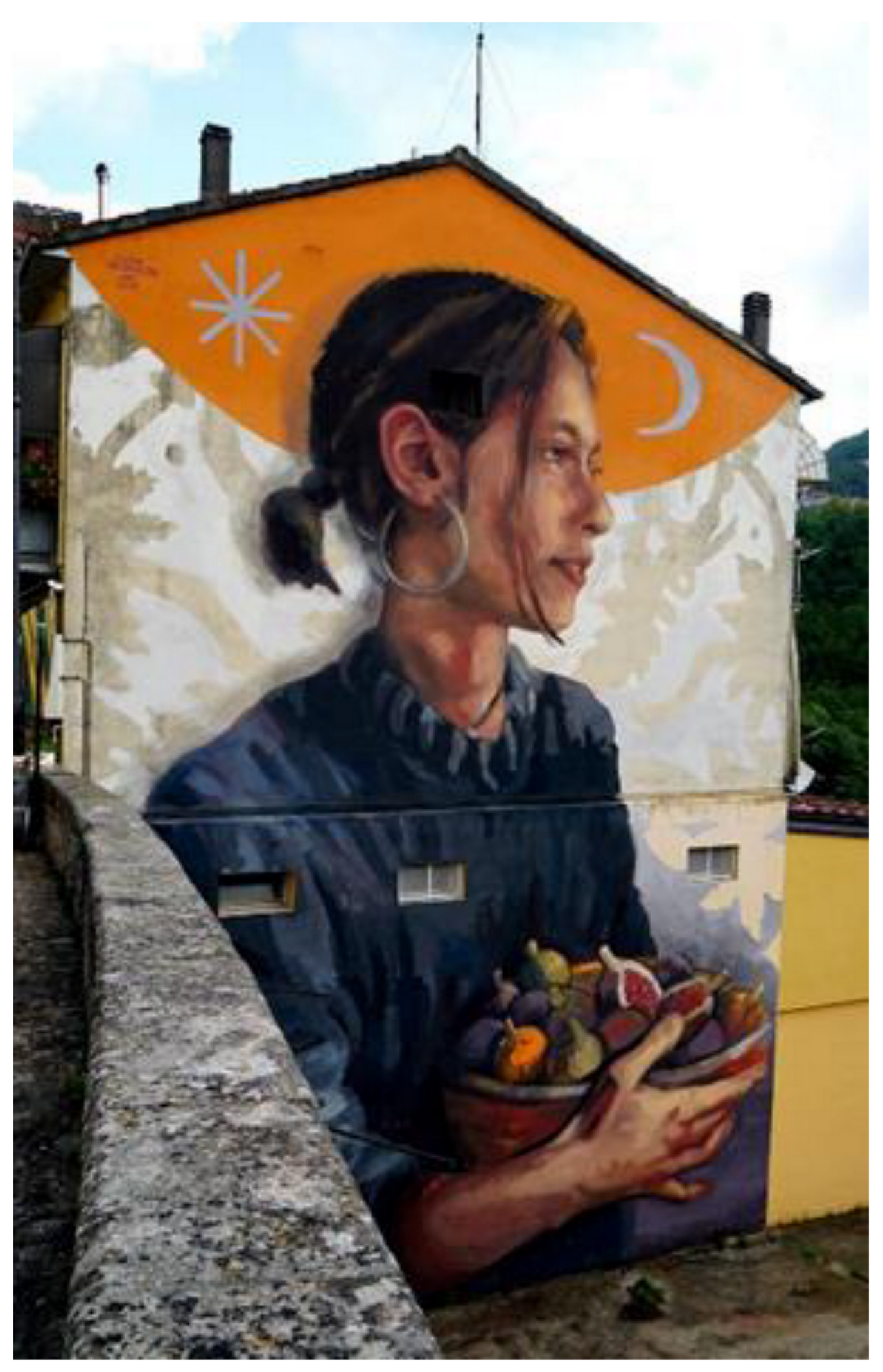
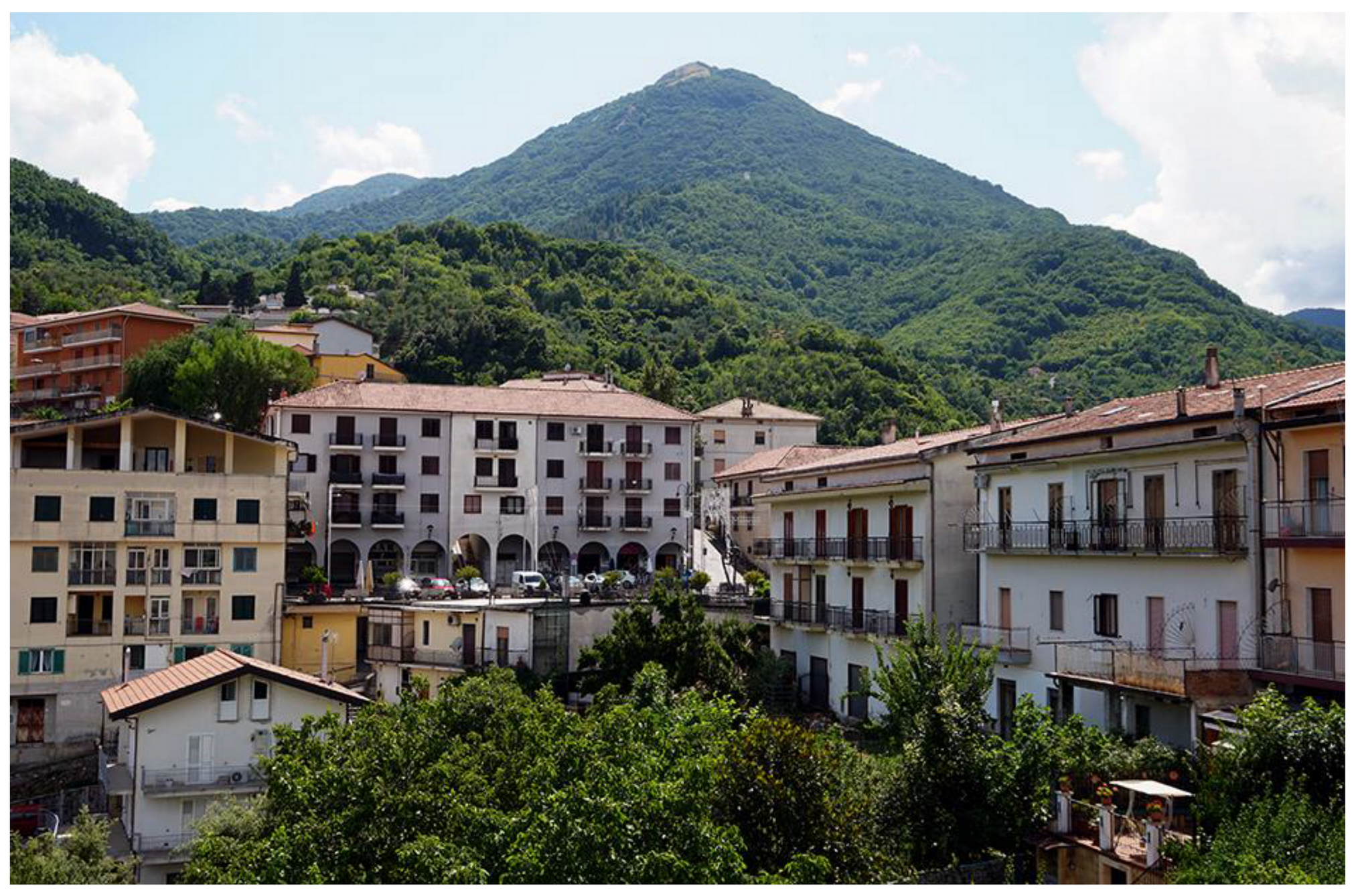
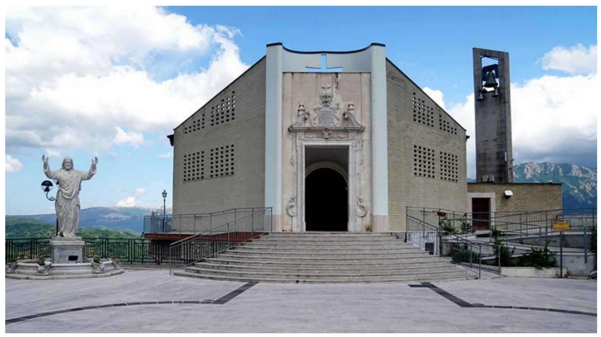
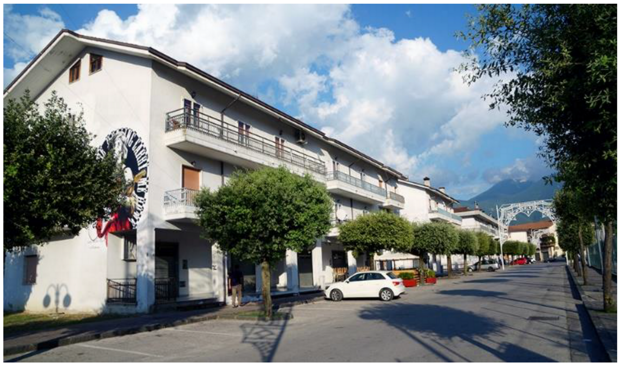
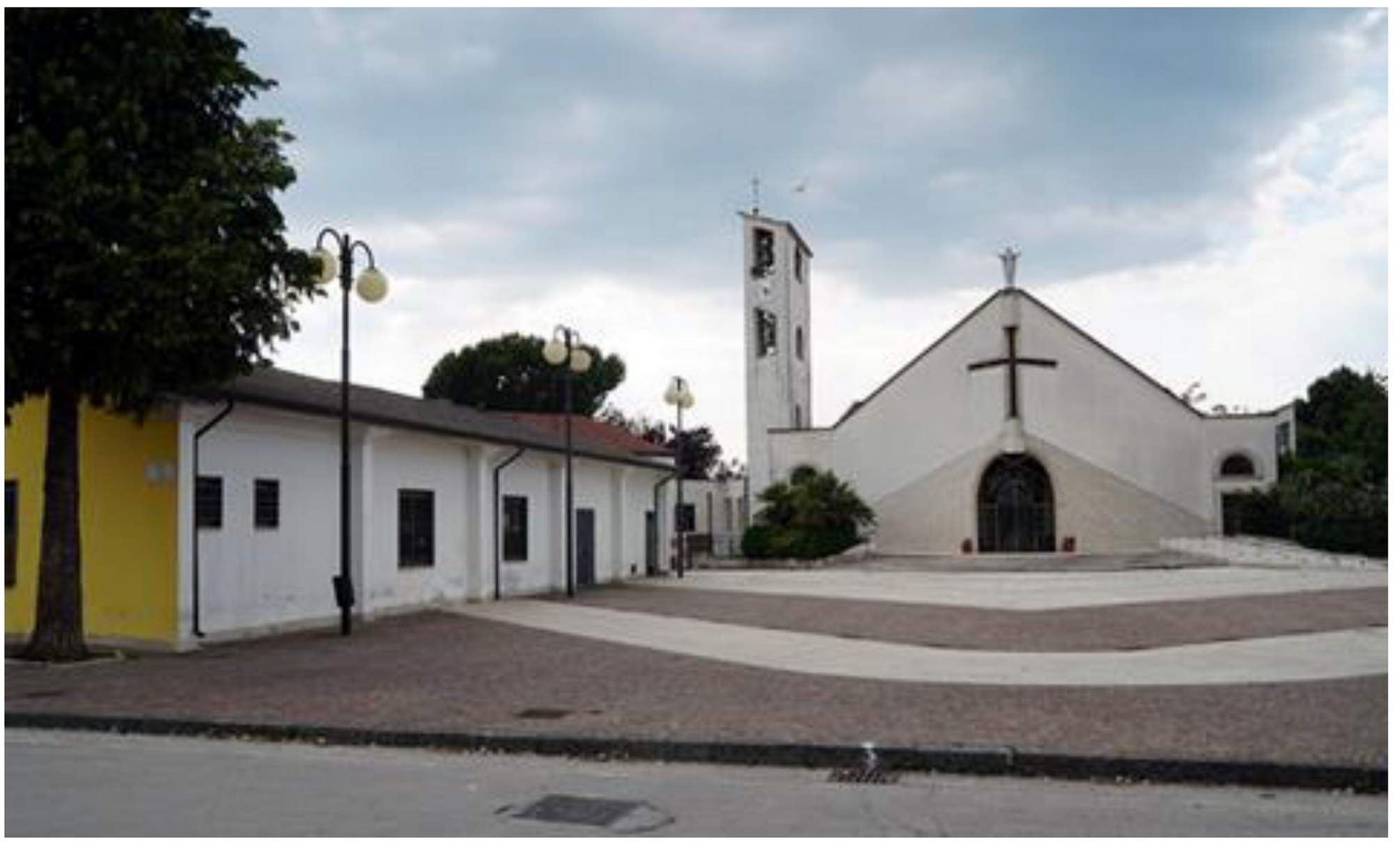
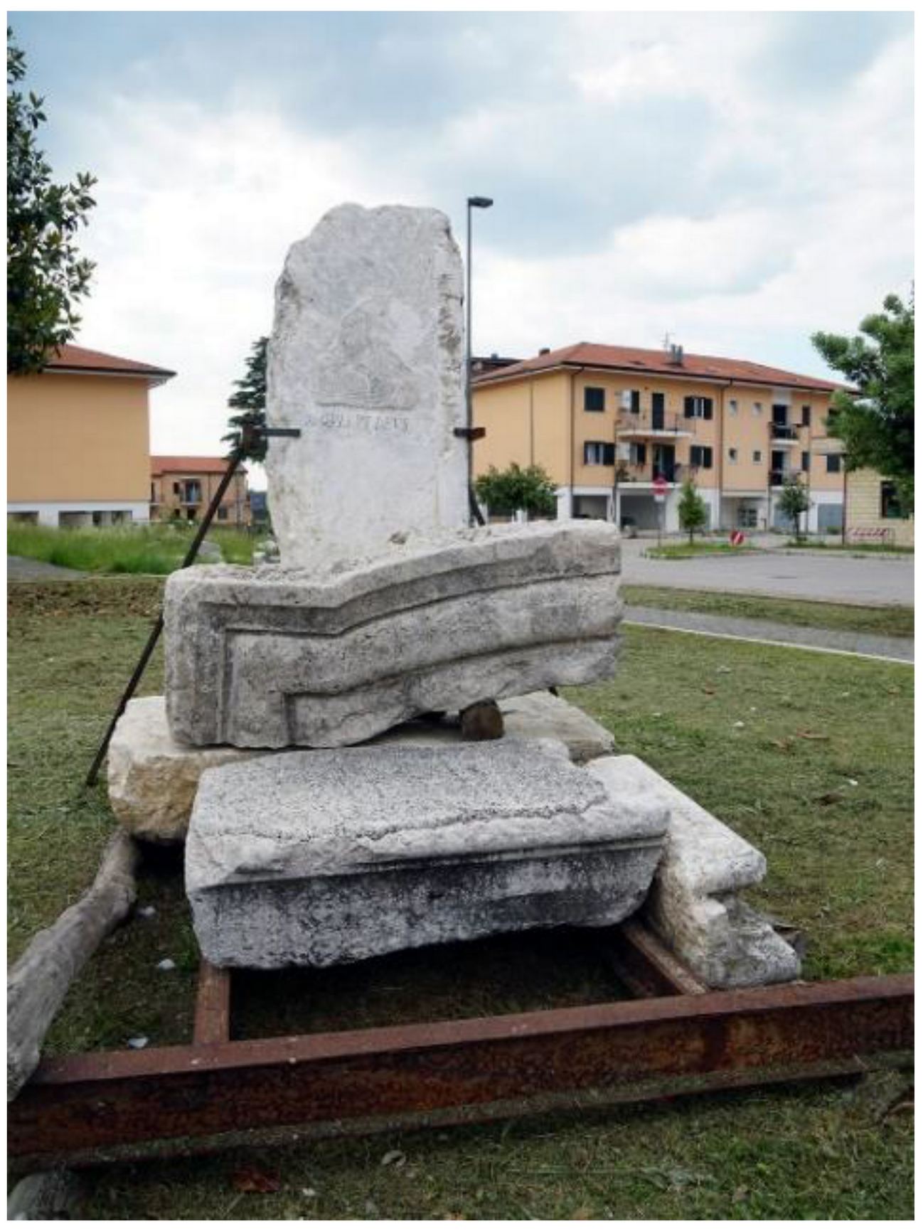
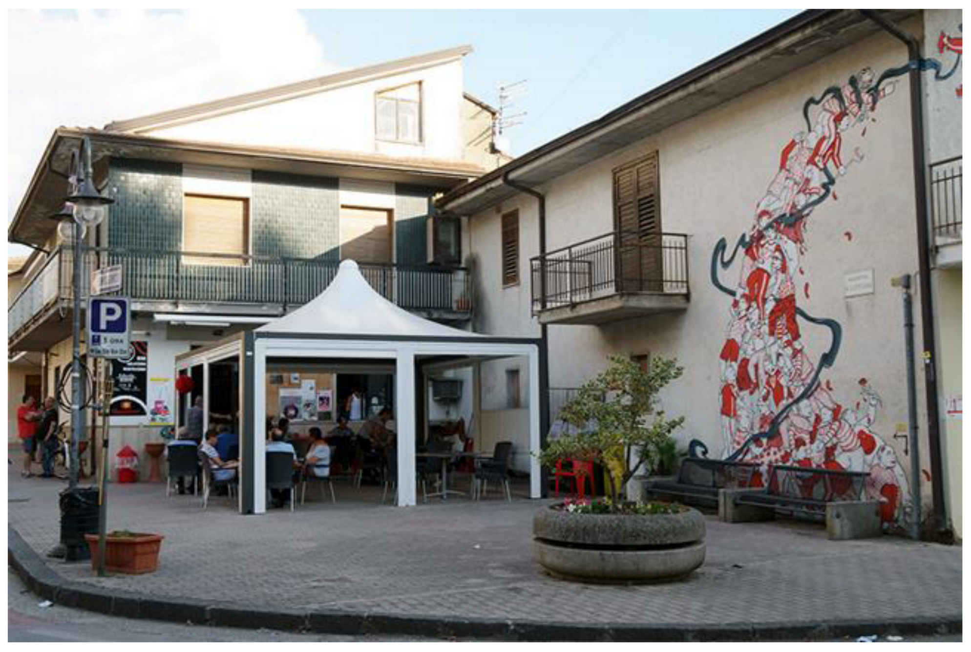
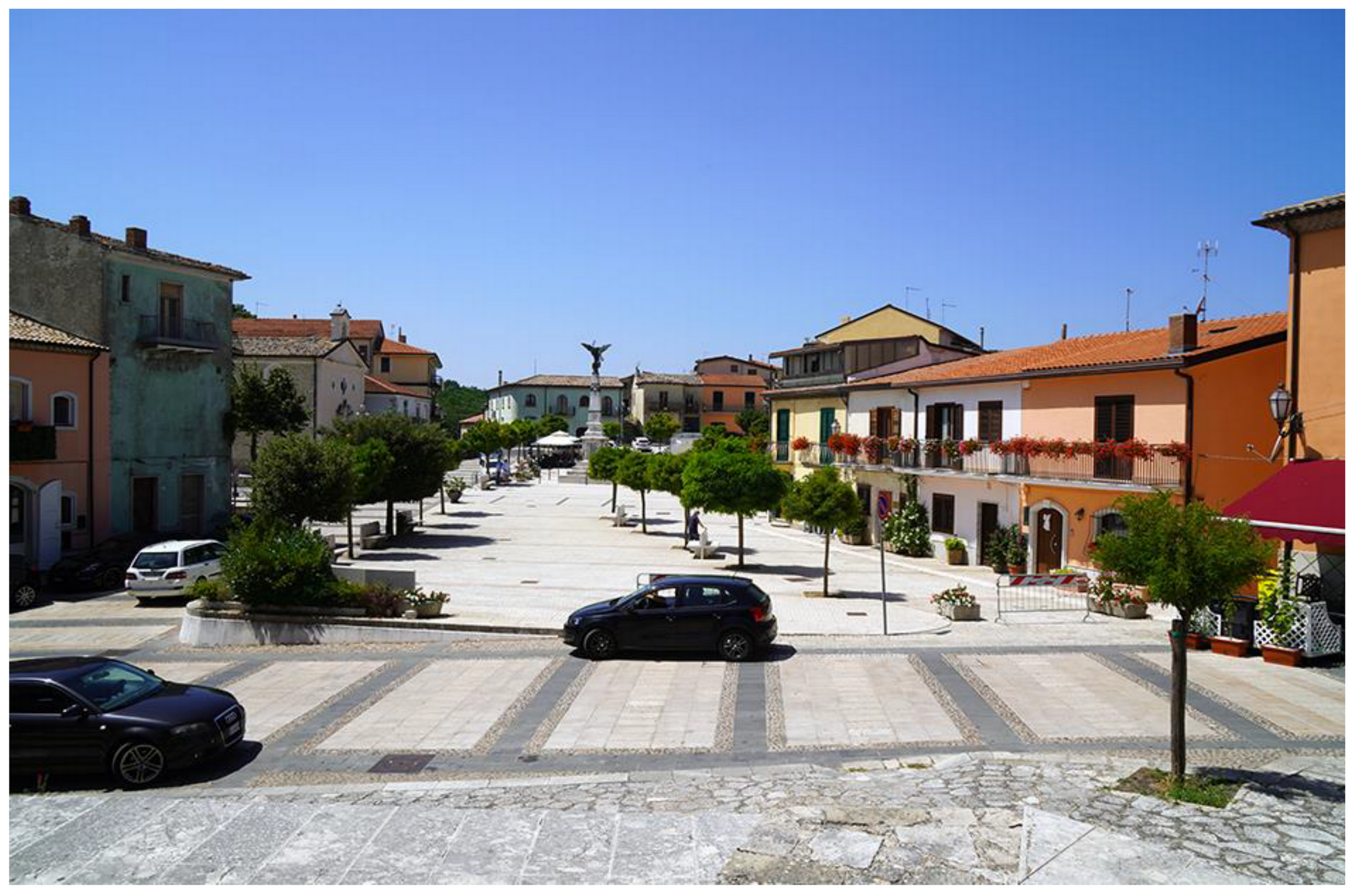
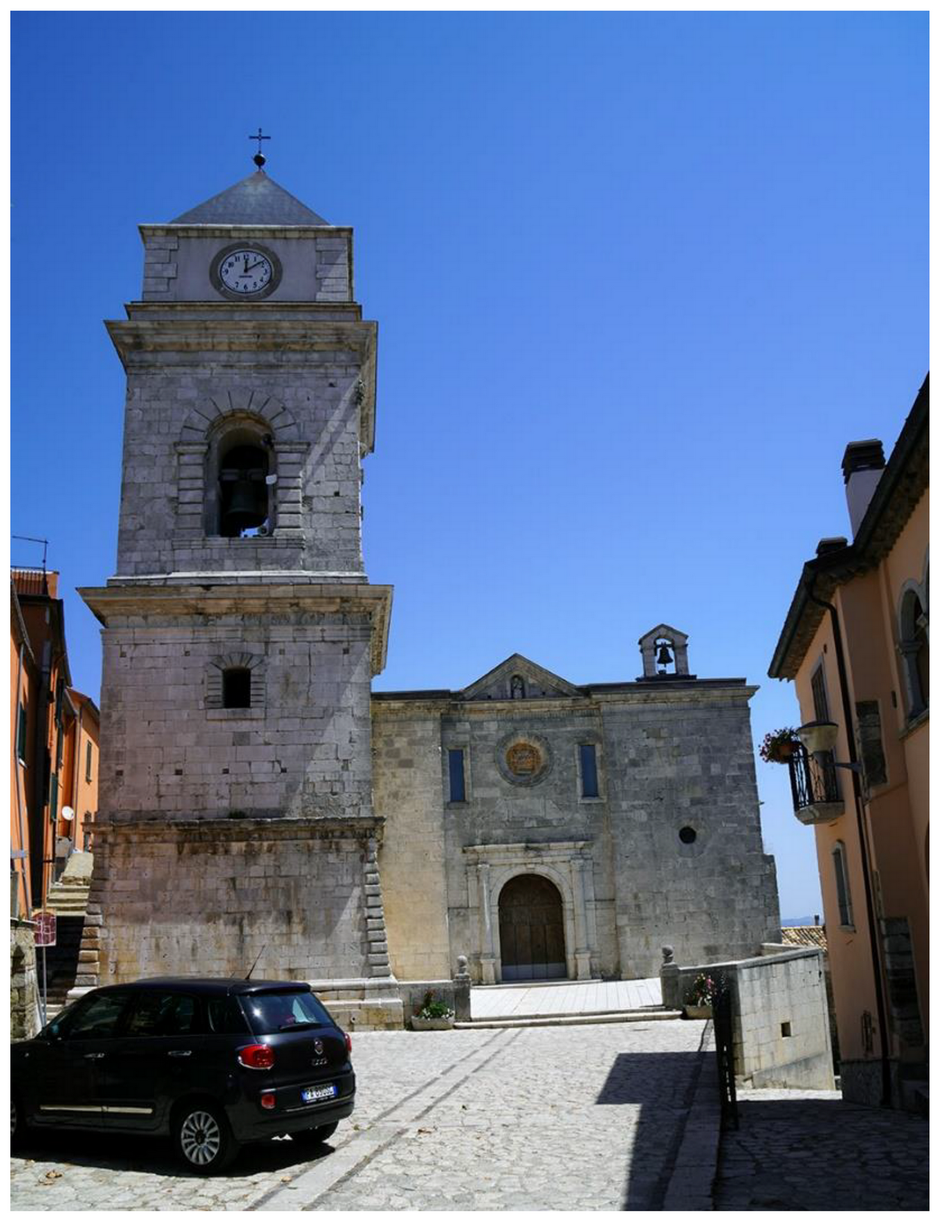
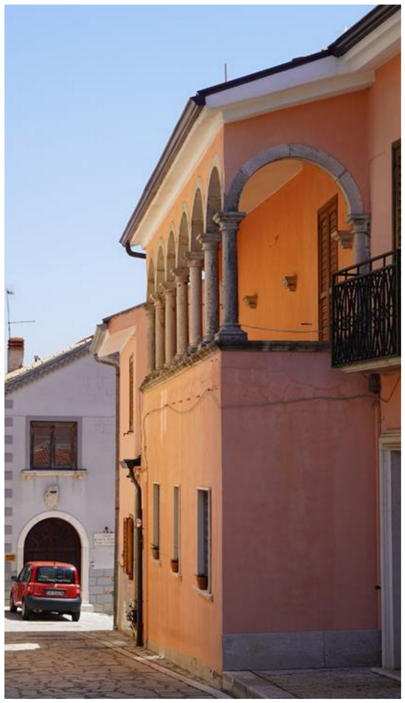
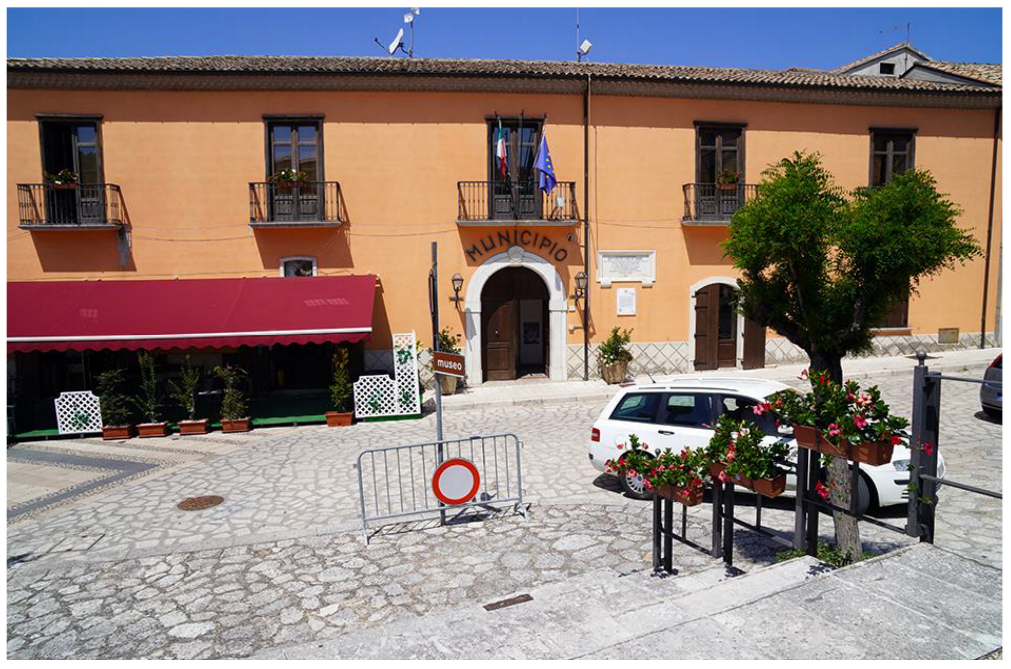
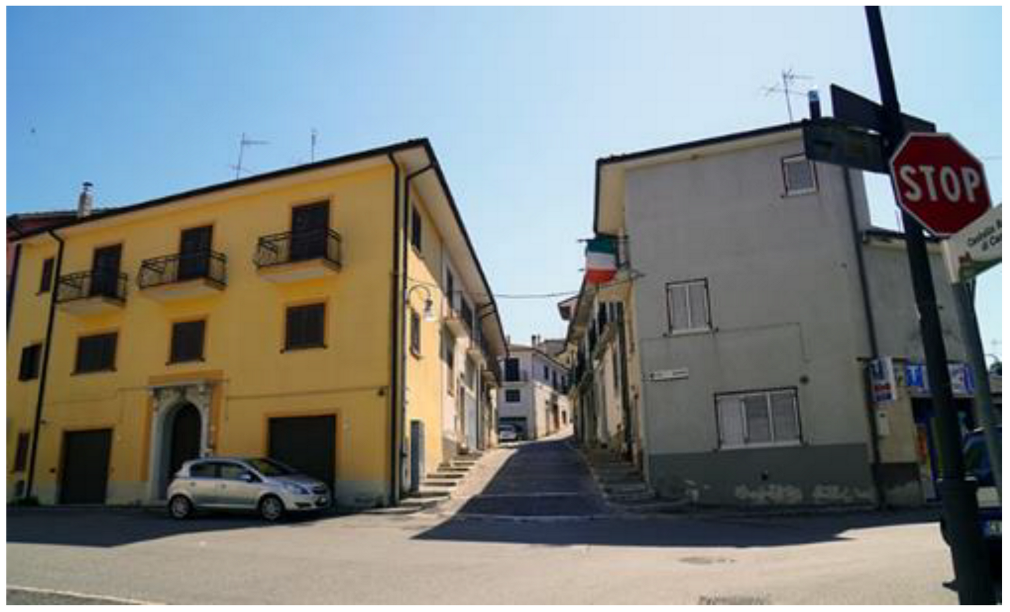
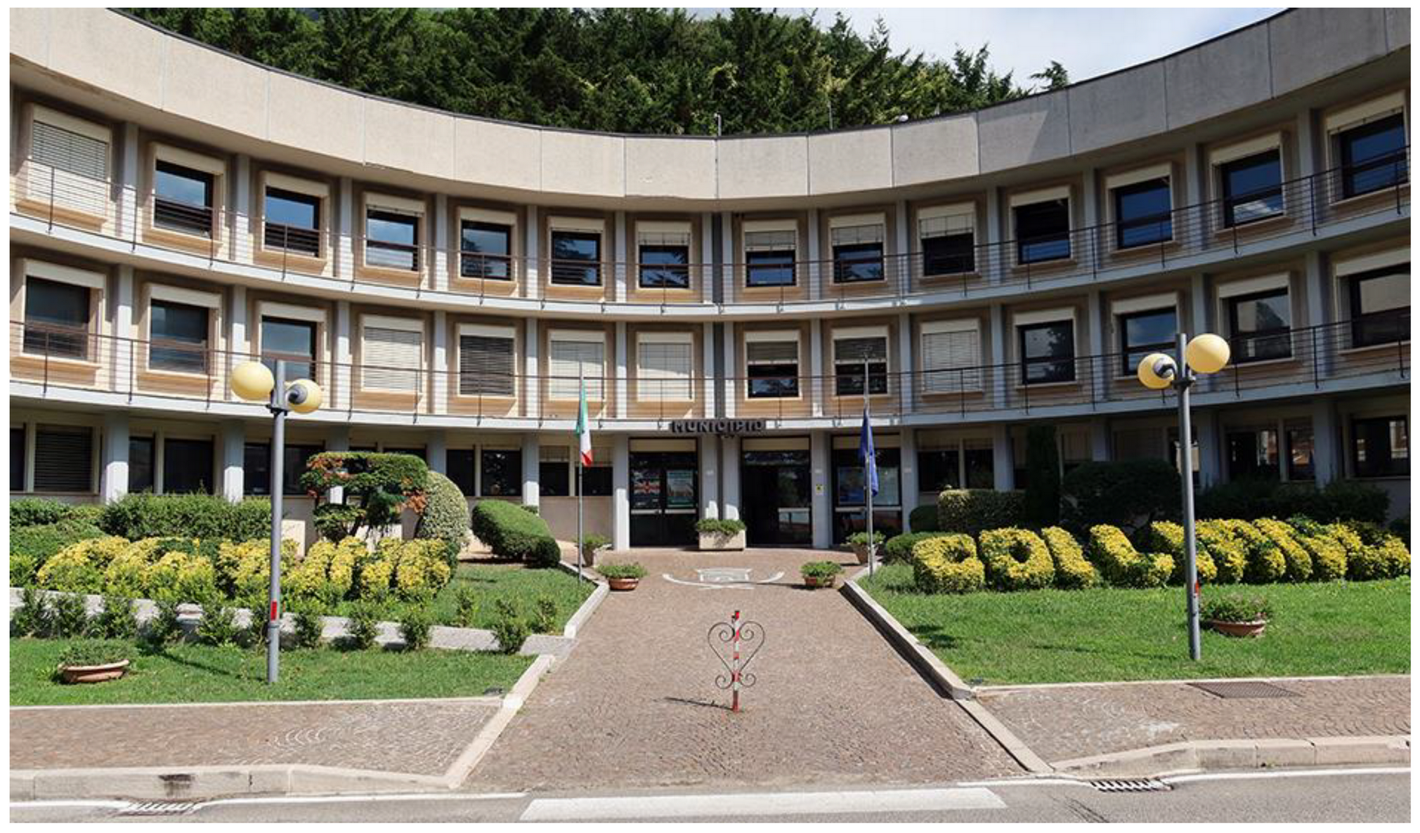
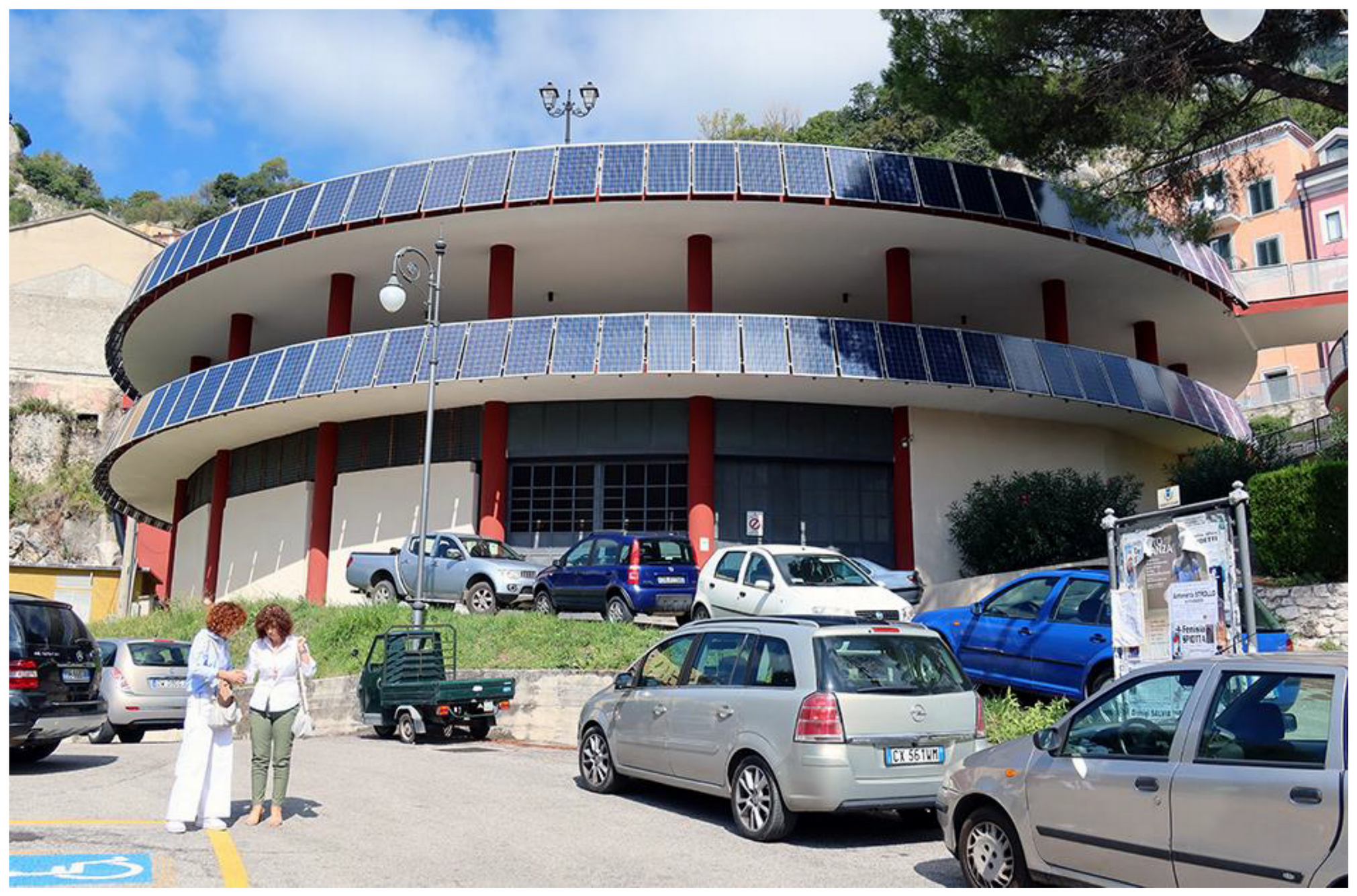
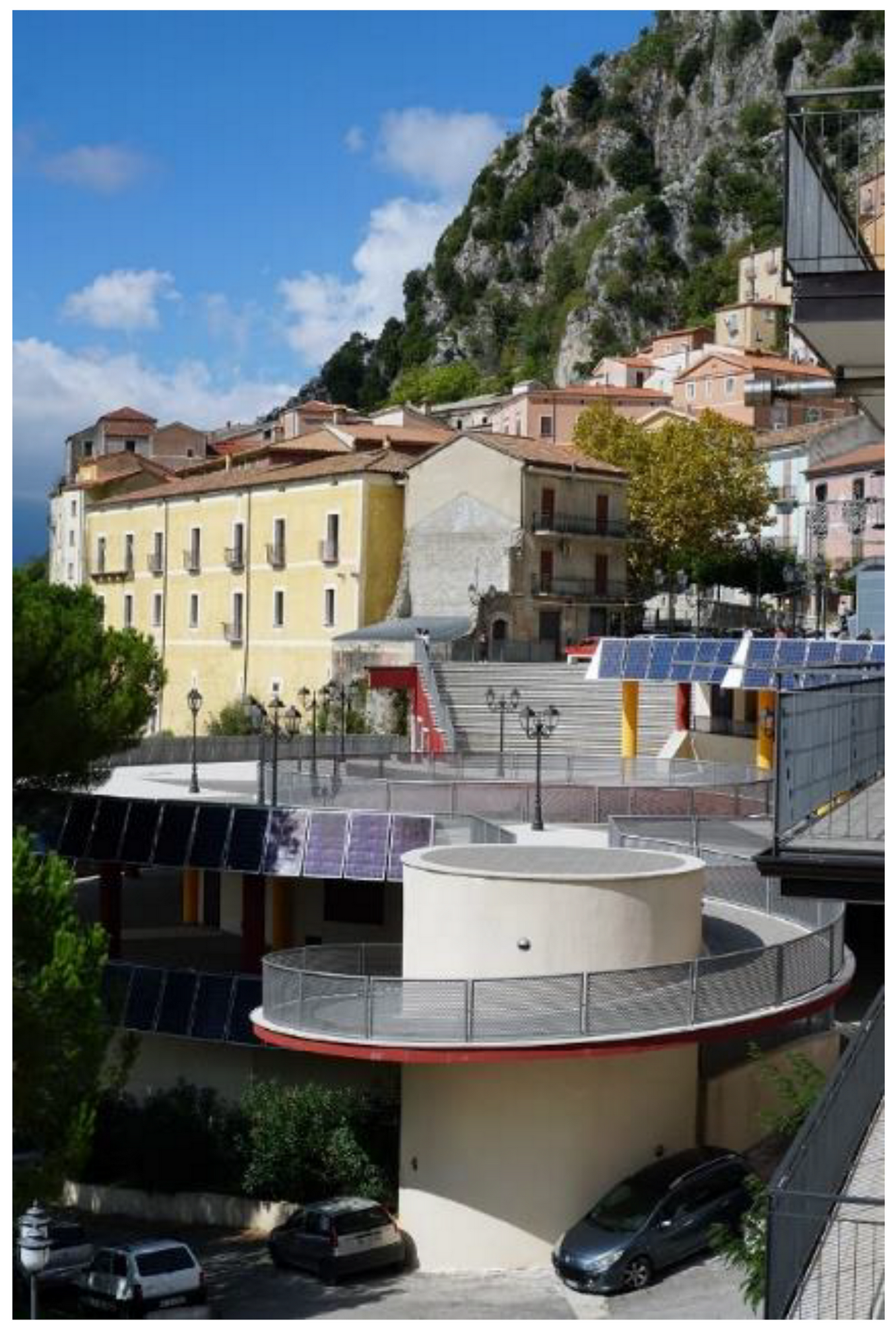
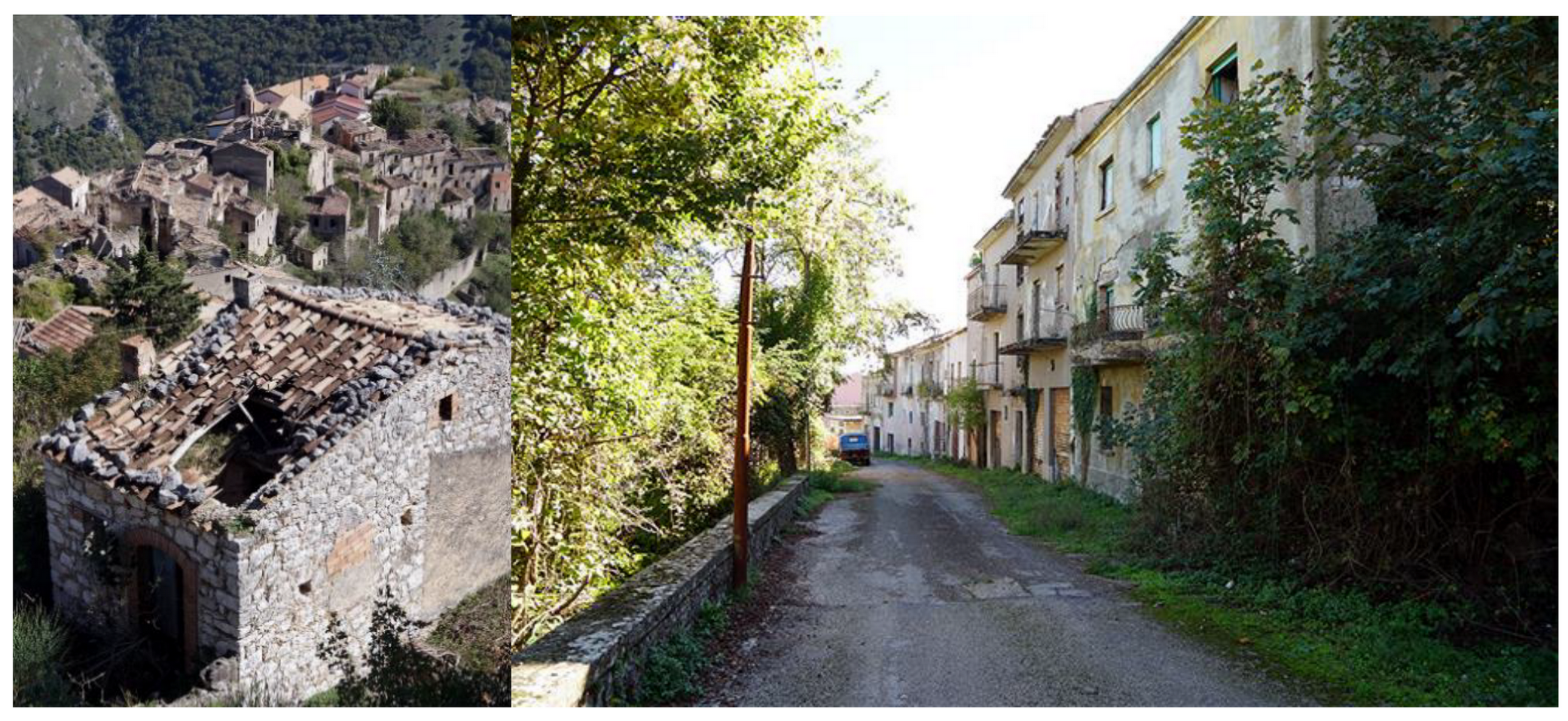
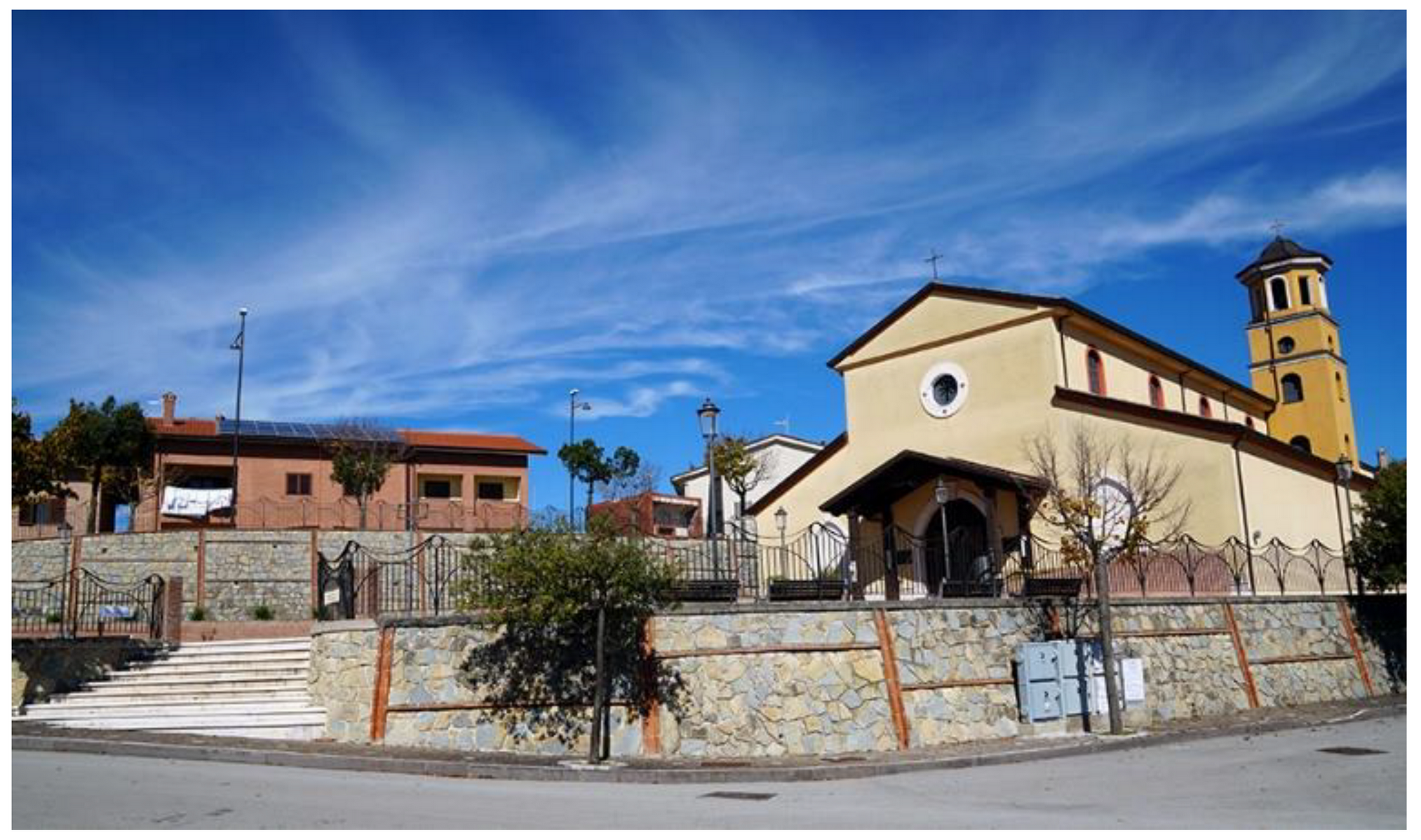
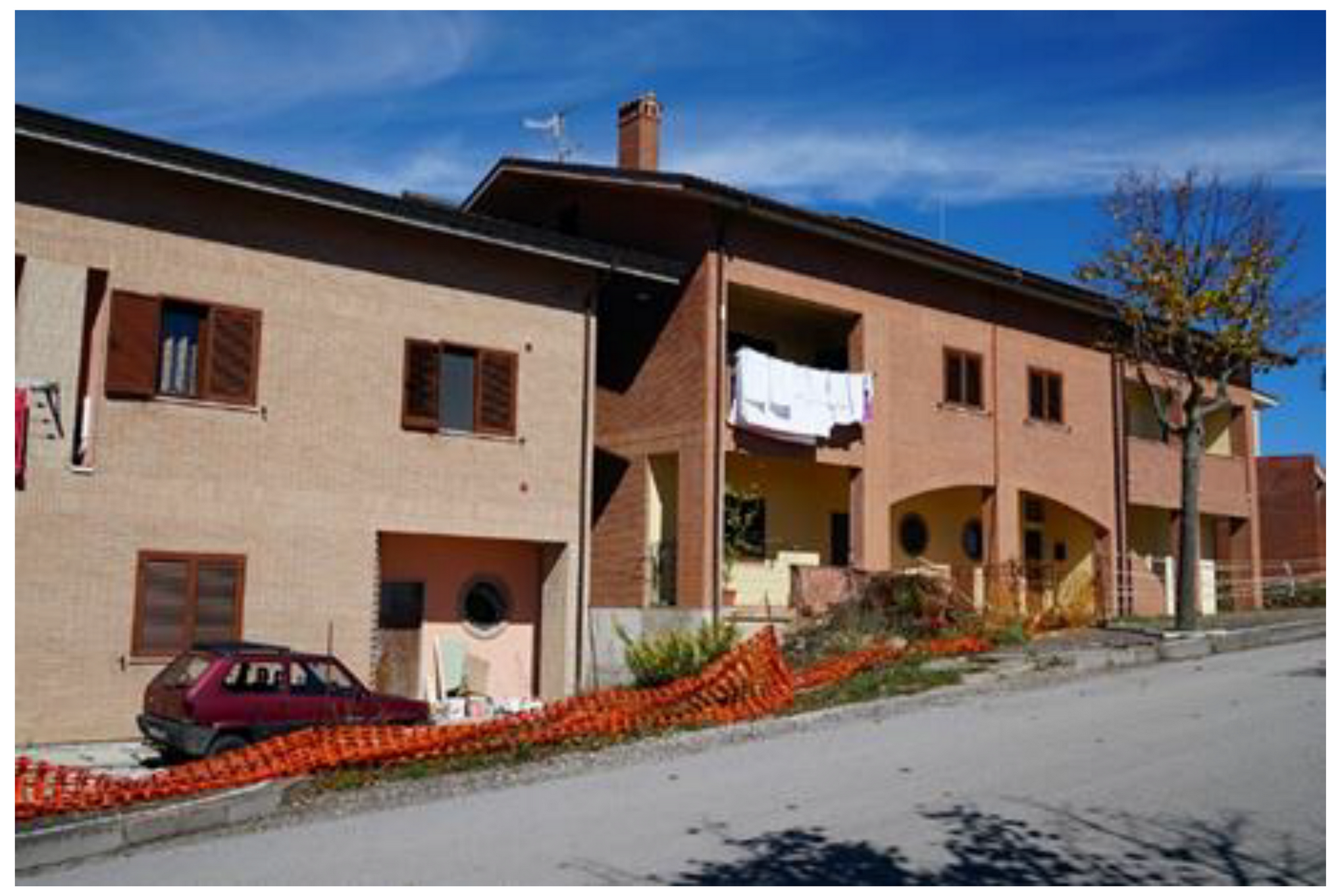
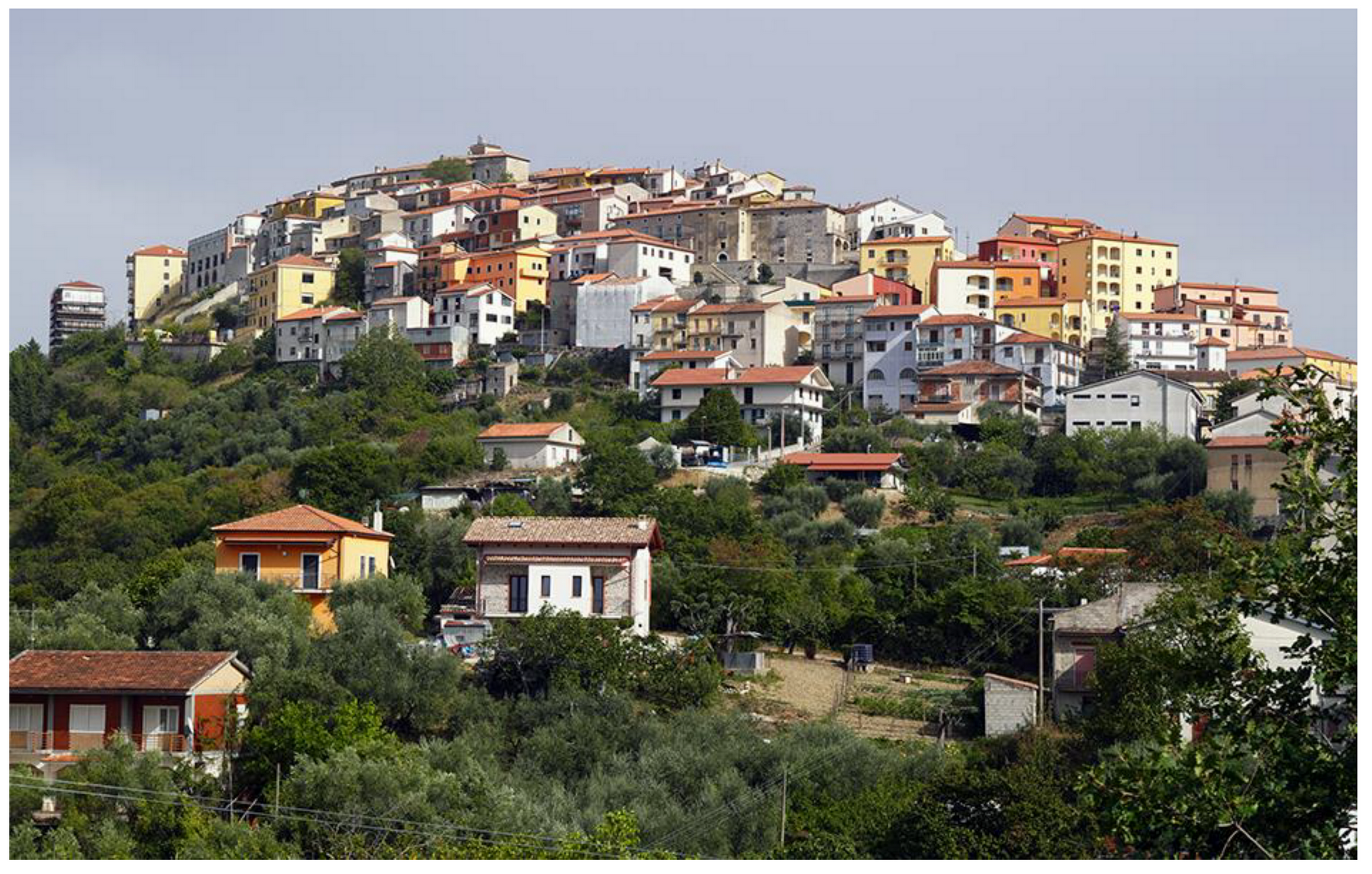
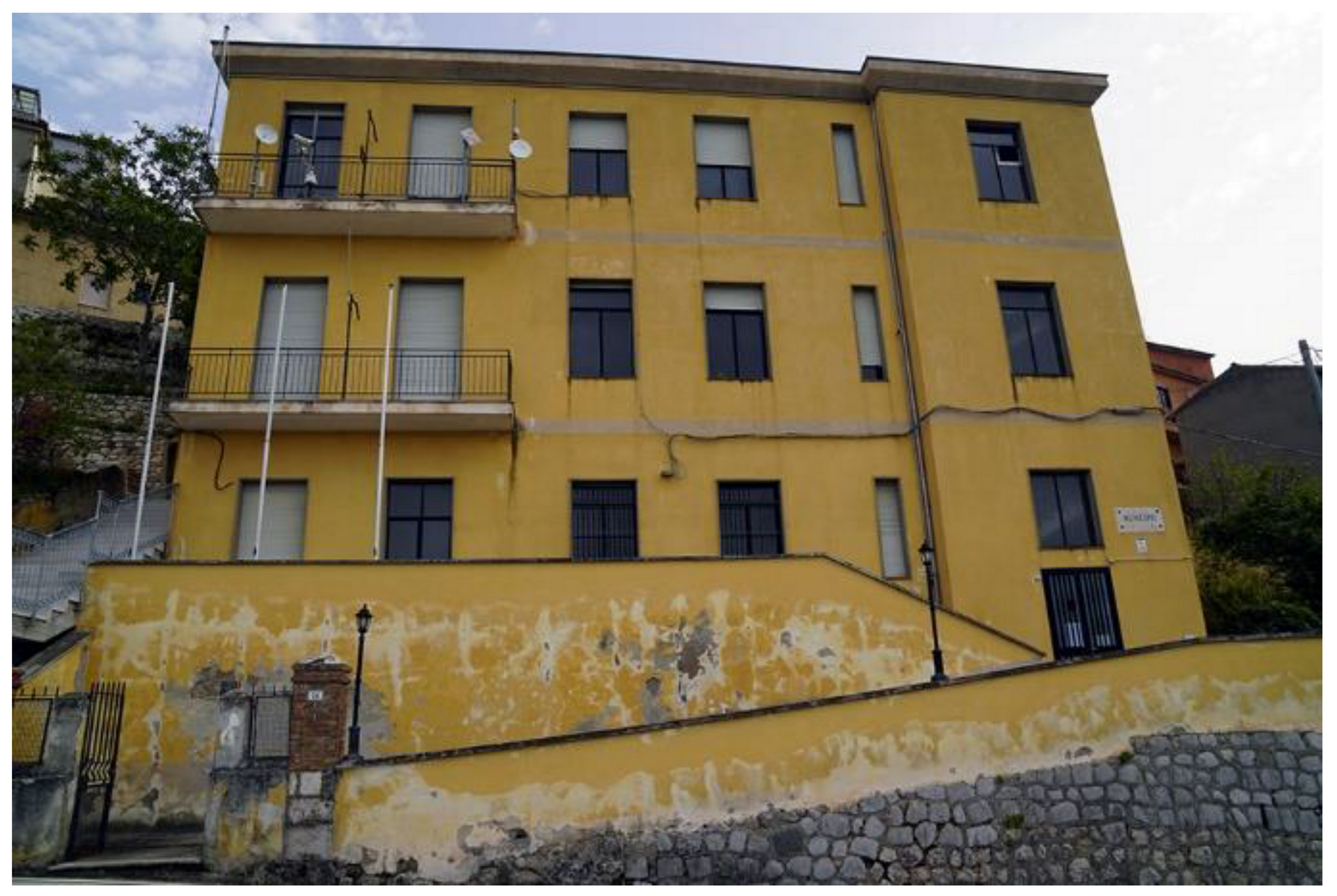
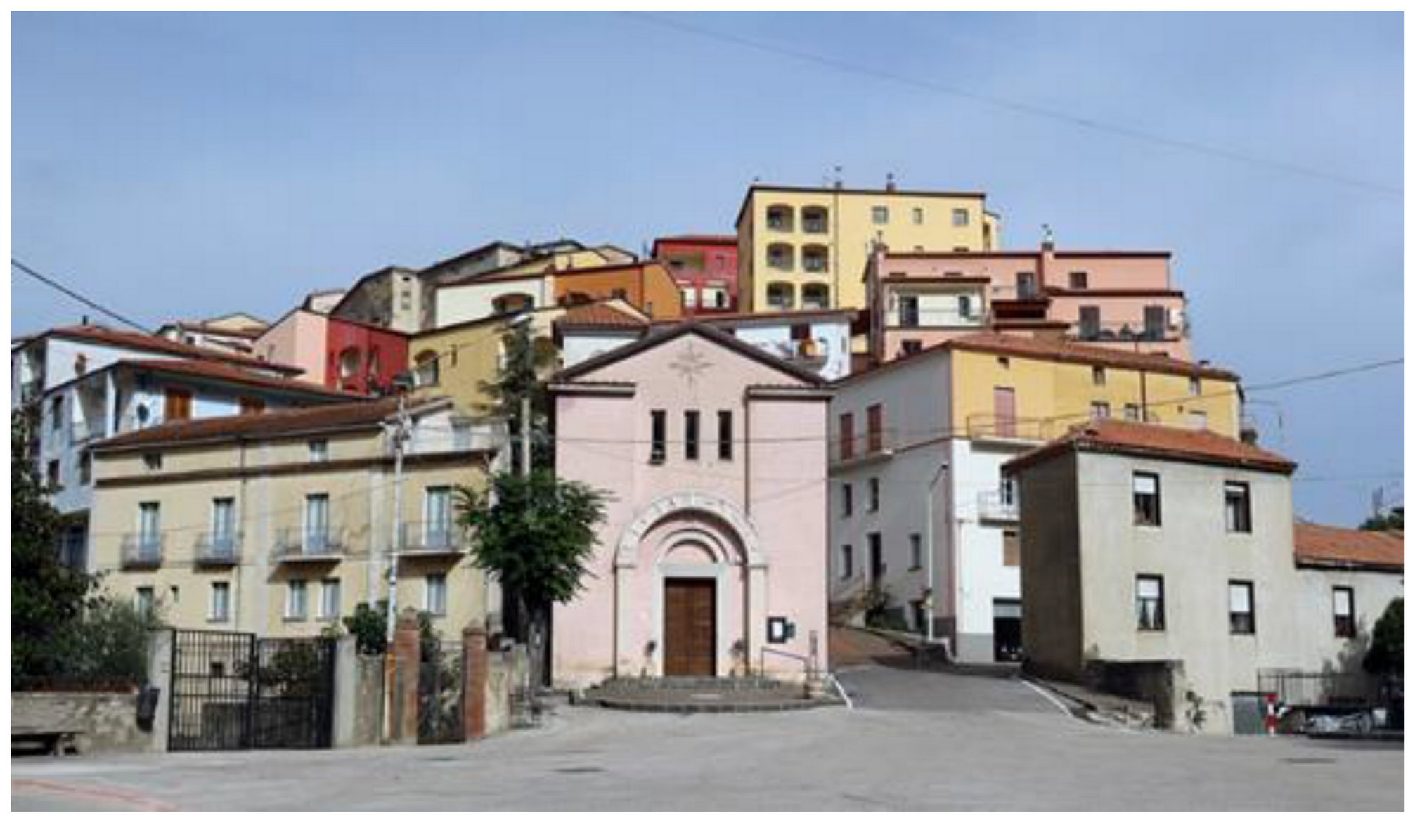
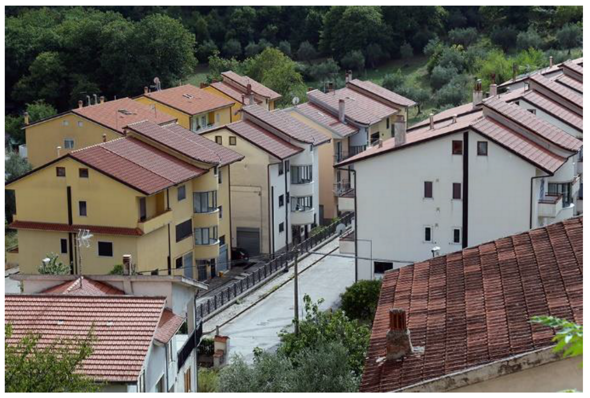
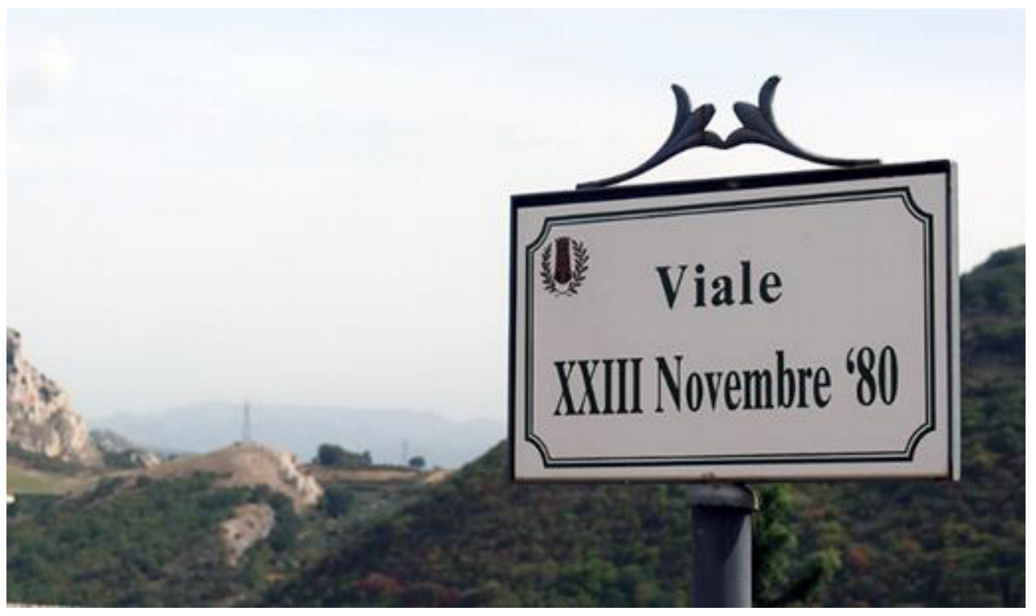
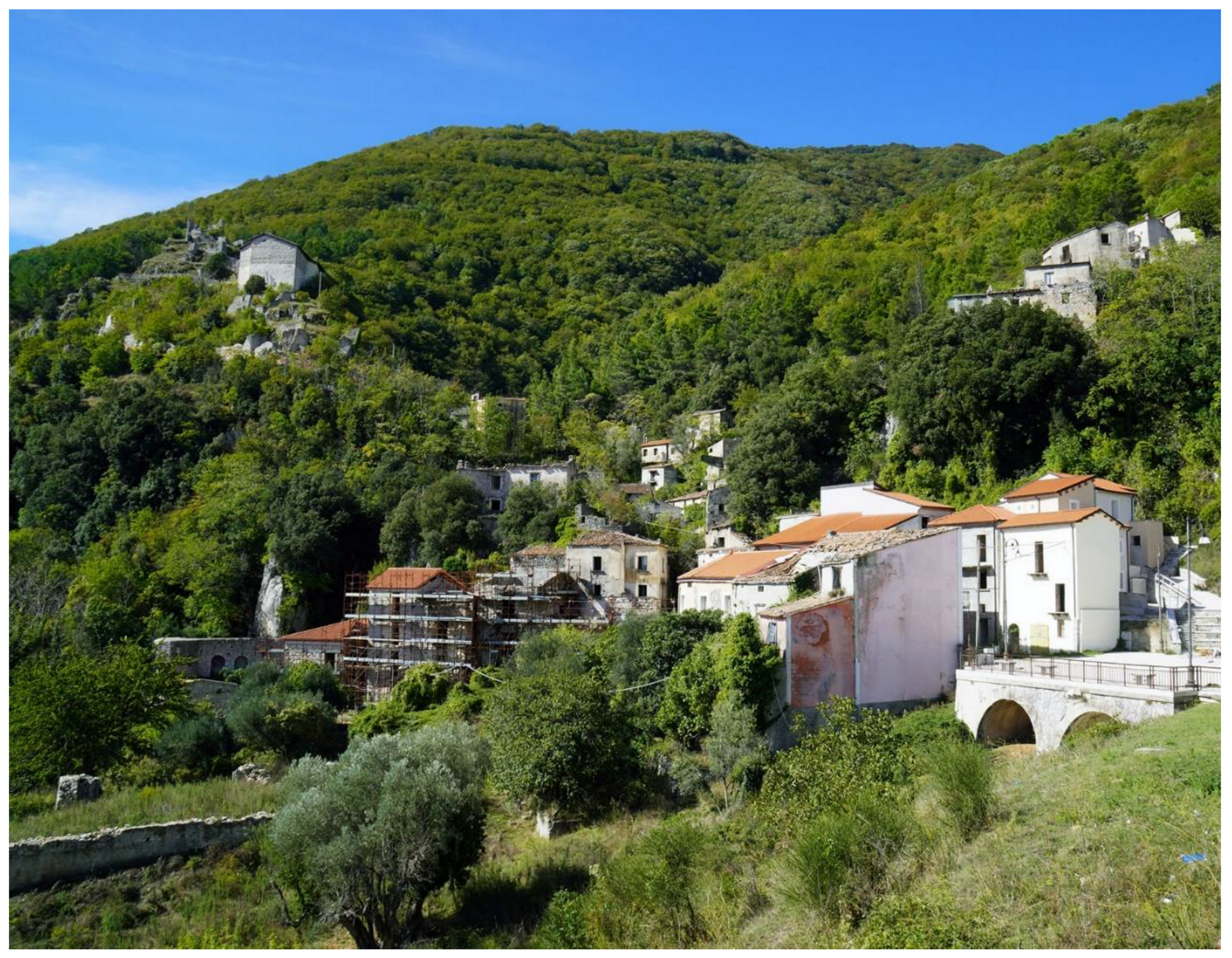
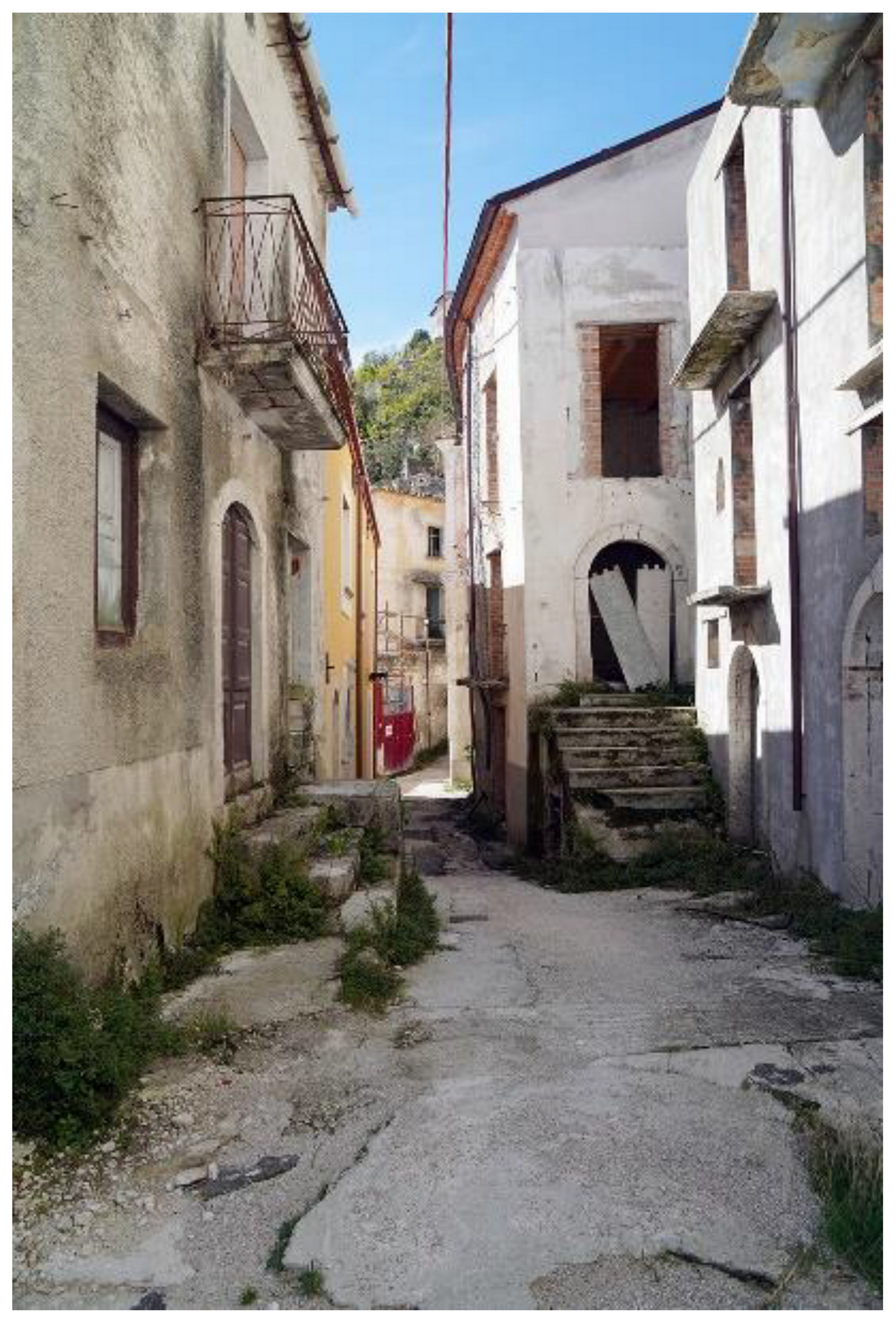
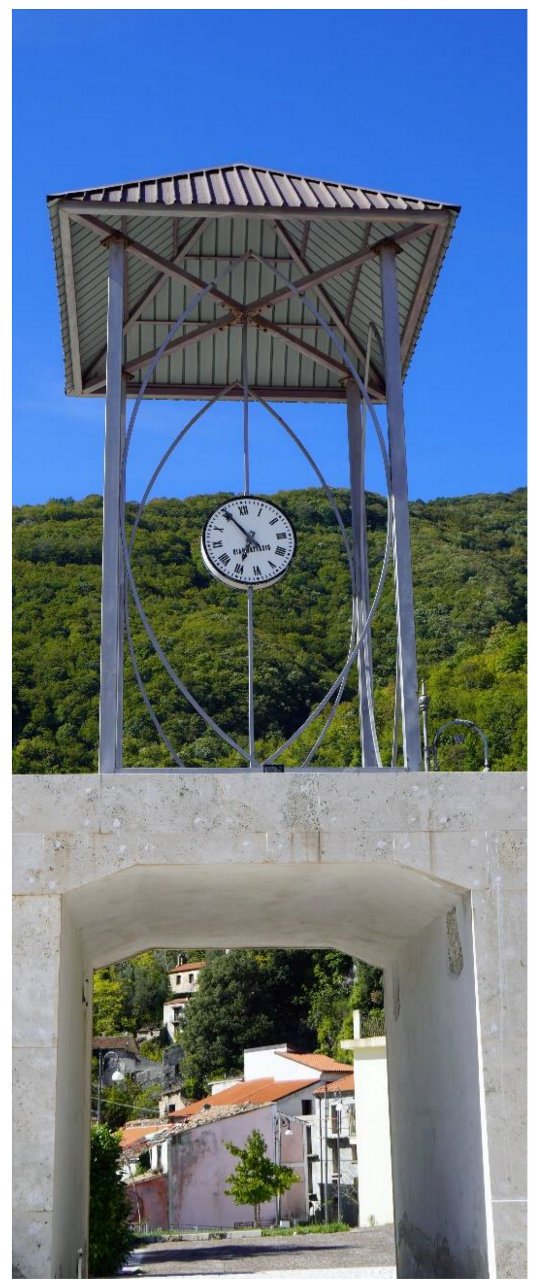
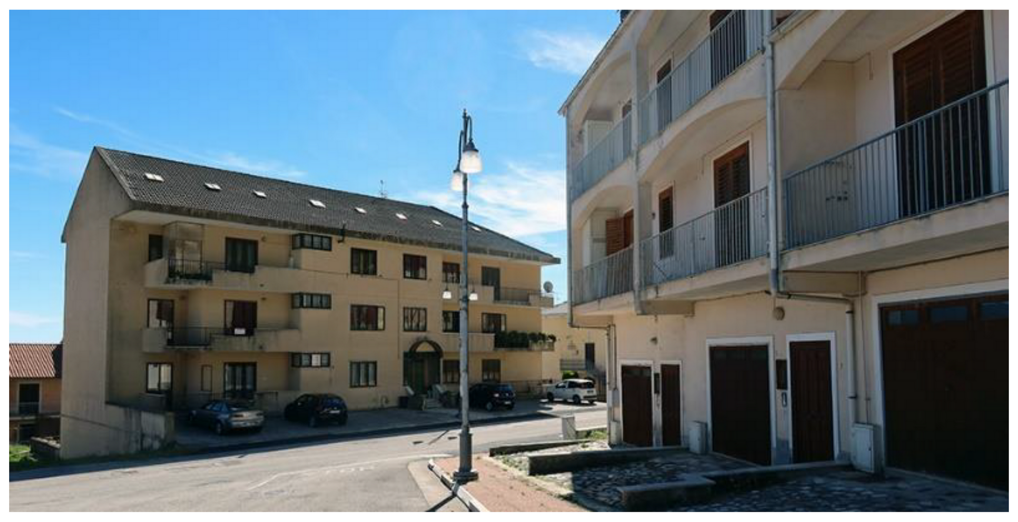
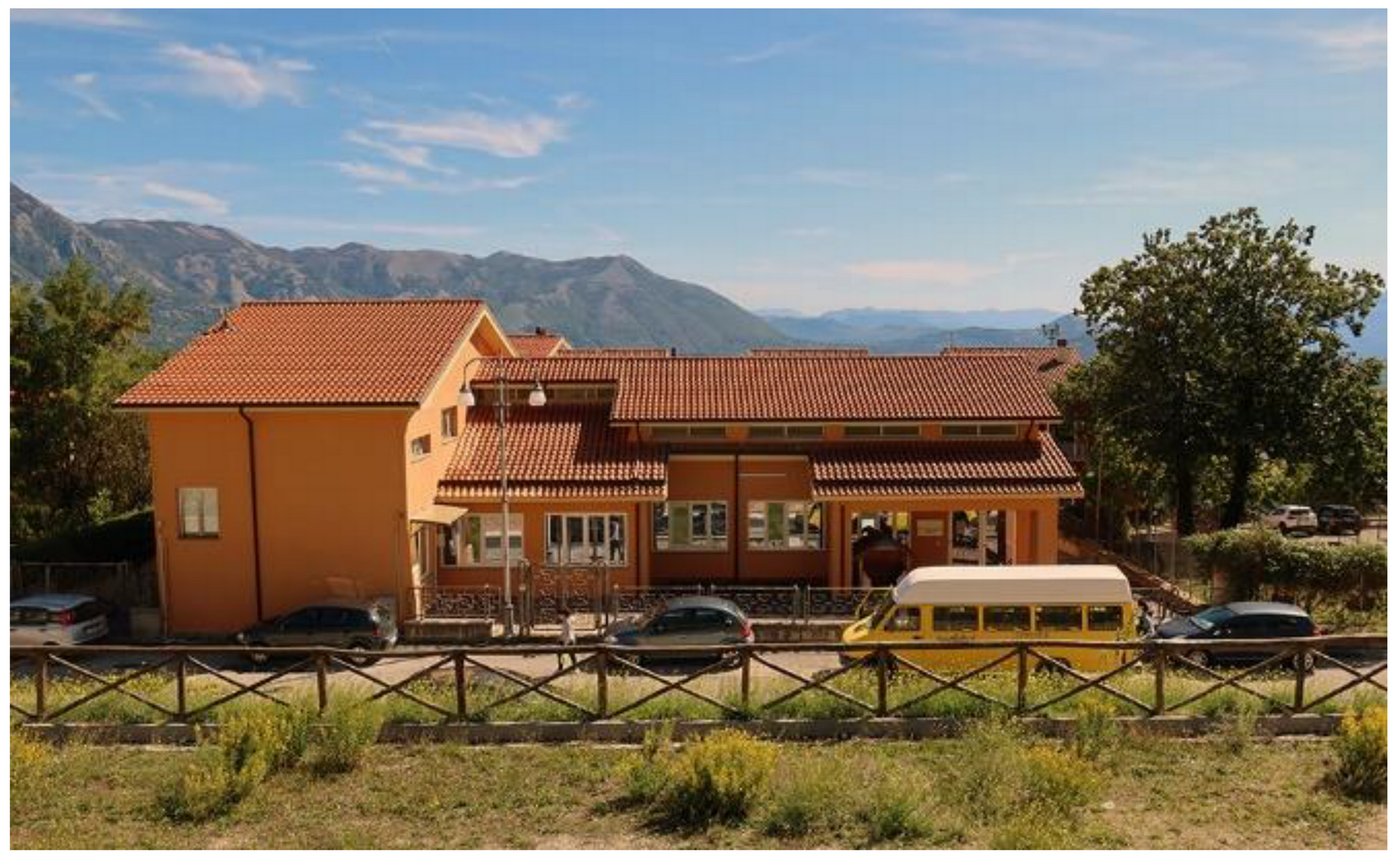
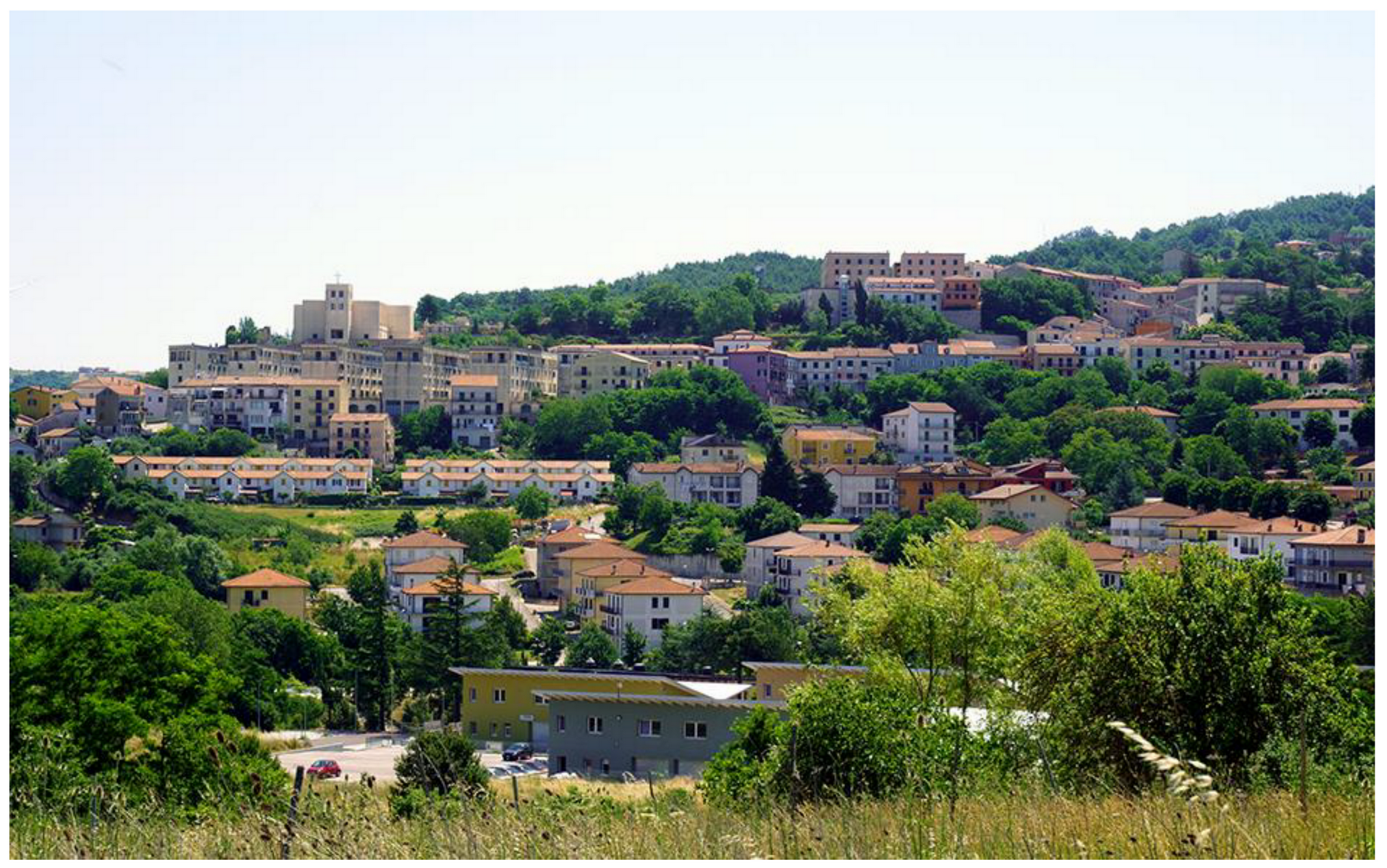
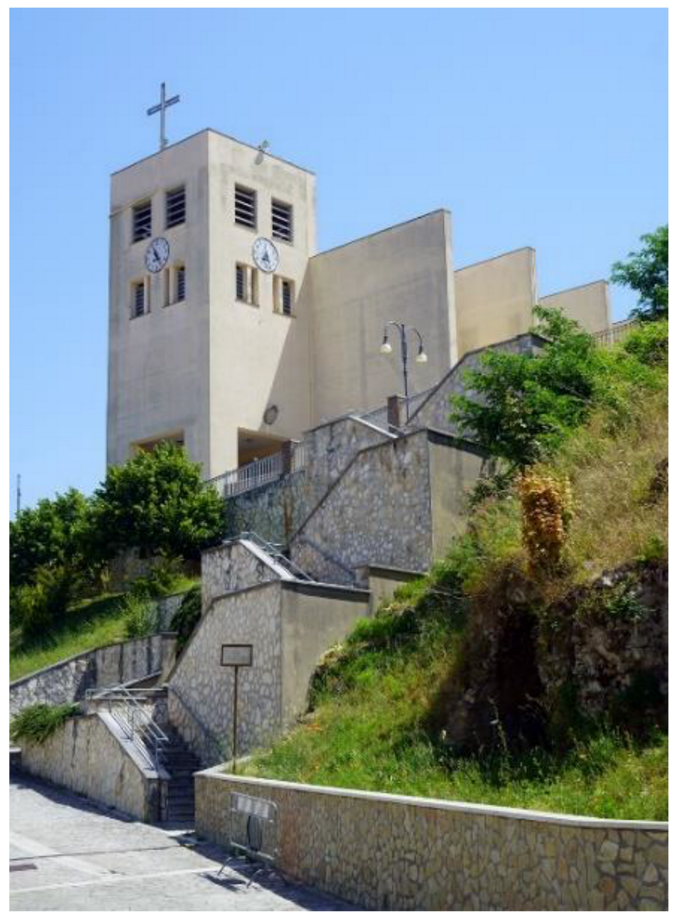
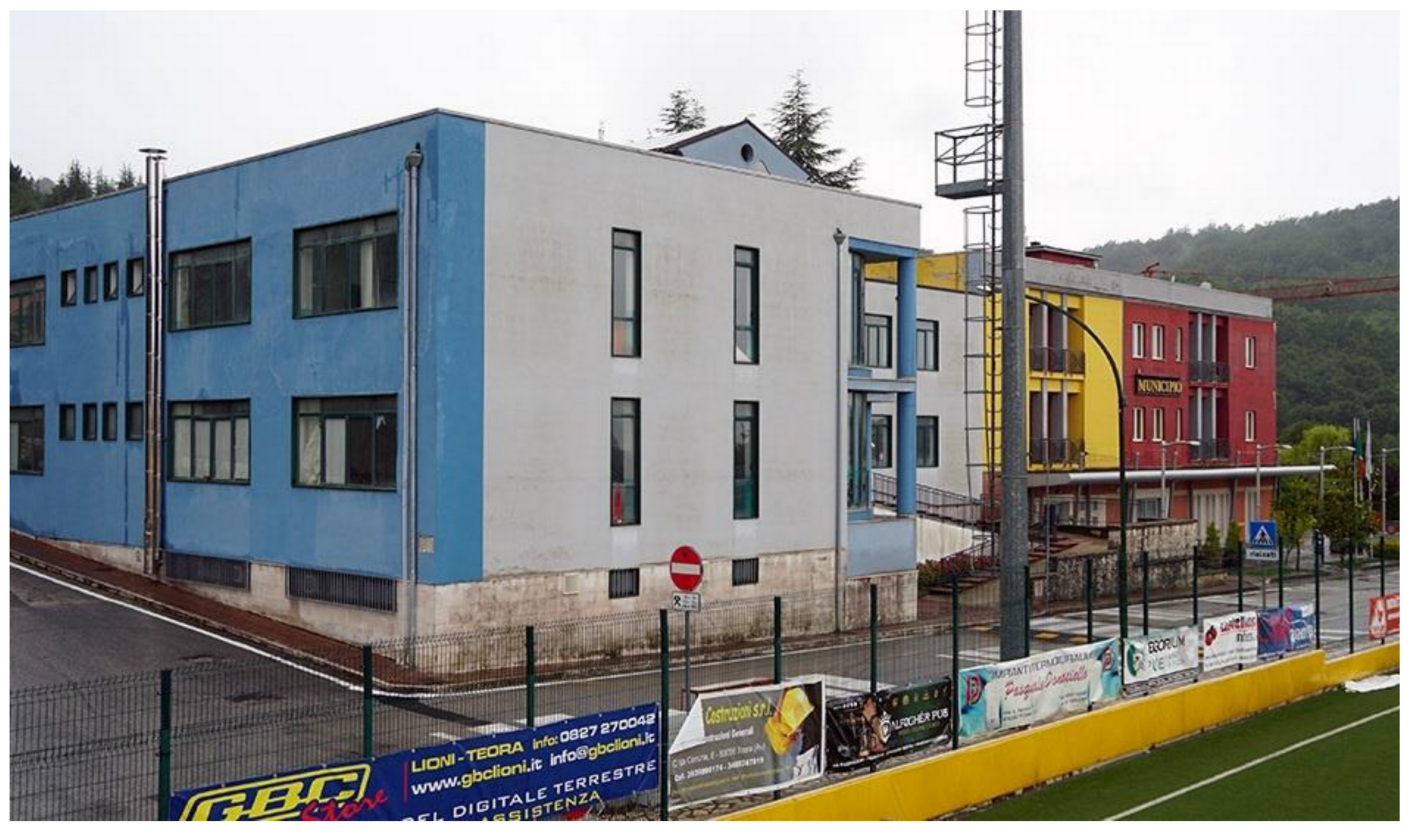
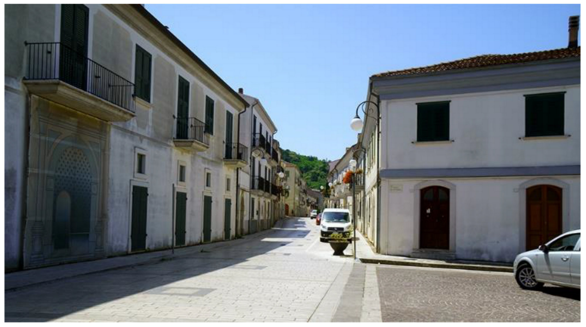
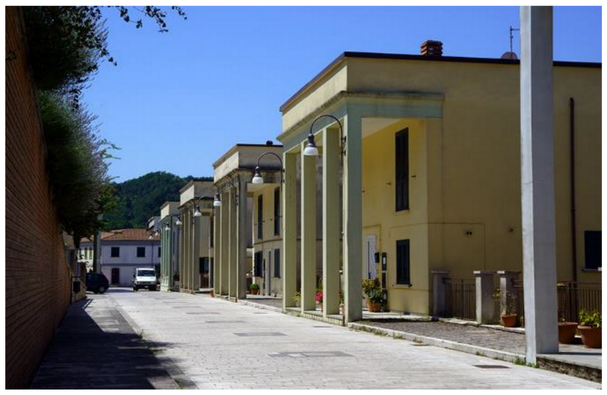
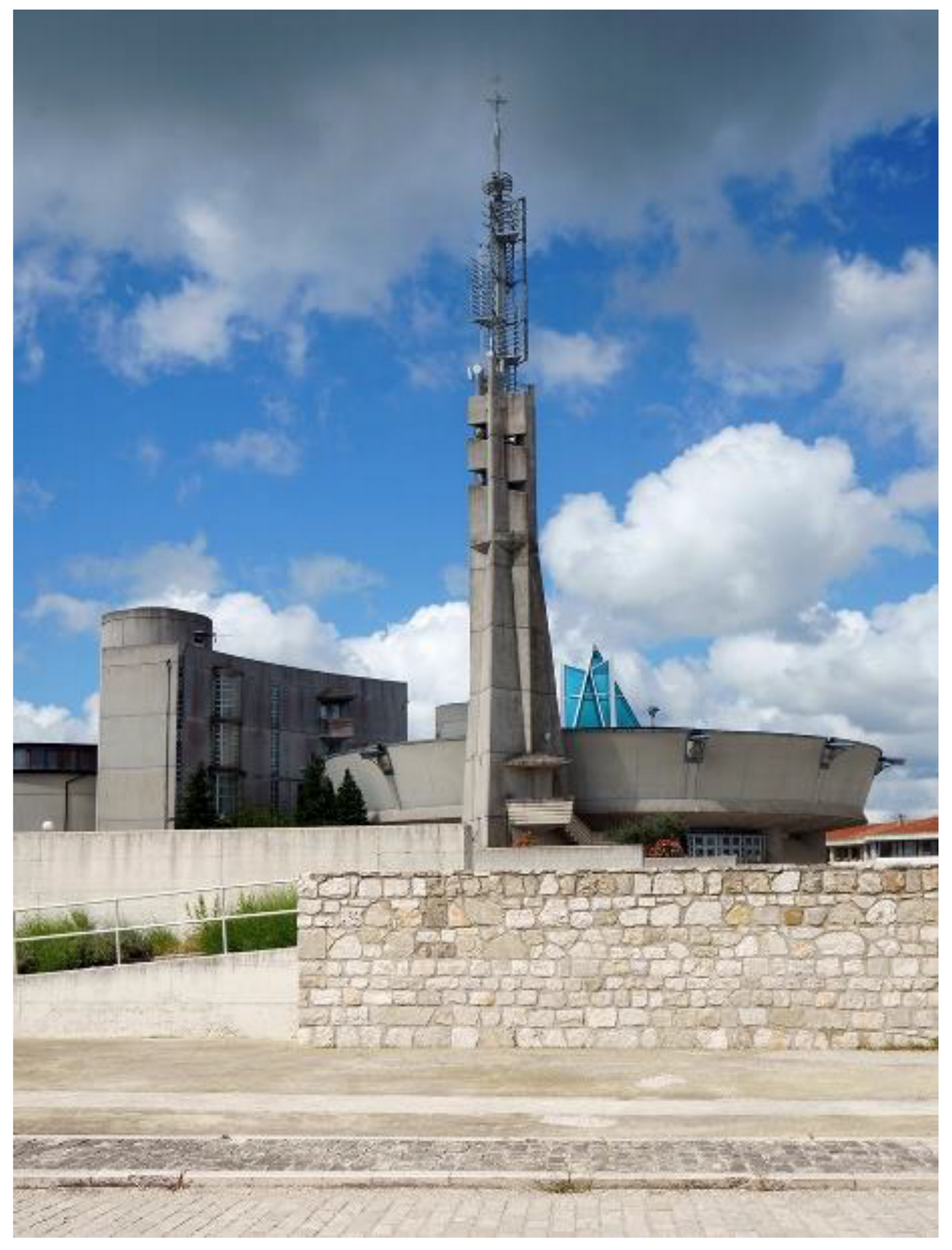
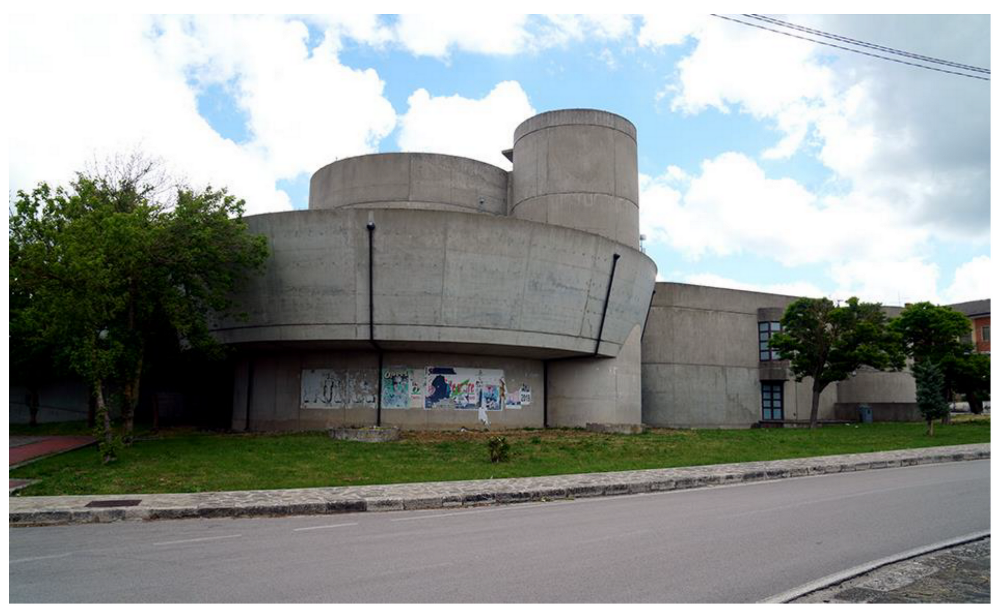
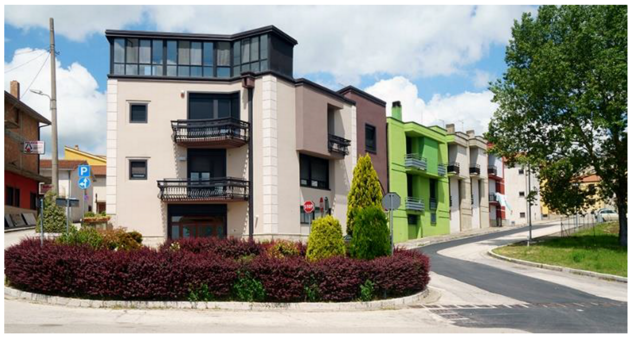
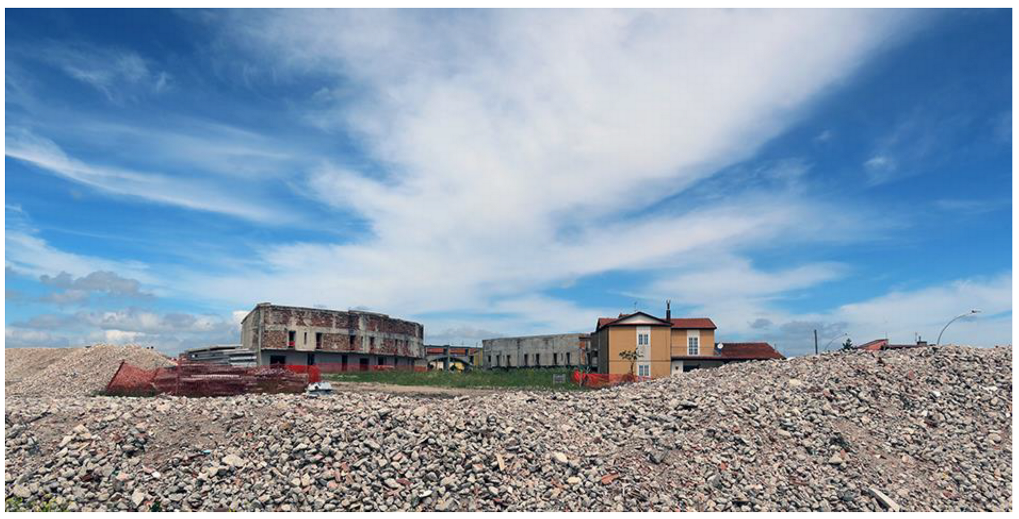
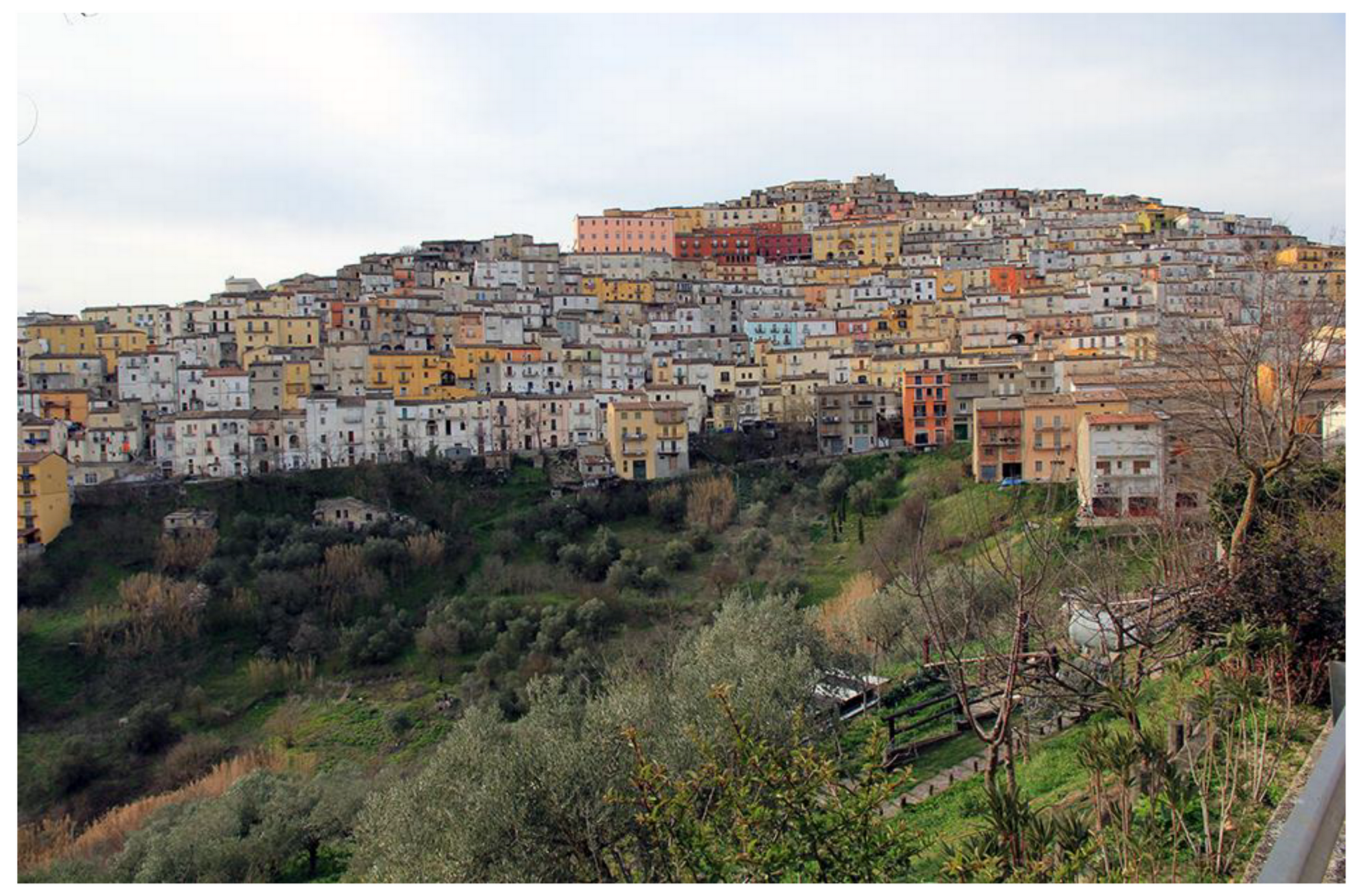
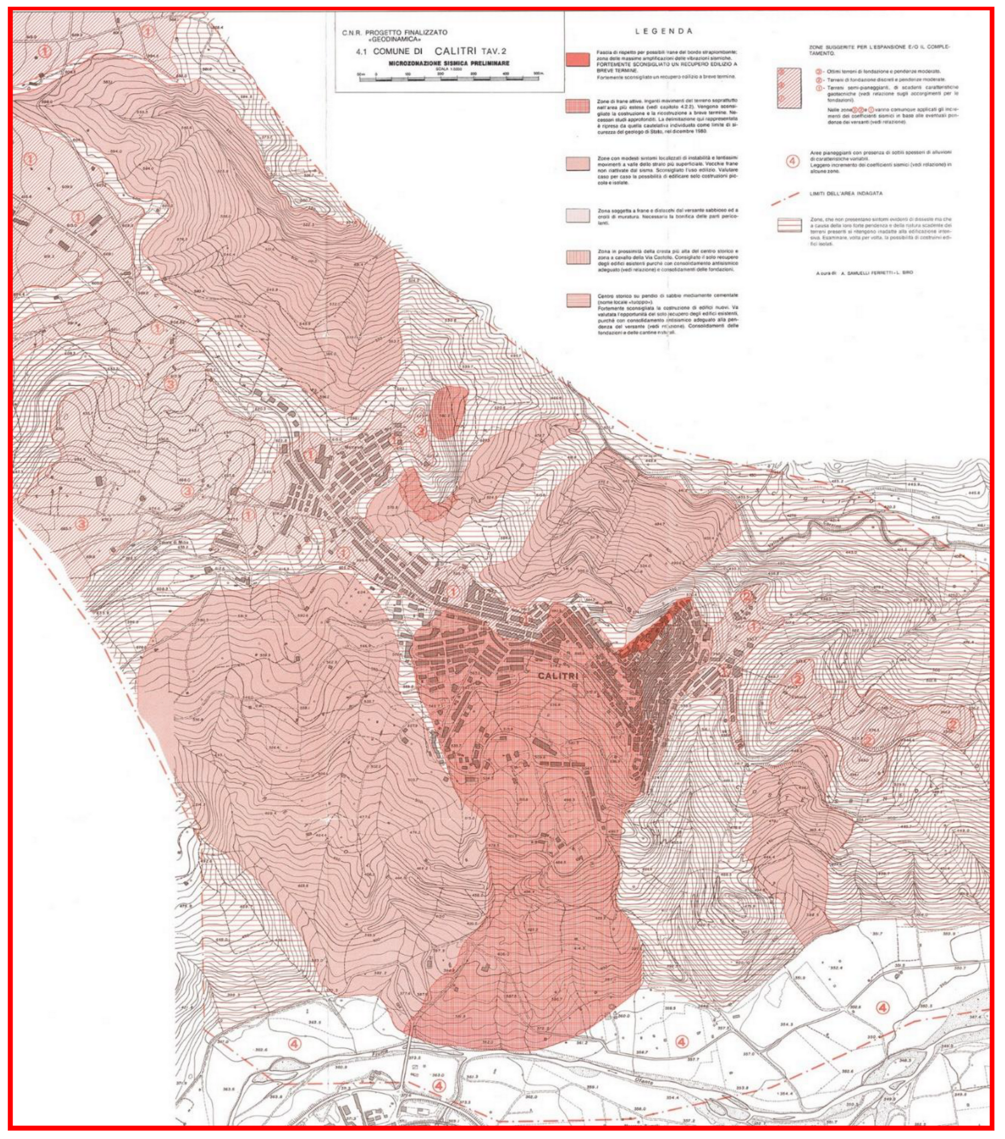
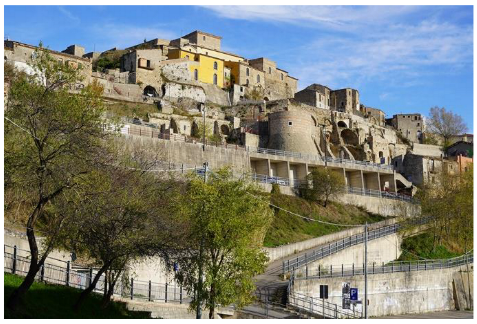
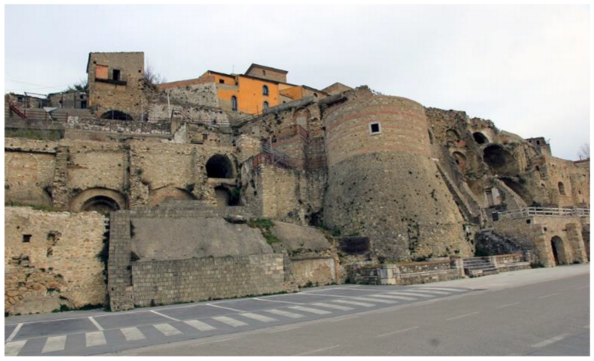
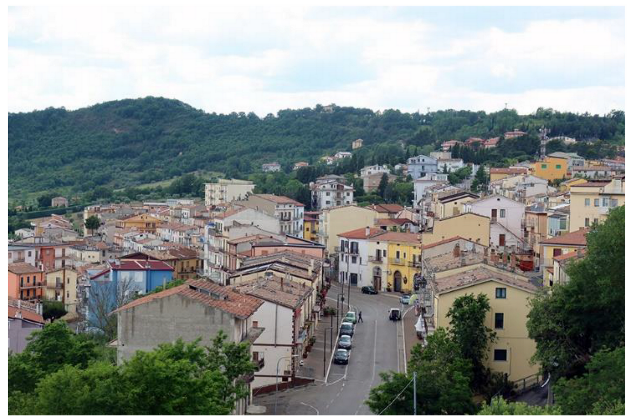
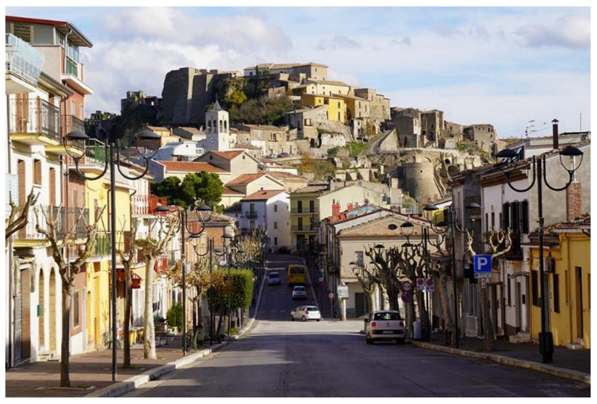
2. Discussion
3. Conclusions
Author Contributions
Funding
Acknowledgments
Conflicts of Interest
References
- Postpischl, D.; Branno, A.; Esposito, E.; Ferrari, G.; Marturano, A.; Porfido, S.; Rinaldis, V.; Stucchi, M. The Irpinia earthquake of November 23, 1980. In Atlas of Isoseismal Maps of Italian Earthquakes; CNR-PFG: Bologna, Italy, 1985; Volume 114, pp. 152–157. [Google Scholar]
- Rovida, A.; Locati, M.; Camassi, R.; Lolli, B.; Gasperini, P. CPTI15, the 2015 Version of the Parametric Catalogue of Italian Earthquakes. INGV 2016. [CrossRef]
- Serva, L.; Esposito, E.; Guerrieri, L.; Porfido, S.; Vittori, E.; Comerci, V. Environmental Effects from some historical earthquakes in Southern Apennines (Italy) and macroseismic intensity assessment. Contribution to INQUA EEE scale project. Quat. Int. 2007, 173–174, 30–44. [Google Scholar] [CrossRef]
- Gizzi, F.T.; Potenza, M.R. The scientific landscape of November 23rd, 1980 Irpinia Basilicata earthquake: Taking stock of (almost) forty years of studies. Geosciences 2020, 10, 482. [Google Scholar] [CrossRef]
- Commissione Parlamentare d’Inchiesta Sulla Attuazione Degli Interventi per la Ricostruzione e lo Sviluppo dei Territori della Basilicata e della Campania Colpiti dai Terremoti del Novembre 1980 e Febbraio 1981. Relazione Conclusiva e Propositiva. 1991, Volume I. Available online: https://storia.camera.it/lavori/sedute/27-novembre-1990-bf-10-19901127-00-01 (accessed on 24 December 2020).
- Proietti, G. “Dopo la Polvere”. Rilevazione Degli Interventi di Recupero Post-Sismico del Patrimonio Archeologico, Architettonico ed Artistico delle Regioni Campania e Basilicata Danneggiato dal Terremoto del 23 Novembre 1980 e del 14 Febbraio 1981; Ministero per i Beni Culturali e Ambientali: Rome, Italy, 1994; Volume 5. [Google Scholar]
- Mazzoleni, D.; Sepe, M. (Eds.) Rischio Sismico, Paesaggio, Architettura: L’Irpinia Contributi per un Progetto; CRdC AMRA: Naples, Italy, 2005. [Google Scholar]
- Bollettinari, G.; Panizza, M. Una faglia di superficie presso San Gregorio Magno in occasione del sisma del 23/11/1980 in Irpinia. Rend. Soc. Geol. Ital. 1981, 4, 135–136. [Google Scholar]
- Cinque, A.; Lambiase, S.; Sgrosso, I. Su due faglie nell’alta valle del Sele legate al terremoto del 23.11.1980. Rend. Soc. Geol. Ital. 1981, 4, 127–129. [Google Scholar]
- Carmignani, L.; Cello, G.; Cerrina Feroni, A.; Funiciello, R.; Klin, O.; Meccheri, M.; Patacca, E.; Pertusati, P.; Plesi, G.; Salvini, F.; et al. Analisi del campo di fratturazione superficiale indotto dal terremoto Campano-Lucano del 23/11/1980. Rend. Soc. Geol. Ital. 1981, 4, 451–465. [Google Scholar]
- Cotecchia, V. Ground deformations and slope instability produced by the earthquake of 23 November 1980 in Campania and Basilicata. Geol. Appl. Idrogeol. 1986, 21, 31–100. [Google Scholar]
- Pantosti, D.; Valensise, G. Faulting mechanism and complexity of the November 23, 1980, Campania-Lucania earthquake, inferred from surface observations. J. Geophys. Res. 1990, 95, 319–341. [Google Scholar] [CrossRef]
- Westaway, R.; Jackson, J. Surface faulting in the southern Italian Campania-Basilicata earthquake of 23 November 1980. Nature 1984, 312, 436–438. [Google Scholar] [CrossRef]
- Blumetti, A.M.; Esposito, E.; Ferreli, L.; Michetti, A.M.; Porfido, S.; Serva, L.; Vittori, E. Ground effects of the 1980 Irpinia earthquake revisited: Evidence for surface faulting near Muro Lucano. In Large-Scale Vertical Movements and Related Gravitational Processes; Dramis, F., Farabollini, P., Molin, P., Eds.; Studi Geol. Camerti: Camerino, Italy, 2002; pp. 19–27. [Google Scholar]
- Bernard, P.; Zollo, A. The Irpinia (Italy) 1980 earthquake: Detailed analysis of a complex normal faulting. J. Geophys. Res. 1989, 94, 1631–1648. [Google Scholar] [CrossRef]
- Ascione, A.; Mazzoli, S.; Petrosino, P.; Valente, E. A decoupled kinematic model for active normal faults: Insights from the 1980, MS = 6.9 Irpinia earthquake, southern Italy. Geol. Soc. Am. Bull. 2013, 125, 1239–1259. [Google Scholar] [CrossRef]
- Galli, P. Roman to Middle Age Earthquakes Sourced by the 1980 Irpinia Fault: Historical, Archaeoseismological, and Paleoseismological Hints. Geosciences 2020, 10, 286. [Google Scholar] [CrossRef]
- Matano, F.; Di Nocera, S.; Criniti, S.; Critelli, S. Geology of the Epicentral Area of the November 23, 1980 Earthquake (Irpinia, Italy): New Stratigraphical, Structural and Petrological Constrains. Geosciences 2020, 10, 247. [Google Scholar] [CrossRef]
- Del Prete, M.; Trisorio Liuzzi, G. Risultati dello studio preliminare della frana di Calitri (AV) mobilitata dal terremoto del 23/11/1980. Geol. Appl. Idrogeol. 1981, 16, 153–165. [Google Scholar]
- Esposito, E.; Gargiulo, A.; Iaccarino, G.M.; Porfido, S. Distribuzione dei fenomeni franosi riattivati dai terremoti dell’Appennino meridionale. Censimento delle frane del terremoto del 1980. In Proceeding Internal Convention on Prevention of Hydrogeological Hazards; CNR(IRPI): Torino, Italy, 1998; pp. 409–429. [Google Scholar]
- Porfido, S.; Esposito, E.; Michetti, A.M.; Blumetti, A.M.; Vittori, E.; Tranfaglia, G.; Guerrieri, L.; Ferreli, L.; Serva, L. Areal distribution of ground effects induced by strong earthquakes in the Southern Apennines (Italy). Surv. Geophys. 2002, 23, 529–562. [Google Scholar] [CrossRef]
- Porfido, S.; Esposito, E.; Guerrieri, L.; Vittori, E.; Tranfaglia, G.; Pece, R. Seismically induced ground effects of the 1805, 1930 and 1980 earthquakes in the Southern Apennines. Boll. Soc. Geol. Ital. 2007, 126, 333–346. [Google Scholar]
- Wasowski, J.; Pierri, V.; Pierri, P.; Capolongo, D. Factors controlling seismic susceptibility of the Sele valley slopes: The Case of the 1980 Irpinia Earthquake Re-examined. Surv. Geophys. 2002, 23, 563–593. [Google Scholar] [CrossRef]
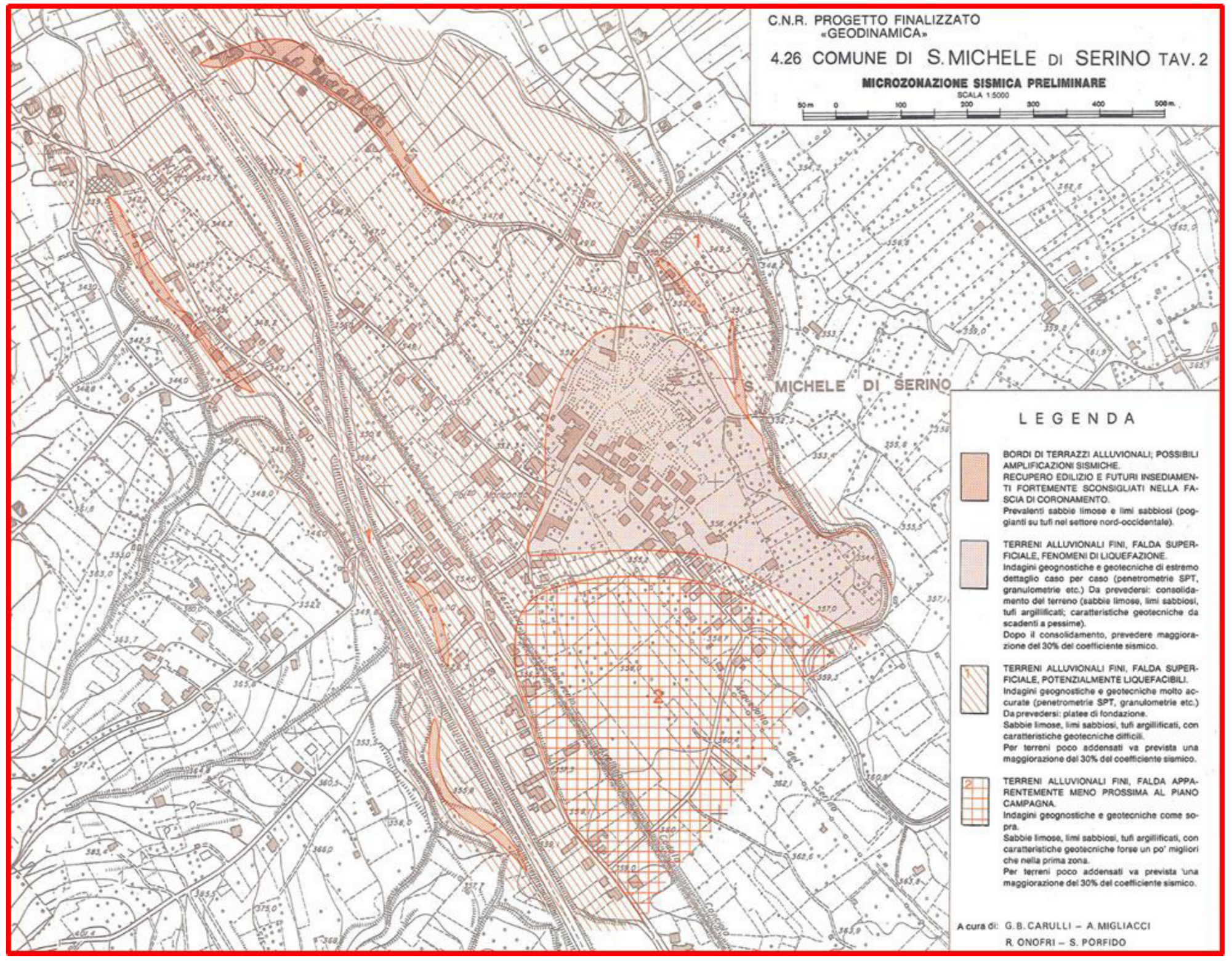
- Carulli, G.B.; Migliacci, A.; Onofri, R.; Porfido, S. Indagini geologiche ed in prospettiva sismica a S. Michele di Serino. Rend. Soc. Geol. Ital. 1981, 161–164. [Google Scholar]
- Cotecchia, V.; Salvemini, A. Correlation between seismic events and discharge variations at Caposele and Cassano Irpino springs, with particular reference to the 23 November 1980 earthquake. [Correlazione fra eventi sismici e variazione di portata alle sorgenti di Caposele e Cassano Irpino, con particolare riferimento al sisma del 23 Novembre 1980]. Geol. Appl. Idrogeol. 1981, 16, 167–192. [Google Scholar]
- Galli, P. New empirical relationships between magnitude and distance for liquefaction. Tectonophysics 2000, 324, 169–187. [Google Scholar] [CrossRef]
- Esposito, E.; Pece, R.; Porfido, S.; Tranfaglia, G. Hydrological anomalies connected to earthquakes in Southern Apennines, Italy. Nat. Hazards Earth Syst. Sci. EGS 2001, 1, 137–144. [Google Scholar] [CrossRef] [Green Version]
- Osservatorio Permanente sul Doposisma. Edizioni MIdA-2010. p. 114. Available online: http://www.laquilaemotion.it/idee/idee/osservatorio-permanente-sul-doposisma.html (accessed on 24 December 2020).
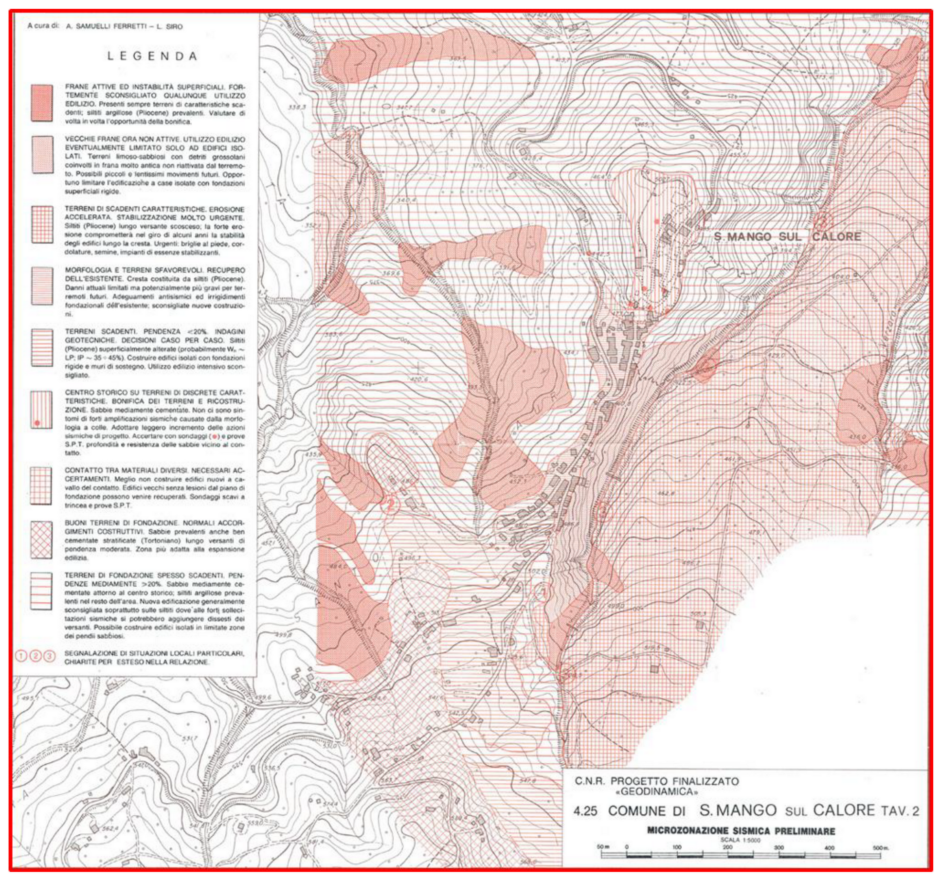
- Siro, L.; Bigi, G.; Testoni, P.; Luongo, G. Indagini di microzonazione sismica. In Intervento Urgente in 39 Comuni della Campania e della Basilicata Colpiti dal Terremoto del 23 Novembre 1980; Pubbl. n. 492; CNR-PFG: Bologna, Italy, 1983; 221p. [Google Scholar]
- Guarino, M. Verso una Nuova Qualità dell’abitare: La Riqualificazione dell’edilizia Residenziale Pubblica. Tesi di Dottorato di Ricerca in Ingegneria delle Strutture e del Recupero Edilizio ed Urbano (2007–2010). Available online: http://elea.unisa.it/jspui/handle/10556/156 (accessed on 24 December 2020).
- Moscaritolo, G.I. Reconstruction as a Long-Term Process. Memory, Experiences and Cultural Heritage in the Irpinia Post-Earthquake (November 23, 1980). Geosciences 2020, 10, 316. [Google Scholar] [CrossRef]
- Maresca, R.; Nardone, L.; Gizzi, F.T.; Potenza, M.R. Ambient noise HVSR measurements in the Avellino historical centre and surrounding area (southern Italy). Correlation with surface geology and damage caused by the 1980 Irpinia-Basilicata earthquake. Measurement 2018, 130, 211–222. [Google Scholar] [CrossRef]
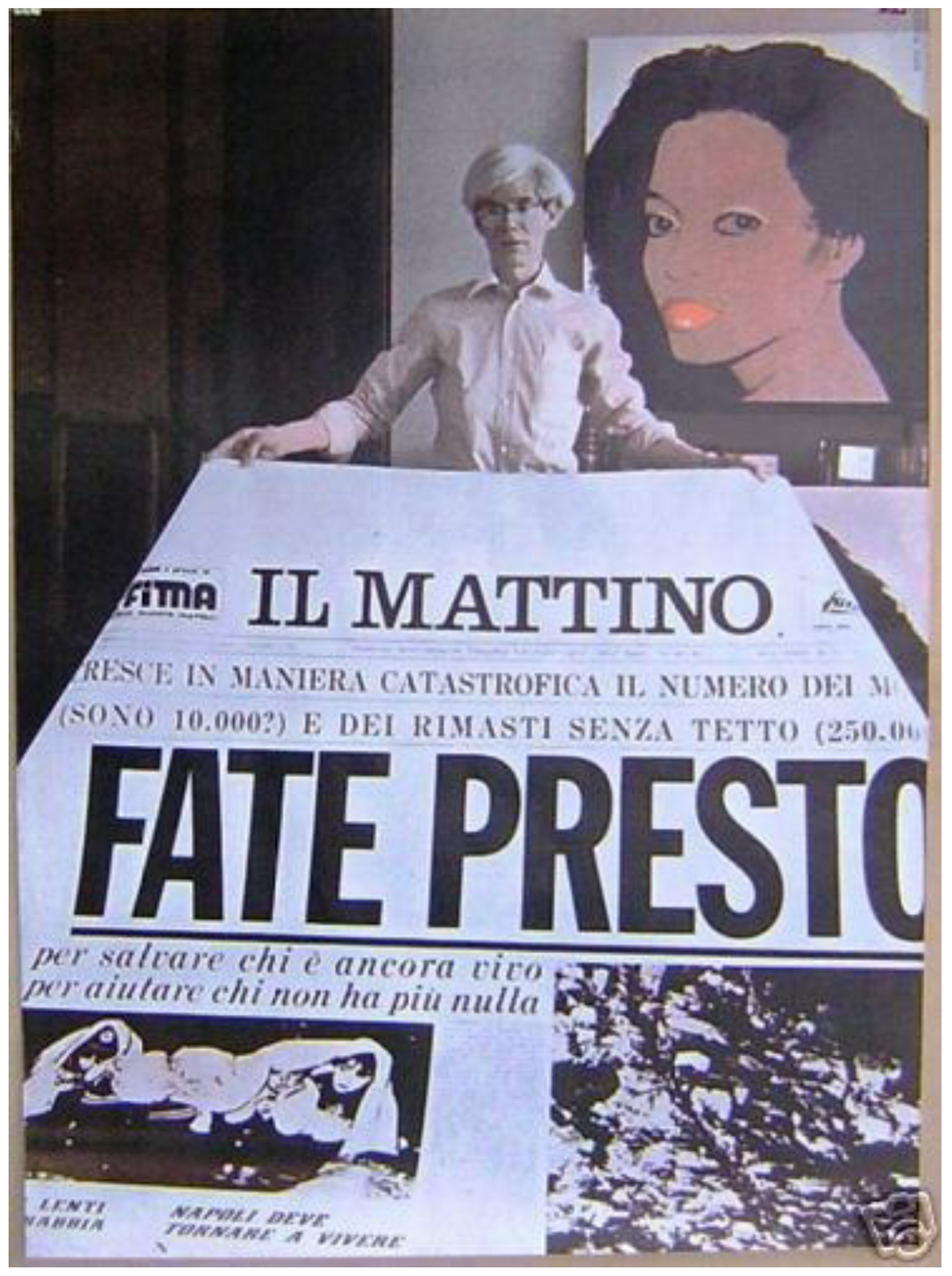
- Artibrune. Dal 2011 Arte Eccetera Eccetera. Available online: https://www.artribune.com/attualita/2011/11/%E2%80%9Cfate-presto%E2%80%9D-stratigrafia-di-un-titolo/ (accessed on 5 October 2020).
- Scirè, E.; Siro, L.; Stucchi, M.; Gaiazzi, M. Geo-seismic investigations and urban planning after the Irpinia- 971 Basilicata 1980 earthquake: Part 1, the case of Caposele and Conza della Campania. Geol. Appl. Idrogeol. 1986, 21, 441–450. [Google Scholar]
- Porfido, S.; Spiga, E. Ricostruzione 1980–2020 Ed; Blurb: San Francisco, CA, USA, 2020; Volume I, ISBN 978-1-71-571504-5. [Google Scholar]
- Porfido, S.; Spiga, E. Ricostruzione 1980–2020 Ed; Blurb: San Francisco, CA, USA, 2020; Volume II, ISBN 978-1-71-572142-8. [Google Scholar]
- Coletta, T. La Conservazione dei Centri Storici Minori Abbandonati. Il Caso Della Campania. Ph.D. Thesis, Università “Federico II” Napoli, Naples, Italy, 2005. [Google Scholar]
- Ventura, S. I ragazzi dell’Ufficio del Piano la ricostruzione urbanistica in Irpinia. In I frutti di Demetra, Bollettino di Storia Ambientale; Donzelli: Roma, Italy, 2010; Volume 22. [Google Scholar]
- Porfido, S.; Alessio, G.; Gaudiosi, G.; Nappi, R.; Spiga, E. The resilience of some villages 36 years after the Irpinia-Basilicata (Southern Italy) 1980 earthquake. In Workshop on World Landslide Forum; Springer: Cham, Switzerland, 2017. [Google Scholar] [CrossRef]
- Porfido, S.; Spiga, E. Il terremoto del 23 novembre 1980: Ricostruzioni e abbandoni di alcuni paesi nell’Appennino meridionale. The earthquake of November 23rd, 1980: Reconstructions and abandonments of some villages in the southern Apennines. In La Città Altra Storia e Immagine della Diversità Urbana: Luoghi e Paesaggi dei Privilegi e del Benessere, Dell’isolamento, del Disagio, della Multiculturalità; Capano, F., Pascariello, M.I., Visone, M., Eds.; CIRICE: Napoli, Italy, 2018; ISBN 978-88-99930-03-5. [Google Scholar] [CrossRef]
- Spiga, E.; Porfido, S. Bisaccia Piano di Zona Ed; Blurb: San Francisco, CA, USA, 2020; ISBN 978-1-71-555296-1. [Google Scholar]
- Locci, M.; Loris Rossi, A. La Concretezza Dell’utopia; Testo & Immagine: Torino, Italy, 1997. [Google Scholar]
- Scirè, E.; Siro, L.; Stucchi, M.; Gaiazzi, M. Geo-seismic investigations and urban planning after the Irpinia-Basilicata 1980 earthquake: Part 2, the case of S. Angelo dei Lombardi (Italy). Geol. Appl. Idrogeol. 1986, 21, 387–397. [Google Scholar]
- Ventura, F. The long-term effects of the 1980 earthquake on the villages of southern Italy. Disasters 1984, 894, 11. [Google Scholar] [CrossRef]
- Alexander, D. Housing crisis after natural disasters: The aftermath of the November 1980 southern Italian earthquake. In Geoforum; Elsevier: Amsterdam, The Netherlands, 1984; pp. 489–516. [Google Scholar]
- Guadagno, L. Disastri Naturali e Vulnerabilità Sociale. Un’analisi del Terremoto in Campania. Ph.D. Thesis, Università degli Studi del Sannio, Benevento, Italy, 2010. [Google Scholar]
- Wyss, M.; Rosset, P. Near-Real-Time Loss Estimates for Future Italian Earthquakes Based on the M6.9 Irpinia Example. Geosciences 2020, 10, 165. [Google Scholar] [CrossRef]
- Colucci, M.; Gallo, S. Campania in movimento-Rapporto sulle migrazioni interne in Italia. In Collana “Fuori Collana”; Società editrice il Mulino: Bologna, Italy, 2020; p. 200. ISBN 978-88-15-28720-5. [Google Scholar]
- Ricciardi, T. Avellino. L’Irpinia 40 anni dopo il terremoto, tra cambiamenti e amare continuità. In Rapporto Italiani nel Mondo 2020; Fondazione Migrantes: Roma, Italy, 2020; pp. 95–106. [Google Scholar]


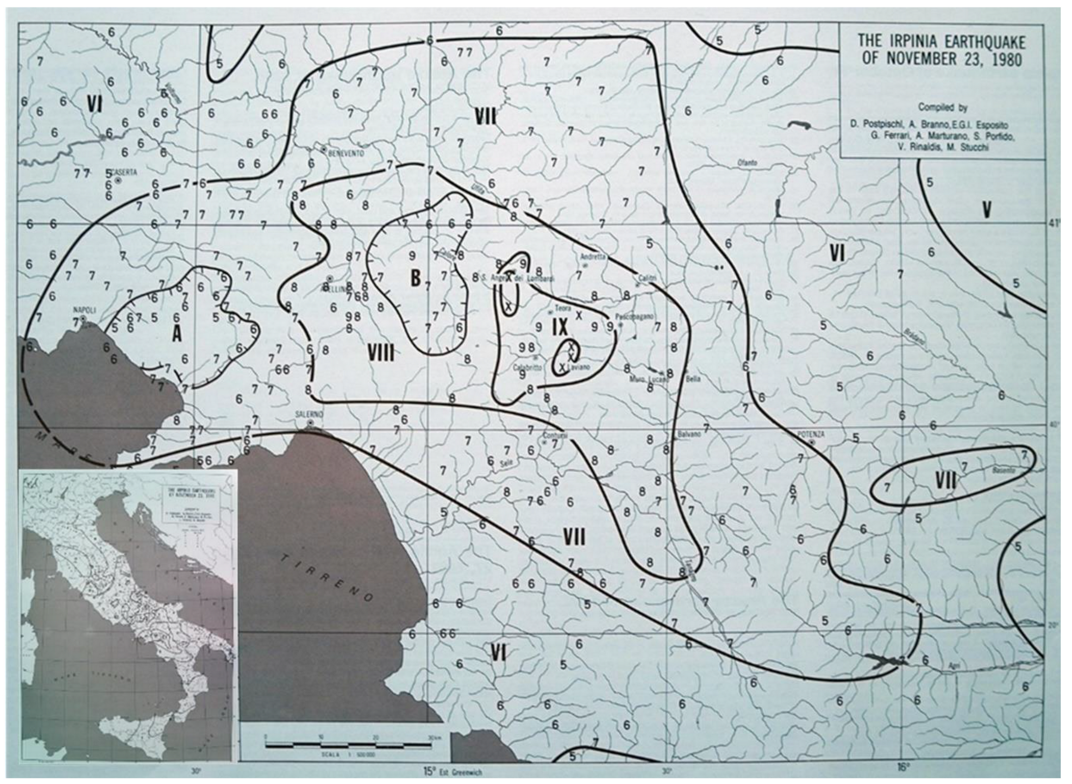
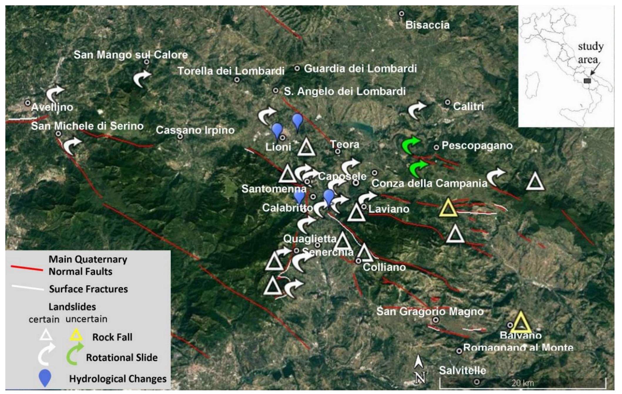
| Locality | Lat. | Long. | (MCS) Intensity | ESI07 Intensity | Environmental Effects |
|---|---|---|---|---|---|
| Castelnuovo di Conza | 40.819091° | 15.319704° | X | 8 | SF, L, F |
| Conza della Campania | 40.870562° | 15.330818° | X | 9 | L, F, SC |
| Laviano | 40.786800° | 15.309247° | X | 9 | SF, F, L |
| Lioni | 40.877996° | 15.189476° | X | 8 | L, SF, LQ, SC |
| S. Angelo dei Lombardi | 40.927716° | 15.177733° | X | 8 | L, temporary lake, F |
| Santomenna | 40.808495° | 15.321044° | X | - | L, F |
| Balvano | 40.650928° | 15.511861° | IX | 7 | L |
| Calabritto | 40.650928° | 15.511861° | IX | 9 | SF, L, F, HC |
| Quaglietta | 40.745299° | 15.235847° | IX | 9 | L, F |
| Caposele | 40.815372° | 15.220236° | IX | 10 | L, SF, SC, HC |
| Guardia dei Lombardi | 40.953346° | 15.209175° | IX | 8 | L, F |
| Pescopagano | 40.835588° | 15.399507° | IX | 8 | L, F |
| San Mango sul Calore | 40.963896° | 14.975828° | IX | 8 | L, F |
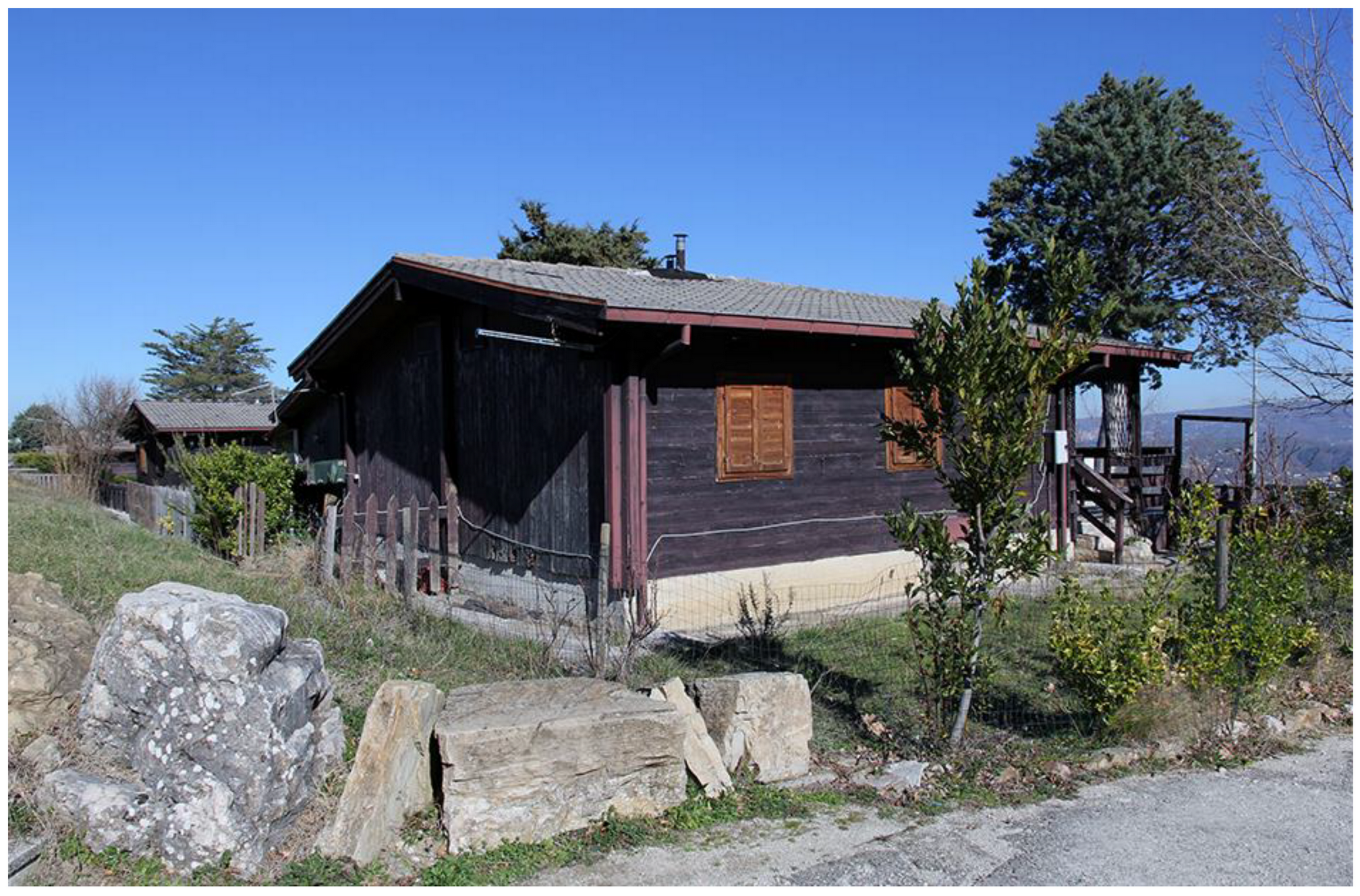
| San Michele di Serino | 40.876228° | 14.855731° | IX | 6 | F, LQ |
| Senerchia | 40.740248° | 15.203956° | IX | 9 | SF, L, F, LQ |
| Teora | 40.852752° | 15.253197° | IX | 6 | F |
| Torella dei Lombardi | 40.940058° | 15.114519° | IX | 8 | F |
| Colliano | 40.725860° | 15.291517° | VIII-IX | 9–10 | SF, F, L |
| Romagnano al Monte | 40.628289° | 15.456647° | VIII-IX | - | L, F |
| Salvitelle | 40.591196° | 15.459109° | VIII-IX | - | F, L |
| Avellino | 40.916753 | 14.797924° | VIII | - | F, L |
| Calitri | 40.899432° | 15.439435° | VIII | 8 | L, F, LQ |
| Bisaccia | 41.013215° | 15.375352° | VIII | 8 | L, F, SC |
Publisher’s Note: MDPI stays neutral with regard to jurisdictional claims in published maps and institutional affiliations. |
© 2020 by the authors. Licensee MDPI, Basel, Switzerland. This article is an open access article distributed under the terms and conditions of the Creative Commons Attribution (CC BY) license (http://creativecommons.org/licenses/by/4.0/).
Share and Cite
Porfido, S.; Alessio, G.; Gaudiosi, G.; Nappi, R.; Michetti, A.M.; Spiga, E. Photographic Reportage on the Rebuilding after the Irpinia-Basilicata 1980 Earthquake (Southern Italy). Geosciences 2021, 11, 6. https://doi.org/10.3390/geosciences11010006
Porfido S, Alessio G, Gaudiosi G, Nappi R, Michetti AM, Spiga E. Photographic Reportage on the Rebuilding after the Irpinia-Basilicata 1980 Earthquake (Southern Italy). Geosciences. 2021; 11(1):6. https://doi.org/10.3390/geosciences11010006
Chicago/Turabian StylePorfido, Sabina, Giuliana Alessio, Germana Gaudiosi, Rosa Nappi, Alessandro Maria Michetti, and Efisio Spiga. 2021. "Photographic Reportage on the Rebuilding after the Irpinia-Basilicata 1980 Earthquake (Southern Italy)" Geosciences 11, no. 1: 6. https://doi.org/10.3390/geosciences11010006