Proceeding Paper

Comparison of Approaches for Determining Grazing Capacity in Forest Rangelands: The Case of Pisoderion Forest Florina-Greece †

by
Katerina Melfou
1,*,
Dimitrios Kalfas
1,
Fotios Chatzitheodoridis
2,
Stavros Kalogiannidis
3,
Efstratios Loizou
2 and
Ermelinda Toska
2
1
Department of Agriculture, Faculty of Agricultural Sciences, University of Western Macedonia, Terma Kondopoulou, 53100 Florina, Greece
2
Department of Regional and Cross-Border Development, Faculty of Economic Sciences, University of Western Macedonia, Koila, 50100 Kozani, Greece
3
Department of Business Administration, University of Western Macedonia, 50100 Kozani, Greece
*
Author to whom correspondence should be addressed.
Presented at the 3rd International Electronic Conference on Forests—Exploring New Discoveries and New Directions in Forests, 15–31 October 2022; Available online: https://iecf2022.sciforum.net/.
Environ. Sci. Proc. 2022, 22(1), 68; https://doi.org/10.3390/IECF2022-13055
Published: 15 October 2022

Abstract

:
False-alpine grasslands, also known as summer grasslands or rangelands, are mainly associated with transhumance. In the past, transhumance and grazing were organized on a mainly family basis, and there existed an informal management system for grazing that was respected by all livestock farmers who used the summer pastures. Nomadic animal husbandry has disappeared, and with it a sense of respect for nature, the rangelands, and more generally, the environment. The aim of this paper is to assess the grazing capacity of rangelands in the Pisoderion Forest, which is located in the region of Florina in Greece, under various specifications introduced by forest management plans and relatively recent legislation. The grazing capacity that is theoretically expected following the specifications of previous forest management plans is compared to the grazing capacity according to the specifications introduced by relatively recent legislation. The conclusion that can be drawn is that the rangelands are underused, and with an appropriate holistic management approach, such as the traditional system of dividing the forest grasslands into yards, the livestock capital can be doubled in these rangelands.

1. Introduction

A rising concern in recent years is the ability to manage resources in a sustainable manner and not allow them to be misused and degenerate faster than their capacity for self-restoration. Intensive production systems generate, along with marketable outputs, non-marketed negative externalities, such as pollution and habitat loss, for example, that have been often set aside and ignored, resulting in a decrease in productivity and socio-economic repercussions. Negative externalities, such as climate change, pollution, and resource overexploitation, are the main causes of the loss of biodiversity and the deterioration of natural ecosystems, leading to reduced provision of ecosystem services and diminishing productivity [1,2]. The management of rangelands is a critical factor for biodiversity preservation, ecosystem services, and regional socio-economic development [1,3]. Evidence suggests that aiming at ecological rehabilitation can enhance biodiversity and the provision of ecosystem services. However, the degree of real recovery stemming from these efforts remains uncertain and untested [1].
Grasslands are the largest terrestrial ecosystem, accounting for approximately 40% of the world’s land area [4,5]. However, due to rapid economic growth and adverse climate change, approximately 16% of global grasslands have been degraded [6,7]. Continued grassland degradation reduces ecosystem services, seriously threatening livestock production and environmental security [6,8]. The way grazing is managed could affect grassland richness, biomass, carbon sequestration capacity, and ecological health [5,9].
They provide important ecosystem goods and services, such as livestock supply, soil and water conservation, and carbon storage [10,11]. As one of the most critical ecosystem services provided by grasslands, livestock provisioning will become increasingly important as global demand for animal protein and dairy products increases in the coming decades [12]. However, the actual level of livestock production on grasslands exceeds the grazing capacity and has become increasingly serious over the years [5].
Overgrazed rangelands is a case of a complex externality, in which the actions of one livestock farmer affect the production possibilities of others, while at the same time the actions of all livestock farmers adversely affect the quality of the resource, imposing damages on society and social welfare [13]. Of course, both the quality and the quantity of the grazing materials in the pastures are affected by biotic and abiotic environmental factors [14,15]. The prohibition of grazing is widely regarded as a practice of restoration and management of rangelands [16,17]. It is an economic approach to rehabilitation, which in practice, excludes animal capital and its harmful activities, taking advantage of the natural resilience of ecosystems to achieve the desired recovery [18,19,20]. Another relatively more modern way of restoration is the holistic management of rangelands or holistic grazing. Savory Allan, relatively early on, linked the state of rangelands to the economic well-being of farmers who manage these areas and to their social and psychological well-being. He argued that holistic grazing, which is effectively the grazing of separate rotated areas, can increase the production of grassland plants, the ability of the soil to retain water, and, in general, can bring the degradation to an end and improve the economic indicators of the pasture [21,22,23]. However, the viability of rangeland ecosystems depends on both anthropogenic and non-anthropogenic interventions, especially in our time, which is characterized by rapid changes on a global scale. Innovative theories and practices are urgently needed to promote the sustainable development of these critical and unique ecosystems of global importance [24].
Accurate assessment of forage production methods can be categorized into three types: direct measurements by harvesting, statistical determination, and integrated models. The commonly used statistical technique uses remote sensing and ground data to build models, and fodder production is estimated with the help of a statistical model. The use of modern remote sensing products (satellite images but also drones) in grassland-related studies has increased due to the higher resolution and accuracy they achieve [5,25,26].
This paper aims to compare grazing capacity that is theoretically expected according to the specifications of forest management plans to the grazing capacity consistent with the technical specifications laid down in the new grazing management plans under recent legislation (Law 4264/2014 for temporary management grazing plans, as defined by a government decision No. 11734 2932/12.12.2014 and published in the Greek Government Gazette Β 3557/30.12.2014).

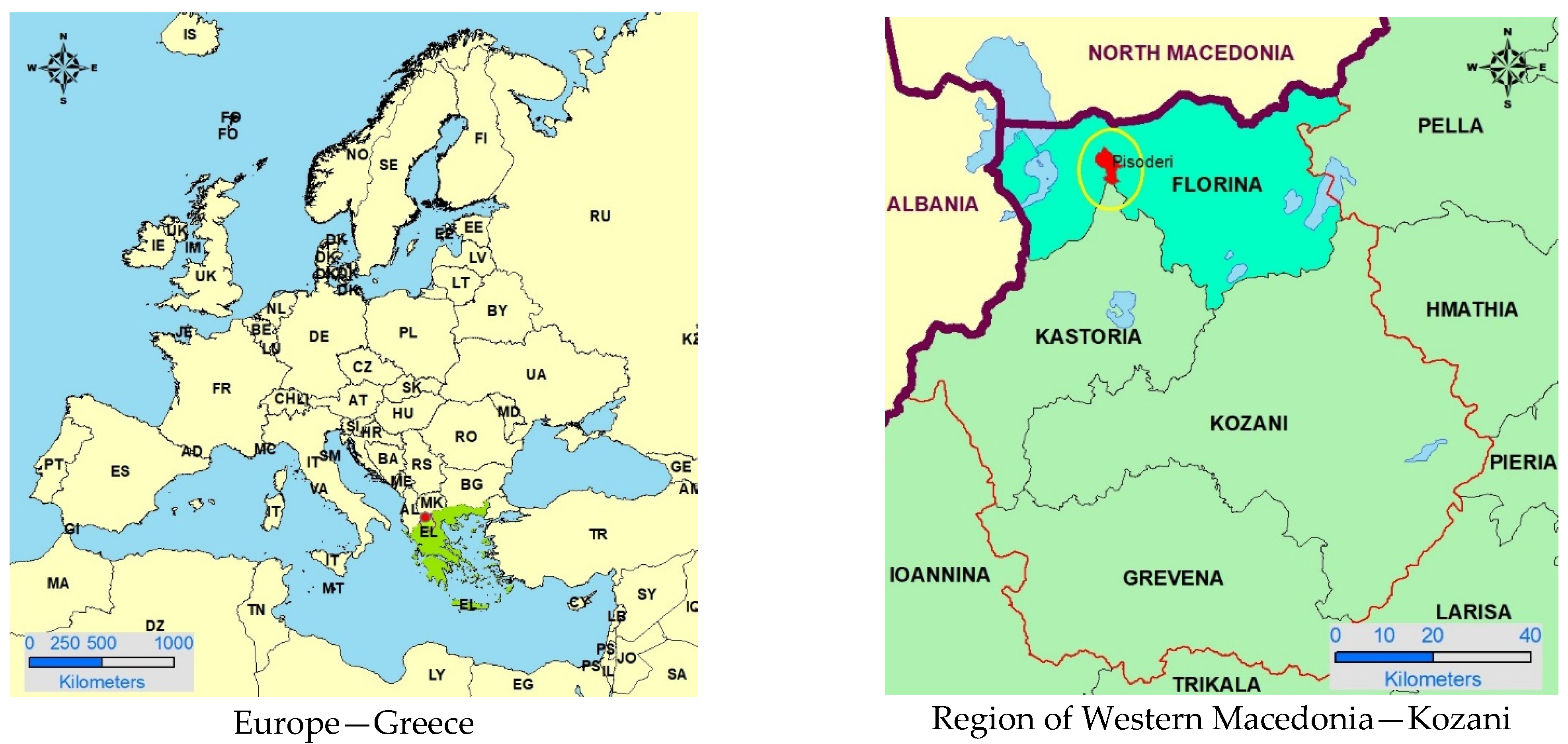
2. Materials and Methods

The area under study was the Pisoderion Forest, located in northwest Greece, near the city of Florina. The Pisoderion Forest extends onto the north-western slopes of Mount Vernon and onto the southwestern slopes of Mount Varnounta; the two mountains join together to form the source of the river Ladopotamos (Pisoderio stream) [16].
A relatively small part (42.6 ha) of the northern side of a NATURA 2000 area belongs to the forest. Another part has been recorded in the Greek habitats of the European CORINE program and has been classified as a landscape of special natural beauty by the Ministry of Environment and Spatial Planning. One more remarkable habitat is Ladopotamos or Rema Pisoderiou, which is essential for the mammal Lutra lutra and for the Aquila chrysaetos (Linnaeus, 1758). It is also worth mentioning that the international trail E6 crosses the Pisoderio Forest from north to south, and the national road connecting Greece to Albania crosses the forest from west to east. A housing control zone is established within the forest, and issues regarding a variety of alternative land uses and building construction rules outside the study area are thus resolved [14,27].
The state of ownership is mixed, with approximately 75% of the forest being owned by local residents and the remaining 25% belonging to the Greek State. The forest is managed by a “Forest Cooperative of Pisoderio” that has been established for this purpose. Hence, the forest map shown in Figure 1 was created as part of the last management plan and depicts the various areas [28]. Moreover, the area measurement of the sections and clusters was carried out in the two most recent management plans using the Geographic Information Systems software (GIS) and the orthophoto maps of the ‘Hellenic Land Registry’ that were available at that time. Therefore, the total area of the forest is 2410.88 ha [27,28]. The methodology followed in this paper is to compare the grazing capacity identified by the last two management plans of the forest that have been compiled according to standard technical specifications of the Ministry of Agriculture to the grazing capacity, which is determined by the temporary management grazing plan under Law 4264/2014 and the more recent specifications.
The depicted areas in each management study differ from the previous one in terms of the vegetation coverage and soil forms that are recorded, and this is mainly due to the more accurate photo-interpretive classification that has been made possible during its compilation. More specifically, the latest draft shows a 7% increase in forested area at the expense of grassland (mainly in the higher grounds of the forest), but also the elimination of agricultural land (which is now non-existent throughout the forest) [28].

3. Results and Discussion

With the purpose of determining the grazing conditions in the forest, useful data are gathered from the two recent management plans and, more specifically, the areas available for grazing, the grazing capacity, and stocking rate. In addition, data are compiled on the various types of land available for grazing namely, forest cover, partly forest cover, farms, and barren land.
Regarding the management of small ruminant livestock, according to the Ministry of Rural Development and Food, for the maintenance of a small animal unit (SAU), for example, one sheep or goat, the monthly requirements depending on the type of land are approximately: 5 stremma of forested area, 2 stremma of partly forested area, and 0.9 stremma of farm or uncovered areas (1 stremma corresponds to 0.1 ha). The corresponding animal unit equivalent for a large animal unit (LAU) is 5 small animal units (SAU). Due to the mountainous nature of the area, the availability of forage for grazing is limited to 5 months. The grazing capacity fluctuates every year, within the period of the management plan, because new grazing prohibition provisions come into force while, at the same time, past prohibitions expire [27,28].
Grazing exclusion provisions apply for 5 years for sheep, 7 years for large animals, and 10 years for goats, unless otherwise stated. Tables are drawn up, taking into account all the above restrictions, in order to obtain the annual grazing capacity of the forest for the duration of the study [27,28]. In the settlement of Pisoderio, approximately 500–1000 sheep have been declared in the last 20 years. The grazing capacity ranges between 1713 and 1930 small animal units for 5 months [27,28].
Regarding the grazing capacity, as it is determined by the temporary management plan (Law 4264/2014), the available grazing lands in the local community of Pisoderion are shown in Table 1, according to data from the Hellenic Statistical Authority (EL.STAT.). The vegetation categories in homogeneous landscape patterns that fall into the class of pastures in the CORINE Land Cover System (231, 321, 322, 323, 324, 332, and 333) are transferred (mapped), measured, and listed in Table 1 [29].
Another source of information is the Greek Payment Authority of Common Agricultural Policy Aid Schemes (OPEKEPE). The eligible grazing areas from the OPEKEPE cartographic background (in this case, ILOTS 2014) are transferred to the map and are measured and listed in Table 2. This procedure is performed in such a way that each CORINE vegetation category corresponds to one of the four eligible categories (−37.5−62.5−100) of OPEKEPE. The seven vegetation categories (codes) of CORINE that fall into the class of pastures are classified into four types of rangelands based on the general appearance of the vegetation, as follows: grassland, brushwood, shrubland, and forest meadows. In the study area, there are mainly two types of rangelands, grassland and forest meadows, which are listed in Table 2 [29].
Grazing capacity is estimated for each type of rangeland based on an approximation that relies on the use of a bibliography. Attached for this purpose is Table 3, which shows the grazing capacity of the four types of rangelands found in the mountainous altitude zone to which the area belongs [29].
The estimation of grazing capacity in Table 4 is formed according to the following assumptions: (1) 50% of total plant growth in the pasture is obtained as forage in the case of grasslands, brushwood, and forest meadows, whereas 65% is the corresponding figure in the case of shrublands; (2) the correspondence between one large animal unit (LAU) (mature cow) and a small animal unit (SAU) (sheep or goat) is calculated as follows: 1 LAU = 6.66 SAU or 1 SAU = 0.15 LAU; and (3) the daily requirements for forage of a mature cow are estimated at 10 kg of dry matter and the monthly requirements at 300 kg, respectively. The daily needs for forage of a sheep or a goat are estimated at 1.5 kg of dry matter, and the corresponding monthly ones at 45 kg. The assessment of grazing capacity in Table 4 is calculated according to the above assumptions and amounts to 3175.59 LAU on average for the whole year.
The pasture is used throughout the year, depending on the number of months. For example, for 5 months, you can graze 661 LAU or 3305 SAU. Overall, as the values in Table 3 reflect average grazing capacity, it would be preferable to use specific local data to calculate the production of forage [29]. Studies have been conducted, but they estimate the grazing capacity by types of habitats. Other studies and works concerning the regional unit estimate the grazing capacity by altitude zones or in total [14].

4. Conclusions

The grazing capacity, which is determined by the temporary management grazing plan under Law 4264/2014, is 661 LAU. However, the average grazing capacity determined by the last two management plans is approximately 356 LAU, specifically for grazing 5 months within the year. The conclusion that can be drawn is that the temporary management plan for grazing allows the introduction of approximately twice the number of animal units compared to the number of animal units allowed by the management study. This difference is certainly not due to a miscalculation. On the contrary, the difference arises from the way in which grazing is determined and, more specifically, the minimum area of rangelands required to cover the diet of one large animal unit.
It is clear that the areas eligible for an aid scheme by OPEKEPE (5369.12 stremma, which is almost all of the area) are much larger compared to Corine’s figure and slightly less than the pasture areas, which were identified by photo interpretation in recent aerial photographs and satellite images as well as on-site inspection. The photo-interpretative classification of types of rangelands, performed in the context of Corine and OPEKEPE, that relied on recent aerial photographs of the ‘Hellenic Land Registry’ and satellite images, as well as on-site assessments, indicated the occurrence of significant discrepancies. Regarding the system adopted by OPEKEPE, the apparent divergence in the figures is due to the use of a different background year and a different scale of photo-interpretation.
Thus, there is no problem with stocking rates in the area under study; on the contrary, the pasture at Pisoderio has been under-utilized in recent years. The vegetation in the rangelands of this area consists mainly of grass, which are better utilized for grazing by both small and large animals. Therefore, the introduction of cattle along with sheep and goats in the area under study, would favor the individual paddocks that are currently being undergrazed. In the past, nomadic livestock farming was organized, mainly on a family basis, and there existed an informal management system for grazing that was respected by all breeders who used the summer pastures. Nomadic animal husbandry has disappeared, and with it a sense of respect for nature, the meadows, and more generally, the environment. The traditional system of dividing rangelands into paddocks may be thought necessary for a more rational use of pastures and an important element of the holistic management of rangelands.
Livestock farming is an economic and ecological activity that can be extremely beneficial to the environment and society as long as economic sustainability is ensured while maintaining and protecting the natural environment. Essential steps for drafting a national strategy in the field of livestock economy are the demarcation of grazing lands, the creation of a spatial inventory of pastures, and the estimation of their stocking rate. In addition, it is necessary to carry out a census of the ownership status of grazing lands, to investigate the selectivity of pastures according to the Rural Development Program, and promote appropriate measures for the improvement of pastures. Along these lines, there has been a recent reform in the legislative framework and a final draft of management grazing plans for the entire country, with the aim of achieving sustainable economic and ecological management of all pastures.
It is finally concluded that the degradation of grasslands can include undergrazing, which reduces the ecosystem services of grasslands and threatens the production of animal products and environmental security [6,8], with the only benefit being an increase in the ecosystem services of forests, due to an increase in their area at the expense of grasslands and biodiversity. Of course, prudent management of grazing could contribute to the richness of meadows and their ecological health, without violating grazing capacity [5,9]. The use of modern technology products, i.e., remote sensing products, satellite images, and even aerial photographs could advocate positively for studies related to grasslands and propose solutions for a management that will be sustainable [5,25,26].

Author Contributions

Conceptualization, D.K. and K.M.; methodology, F.C.; validation, S.K., E.L., and E.T.; formal analysis, K.M.; investigation, D.K.; resources, F.C.; data curation, S.K.; writing—original draft preparation, D.K. and E.T.; writing—review and editing, D.K.; visualization, E.L.; supervision, K.M.; project administration, S.K. All authors have read and agreed to the published version of the manuscript.

Funding

This research received no external funding.

Institutional Review Board Statement

Not applicable.

Informed Consent Statement

Not applicable.

Data Availability Statement

Not applicable.

Conflicts of Interest

The authors declare no conflict of interest.

References

  1. Ren, Y.; Lü, Y.; Fu, B. Quantifying the impacts of grassland restoration on biodiversity and ecosystem services in China: A meta-analysis. Ecol. Eng. 2016, 95, 542–550. [Google Scholar] [CrossRef]
  2. Melfou, K.; Theocharopoulos, A.; Papanagiotou, E. Total Factor Productivity and Sustainable Agricultural Development. Econ. Rural Dev. 2007, 3, 32–38. [Google Scholar]
  3. Zhao, H.; Liu, S.; Dong, S.; Su, X.; Wang, X.; Wu, X.; Wu, L.; Zhang, X. Analysis of vegetation change associated with human disturbance using MODIS data on the rangelands of the Qinghai-Tibet Plateau. Rangel. J. 2015, 37, 77–87. [Google Scholar] [CrossRef]
  4. Tilman, D.; Reich, P.B.; Knops, J.; Wedin, D.; Mielke, T.; Lehman, C. Diversity and Productivity in a Long-Term Grassland Experiment. Science 2001, 294, 843–845. [Google Scholar] [CrossRef] [PubMed] [Green Version]
  5. Qu, Y.; Zhao, Y.; Ding, G.; Chi, W.; Gao, G. Spatiotemporal patterns of the forage-livestock balance in the Xilin Gol steppe, China: Implications for sustainably utilizing grassland-ecosystem services. J. Arid Land 2021, 13, 135–151. [Google Scholar] [CrossRef]
  6. Cao, F.; Li, J.; Fu, X.; Wu, G. Impacts of land conversion and management measures on net primary productivity in semi-arid grassland. Ecosyst. Health Sustain. 2020, 6, 1749010. [Google Scholar] [CrossRef] [Green Version]
  7. Gibbs, H.K.; Salmon, J.M. Mapping the world’s degraded lands. Appl. Geogr. 2015, 57, 12–21. [Google Scholar] [CrossRef]
  8. Wang, Y.; Wesche, K. Vegetation and soil responses to livestock grazing in Central Asian grasslands: A review of Chinese literature. Biodivers. Conserv. 2016, 25, 2401–2420. [Google Scholar] [CrossRef]
  9. Atsbha, T.; Belayneh Desta, A.; Zewdu, T. Carbon sequestration potential of natural vegetation under grazing influence in Southern Tigray, Ethiopia: Implication for climate change mitigation. Heliyon 2019, 5, e02329. [Google Scholar] [CrossRef] [Green Version]
  10. Zhao, Y.; Wu, J.; He, C.; Ding, G. Linking wind erosion to ecosystem services in drylands: A landscape ecological approach. Landsc. Ecol. 2017, 32, 2399–2417. [Google Scholar] [CrossRef]
  11. Zhao, M.; Running, S.W. Drought-Induced Reduction in Global Terrestrial Net Primary Production from 2000 through 2009. Science 2010, 329, 940–943. [Google Scholar] [CrossRef] [PubMed]
  12. Tabassum-Abbasi; Abbasi, T.; Abbasi, S.A. Reducing the global environmental impact of livestock production: The minilivestock option. J. Clean. Prod. 2016, 112, 1754–1766. [Google Scholar] [CrossRef]
  13. Kampas, A.; Melfou, K.; Aftab, A. Designing regulatory policies for complex externalities: The case of agricultural pollution. Agric. Econ. Rev. 2013, 14, 75–88. [Google Scholar]
  14. Mountousis, Ι.; Papanikolaou, K.; Stanogias, G.; Chatzitheodoridis, F.; Karalazos, V. Altitudinal chemical composition variations in biomass of rangelands in Northern Greece. Livest. Res. Rural Dev. 2006, 18, 8. [Google Scholar]
  15. de Aldana, B.R.V.; Ciudad, A.G.; Corona, M.E.P.; Criado, B.G. Nutritional quality of semi-arid grassland in western Spain over a 10- year period: Changes in chemical composition of grasses, legumes and forbs. Grass Forage Sci. 2000, 55, 209–220. [Google Scholar] [CrossRef] [Green Version]
  16. Hu, Z.; Li, S.; Guo, Q.; Niu, S.; He, N.; Li, L.; Yu, G. A synthesis of the effect of grazing exclusion on carbon dynamics in grasslands in China. Glob. Chang. Biol. 2016, 22, 1385–1393. [Google Scholar] [CrossRef]
  17. Zhao, J.; Li, X.; Li, R.; Tian, L.; Zhang, T. Effect of grazing exclusion on ecosystem respiration among three different alpine grasslands on the central Tibetan Plateau. Ecol. Eng. 2016, 94, 599–607. [Google Scholar] [CrossRef]
  18. Frank, A.S.K.; Wardle, G.M.; Dickman, C.R.; Greenville, A.C. Habitat- and rainfall-dependent biodiversity responses to cattle removal in an arid woodland–grassland environment. Ecol. Appl. 2014, 24, 2013–2028. [Google Scholar] [CrossRef]
  19. Su, H.; Liu, W.; Xu, H.; Wang, Z.; Zhang, H.; Hu, H.; Li, Y. Long-term livestock exclusion facilitates native woody plant encroachment in a sandy semiarid rangeland. Ecol. Evol. 2015, 5, 2445–2456. [Google Scholar] [CrossRef]
  20. Tang, J.; Davy, A.J.; Jiang, D.; Musa, A.; Wu, D.; Wang, Y.; Miao, C. Effects of excluding grazing on the vegetation and soils of degraded sparse-elm grassland in the Horqin Sandy Land, China. Agric. Ecosyst. Environ. 2016, 235, 340–348. [Google Scholar] [CrossRef] [Green Version]
  21. Savory, A.; Butterfield, J. Holistic Management, Third Edition: A Commonsense Revolution to Restore Our Environment; Island Press: Washington, DC, USA, 2016; ISBN 9781610917438. [Google Scholar]
  22. Savory, A.; Butterfield, J. Holistic Management: A New Framework for Decision Making, 2nd ed.; Island Press: Washington, DC, USA, 1999; ISBN 155963488X. [Google Scholar]
  23. Gosnell, H.; Grimm, K.; Goldstein, B.E. A half century of Holistic Management: What does the evidence reveal? Agric. Human Values 2020, 37, 849–867. [Google Scholar] [CrossRef]
  24. Dong, S.; Shang, Z.; Gao, J.; Boone, R.B. Enhancing sustainability of grassland ecosystems through ecological restoration and grazing management in an era of climate change on Qinghai-Tibetan Plateau. Agric. Ecosyst. Environ. 2020, 287, 106684. [Google Scholar] [CrossRef]
  25. Yu, M.; Ellis, J.E.; Epstein, H.E. Regional Analysis of Climate, Primary Production, and Livestock Density in Inner Mongolia. J. Environ. Qual. 2004, 33, 1675–1681. [Google Scholar] [CrossRef] [PubMed]
  26. Oñatibia, G.R.; Aguiar, M.R. Grasses and grazers in arid rangelands: Impact of sheep management on forage and non-forage grass populations. J. Environ. Manag. 2019, 235, 42–50. [Google Scholar] [CrossRef] [PubMed]
  27. Kalfas, D.; Karantzidis, N. Forest Management Study (Report) of Co-Owned Pisoderio Forest for the Decade 2006–2015; Forest Cooperative of Pisoderio: Florina, Greece, 2006. (In Greek) [Google Scholar]
  28. Lagkas, T. Forest Management Study (Report) of Co-Owned Pisoderio Forest for the Decade 2016–2025; Forest Cooperative of Pisoderio: Thessaloniki, Greece, 2016. (In Greek) [Google Scholar]
  29. Lagkas, T.; Zagkas, D. Temporary Management Plan for Grazing, Co-Owned Forest of Pisoderi; Forest Cooperative of Pisoderio: Thessaloniki, Greece, 2015. (In Greek) [Google Scholar]
Figure 1. Orientatio map of Pisoderio co-owned forest.
Environsciproc 22 00068 g001
Table 1. Distribution of land uses in the Pisoderio Pasture EL.STAT. and by Corine.
EL.STAT.Corine
Land Use CategoriesArea, StremmaPercentage, %DescriptionCorine CodeArea, Stremma
Agricultural land5002.7Land principally occupied by agriculture, with significant areas of natural vegetation2431013.9
Pastures460024.9Broad-leaved forest31119,740.5
Forests13,00070.3Natural Pastures3211039.5
Other areas4002.2Sclerophyllous vegetation323410.9
Transitional woodland-shrub3241903.7
Total18,500100Total 24,108.5
Source: Hellenic Statistical Authority—EL.STAT. and CORINE Land cover system.
Table 2. Land uses and eligible categories in Pisoderio pasture, according to ILOTS 2014, and also types of rangelands.
Land UsesEligible CategoriesTypes of Rangelands
Land Use ClustersCOVER IDArea, StremmaEligible CategoriesArea, StremmaType of RangelandArea, Stremma
Forest108000.7018,739.4Grassland5606.9
Forest grazing land 1103171215,353.737.51296.6Shrublands592.2
Urban2040.462.5494.5Forest meadows330.1
Not Pasture in 2003–200733713.71003578Forest17,467
Other112.3
Total 24,108.5 24,108.5 24,108.5
Table 3. Average production, grazing substance, and grazing capacity of rangelands.
Type of
Rangeland
Average
Production,
kg of Dry Matter/Stremma
Grazing
Substance,
kg of Dry Matter/Stremma
Grazing Capacity, LAU/acreAverage
Range *AverageStremma/LAUStremma/SAU
Grassland251–350125–1750.42–0.580.530.45
Brushwood131–18065–900.22–0.300.265.90.88
Shrubland 181–240117–1560.39–0.520.453.10.47
Forest meadows161–22080–1100.27–0.370.324.50.67
Note: * The lowest value corresponds to poor site quality (soil depth < 15 cm, transverse slope > 30%), and the highest value corresponds to a site of good quality (soil depth > 30 cm, transverse slope < 15%).
Table 4. Types of meadows and grazing capacity in the pasture of Pisoderio.
Type of RangelandArea,
Stemma
GreeceStudy Area
Grazing Capacity, LAU/StremmaGrazing Capacity
Total
Grazing Capacity, LAU/StremmaGrazing Capacity
Total
Forest meadows330.10.32105.640.33108.94
Brushwood00000
Shrublands 592.20.45266.490.47278.33
Grassland5606.90.52803.460.522915.60
Total6529.2 3175.59 3302.87
Publisher’s Note: MDPI stays neutral with regard to jurisdictional claims in published maps and institutional affiliations.

