NOAA/WDS Paleoclimatology - Larson - Dry Dog Ranch - QUAL - ITRDB WI027

browse graphicPaleoclimatology - Tree Ring
This archived Paleoclimatology Study is available from the NOAA National Centers for Environmental Information (NCEI), under the World Data Service (WDS) for Paleoclimatology. The associated NCEI study type is Tree Ring. The data include parameters of tree ring with a geographic location of Wisconsin, United States Of America. The time period coverage is from 162 to -64 in calendar years before present (BP). See metadata information for parameter and study location details. Please cite this study when using the data.
  • Cite as: Larson, E.R.; Allen, S.A.; Underwood, C.A. (2021-07-03): NOAA/WDS Paleoclimatology - Larson - Dry Dog Ranch - QUAL - ITRDB WI027. [indicate subset used]. NOAA National Centers for Environmental Information. https://doi.org/10.25921/wddp-3v02. Accessed [date].
  • Please refer to Credit tab for full citation information.
noaa-tree-33928
XML
Search Data
Download Data
Distribution Formats
  • Native Format(s)
Ordering InstructionsContact NCEI for other distribution options and instructions.
DistributorNOAA National Centers for Environmental Information
ncei.info@noaa.gov
Dataset Point of Contact NOAA National Centers for Environmental Information
ncei.info@noaa.gov
Dataset Point of Contact Data Center Contact
NOAA World Data Service for Paleoclimatology
828-271-4800
paleo@noaa.gov
Coverage DescriptionDate Range: 1788 CE to 2014 CE; Date Range: 162 cal yr BP to -64 cal yr BP;
Time Period1788 to 2014
Spatial Bounding Box Coordinates
N: 43.156
S: 43.156
E: -91.389
W: -91.389
Spatial Coverage Map
General Documentation
Associated Resources
  • The Driftless Oaks: A new network of tree-ring chronologies to improve regional perspectives of drought in the Upper Midwest, USA
    • Associated Reference published 2021
      Larson, Evan R., Sara A. Allen, Chris A. Underwood, 2021: The Driftless Oaks: A new network of tree-ring chronologies to improve regional perspectives of drought in the Upper Midwest, USA. Progress in Physical Geography, 45, 375-406, 10.1177/0309133320960670
Publication Dates
  • publication: 2021-07-03
Data Presentation Form Digital table - digital representation of facts or figures systematically displayed, especially in columns
Dataset Progress StatusComplete - production of the data has been completed
Data Update Frequency Data update frequency not available
Supplemental Information
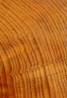
STUDY NOTES: Oak ring width data from the Driftless Area of southwest Wisconsin and northeast Iowa, USA, sampled from living oak trees, remnants, and archeological beams. NOAA Template Raw Measurements file added 2021-10-19.
ABSTRACT SUPPLIED BY ORIGINATOR: New and updated multi-century tree-ring chronologies from living oak trees, remnants, and archeological beams from across the Driftless Area of southwest Wisconsin and northeast Iowa, USA, were developed to fill a spatial gap in the network of available tree-ring chronologies. We produced a robust 303-year summer drought reconstruction (June-August Palmer's Modified Drought Index (PMDI): r2 = 0.45) that identified clusters of extreme droughts and pluvials (PMDI <= -4.0 or >= 4.0) in the early 1700s and more even distributions of drought conditions, with the exception of the post 1930s period when drought became relatively infrequent. Compared to the Living Blended Drought Atlas (LBDA) and the North American Drought Atlas (NADA), our reconstruction more accurately represented moderate moisture conditions across the Driftless Area, the NADA and LBDA more closely represented extreme pluvials, and our reconstruction and the LBDA better represented extreme drought years. The three reconstructions largely captured the same high-frequency variability in drought conditions and differed most at low frequencies. Significant correlations were identified between our reconstruction and corn (r = 0.30, n = 91, p = 0.002) and soybean (r = 0.25, n = 81, p = 0.012) yields, with the strength of the correlations increasing over recent decades suggesting a tighter coupling of interannual climate variability and crop productivity in the region. Superposed epoch analyses indicated significantly wetter conditions in the Driftless Area two years after major volcanic eruptions. In the context of long-term climatic variability, the Driftless Oaks drought reconstruction demonstrated that drought and pluvial conditions more extreme than those experienced during the instrumental record have occurred in the past.
PurposeTree ring data from the International Tree Ring Data Bank and World Data Center for Paleoclimatology archives. Most data sets include raw treering measurements (most are annual ring width, with some collections of earlywood or latewood width or wood density), plus chronologies (standardized growth indices for a site compiled from multiple treering samples). Reconstructions of climate variables are included with some of these data sets. Each data type is stored in a separate data file; the data type is coded into the file name. For details please see: http://www.ncei.noaa.gov/products/paleoclimatology/tree-ring
Dataset Citation
  • Cite as: Larson, E.R.; Allen, S.A.; Underwood, C.A. (2021-07-03): NOAA/WDS Paleoclimatology - Larson - Dry Dog Ranch - QUAL - ITRDB WI027. [indicate subset used]. NOAA National Centers for Environmental Information. https://doi.org/10.25921/wddp-3v02. Accessed [date].
  • Please cite original publication, online resource, dataset and publication DOIs (where available), and date accessed when using downloaded data. If there is no publication information, please cite investigator, title, online resource, and date accessed. The appearance of external links associated with a dataset does not constitute endorsement by the Department of Commerce/National Oceanic and Atmospheric Administration of external Web sites or the information, products or services contained therein. For other than authorized activities, the Department of Commerce/NOAA does not exercise any editorial control over the information you may find at these locations. These links are provided consistent with the stated purpose of this Department of Commerce/NOAA Web site.
Cited Authors
  • Larson, E.R.
  • Allen, S.A.
  • Underwood, C.A.
Originators
  • Larson, E.R.
  • Allen, S.A.
  • Underwood, C.A.
Publishers
  • NOAA National Centers for Environmental Information
Theme keywordsGlobal Change Master Directory (GCMD) Science Keywords
  • Earth Science > Climate Indicators > Paleoclimate Indicators > Biological Records > Tree Rings
  • Earth Science > Paleoclimate > Land Records > Tree Rings
Global Change Master Directory (GCMD) Science Keywords
  • earth science > paleoclimate > tree ring
  • earth science > paleoclimate > tree ring
  • earth science > paleoclimate > tree ring
  • earth science > paleoclimate > tree ring
  • earth science > paleoclimate > tree ring
  • earth science > paleoclimate > tree ring
  • earth science > paleoclimate > tree ring
  • earth science > paleoclimate > tree ring
  • earth science > paleoclimate > tree ring
  • earth science > paleoclimate > tree ring
  • earth science > paleoclimate > tree ring
  • earth science > paleoclimate > tree ring
  • earth science > paleoclimate > tree ring
  • earth science > paleoclimate > tree ring
  • earth science > paleoclimate > tree ring
  • earth science > paleoclimate > tree ring
  • earth science > paleoclimate > tree ring
  • earth science > paleoclimate > tree ring
  • earth science > paleoclimate > tree ring
  • earth science > paleoclimate > tree ring
  • earth science > paleoclimate > tree ring
  • earth science > paleoclimate > tree ring
  • earth science > paleoclimate > tree ring
  • earth science > paleoclimate > tree ring
  • earth science > paleoclimate > tree ring
  • earth science > paleoclimate > tree ring
  • earth science > paleoclimate > tree ring
  • earth science > paleoclimate > tree-ring > width
  • QUAL
  • Quercus alba L.
  • white oak
Paleoenvironmental Standard Terms (PaST) Thesaurus
  • What: total ring width; Material: null
  • What: total ring width; Material: null
  • What: total ring width; Material: null
  • What: total ring width; Material: null
  • What: total ring width; Material: null
  • What: total ring width; Material: null
  • What: total ring width; Material: null
  • What: total ring width; Material: null
  • What: total ring width; Material: null
  • What: total ring width; Material: null
  • What: total ring width; Material: null
  • What: total ring width; Material: null
  • What: age; Material: null
  • What: total ring width; Material: null
  • What: total ring width; Material: null
  • What: total ring width; Material: null
  • What: total ring width; Material: null
  • What: total ring width; Material: null
  • What: total ring width; Material: null
  • What: total ring width; Material: null
  • What: total ring width; Material: null
  • What: total ring width; Material: null
  • What: total ring width; Material: null
  • What: total ring width; Material: null
  • What: total ring width; Material: null
  • What: total ring width; Material: null
  • What: total ring width; Material: null
Data Center keywordsGlobal Change Master Directory (GCMD) Data Center Keywords
  • DOC/NOAA/NESDIS/NCEI > National Centers for Environmental Information, NESDIS, NOAA, U.S. Department of Commerce
Place keywords
  • Continent > North America > United States Of America > Wisconsin > Dry Dog Ranch > LATITUDE 43.156 > LONGITUDE -91.389
Use Constraints
  • Cite as: Larson, E.R.; Allen, S.A.; Underwood, C.A. (2021-07-03): NOAA/WDS Paleoclimatology - Larson - Dry Dog Ranch - QUAL - ITRDB WI027. [indicate subset used]. NOAA National Centers for Environmental Information. https://doi.org/10.25921/wddp-3v02. Accessed [date].
  • Use liability: NOAA and NCEI cannot provide any warranty as to the accuracy, reliability, or completeness of furnished data. Users assume responsibility to determine the usability of these data. The user is responsible for the results of any application of this data for other than its intended purpose.
  • Please cite original publication, online resource, dataset and publication DOIs (where available), and date accessed when using downloaded data. If there is no publication information, please cite investigator, title, online resource, and date accessed. The appearance of external links associated with a dataset does not constitute endorsement by the Department of Commerce/National Oceanic and Atmospheric Administration of external Web sites or the information, products or services contained therein. For other than authorized activities, the Department of Commerce/NOAA does not exercise any editorial control over the information you may find at these locations. These links are provided consistent with the stated purpose of this Department of Commerce/NOAA Web site.
Access Constraints
  • Distribution liability: NOAA and NCEI make no warranty, expressed or implied, regarding these data, nor does the fact of distribution constitute such a warranty. NOAA and NCEI cannot assume liability for any damages caused by any errors or omissions in these data. If appropriate, NCEI can only certify that the data it distributes are an authentic copy of the records that were accepted for inclusion in the NCEI archives.
  • None
Fees
  • In most cases, electronic downloads of the data are free. However, fees may apply for custom orders, data certifications, copies of analog materials, and data distribution on physical media.
Last Modified: 2023-05-22
For questions about the information on this page, please email: ncei.info@noaa.gov