NOAA/WDS Paleoclimatology - Western Australian Speleothem d18O Data over the last 1500 Years
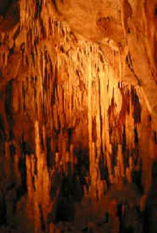 Paleoclimatology - Speleothem
This archived Paleoclimatology Study is available from the NOAA National Centers for Environmental Information (NCEI), under the World Data Service (WDS) for Paleoclimatology. The associated NCEI study type is Cave. The data include parameters of speleothems with a geographic location of Western Australia, Australia. The time period coverage is from 1516 to 291 in calendar years before present (BP). See metadata information for parameter and study location details. Please cite this study when using the data.
- Cite as: Denniston, R.F.; Ummenhofer, C.C.; Emanuel, K.; Ingrosso, R.; Pausata, F.S.R.; Wanamaker, A.D.; Lachniet, M.S.; Carr, K.; Asmerom, Y.; Polyak, V.J.; Nott, J.; Zhang, W.; Villarini, G.; Cugley, J.; Brooks, D.; Woods, D.; Humphreys, W.F. (2022-09-19): NOAA/WDS Paleoclimatology - Western Australian Speleothem d18O Data over the last 1500 Years. [indicate subset used]. NOAA National Centers for Environmental Information. https://doi.org/10.25921/rn5v-3710. Accessed [date].
- Please refer to Credit tab for full citation information.
- doi:10.25921/rn5v-3710
- noaa-cave-36853
- NCEI DSI 1200_02
- NCEI DSI 1200_01
noaa-cave-36853
| Search Data |
|
| Download Data |
|
| Distribution Formats |
|
| Ordering Instructions | Contact NCEI for other distribution options and instructions. |
| Distributor | NOAA National Centers for Environmental Information
ncei.info@noaa.gov |
| Dataset Point of Contact | NOAA National Centers for Environmental Information
ncei.info@noaa.gov |
| Dataset Point of Contact | Data Center Contact
NOAA World Data Service for Paleoclimatology 828-271-4800 paleo@noaa.gov |
| Coverage Description | Date Range: 1516 cal yr BP to 291 cal yr BP; |
| Time Period | 434 to 1659 |
| Spatial Bounding Box Coordinates |
N: -15.18
S: -15.18
E: 128.37
W: 128.37
|
| Spatial Coverage Map | |
| General Documentation |
|
| Associated Resources |
|
| Publication Dates |
|
| Data Presentation Form | Digital table - digital representation of facts or figures systematically displayed, especially in columns
|
| Dataset Progress Status | Complete - production of the data has been completed |
| Data Update Frequency | Data update frequency not available |
| Supplemental Information |
ABSTRACT SUPPLIED BY ORIGINATOR: Tropical cyclones (TCs) regularly form in association with the intertropical convergence zone (ITCZ), and thus its positioning has implications for global TC activity. While the poleward extent of the ITCZ has varied markedly over past centuries, the sensitivity with which TCs responded remains poorly understood from the proxy record, particularly in the Southern Hemisphere. Here we present a high resolution, composite stalagmite record of ITCZ migrations over tropical Australia for the last 1500 years. When integrated with a TC reconstruction from the Australian subtropics, this time series, along with downscaled climate model simulations, provides an unprecedented examination of the dependence of subtropical TC activity on meridional shifts in the ITCZ. TCs tracked the ITCZ at multidecadal to centennial scales, with a more southward position enhancing TC-derived rainfall in the subtropics. TCs may play an increasingly important role in Western Australia moisture budgets as subtropical aridity increases due to anthropogenic warming.
|
| Purpose | Records of past temperature, precipitation, and other aspects of climate derived from mineral deposits found in caves. Parameter keywords describe what was measured in this dataset. Additional summary information can be found in the abstracts of papers listed in the dataset citations. |
| Dataset Citation |
|
| Cited Authors |
|
| Originators |
|
| Publishers |
|
| Theme keywords | Global Change Master Directory (GCMD) Science Keywords
|
| Data Center keywords | Global Change Master Directory (GCMD) Data Center Keywords
|
| Place keywords |
|
| Use Constraints |
|
| Access Constraints |
|
| Fees |
|
Last Modified: 2023-09-01
For questions about the information on this page, please email: ncei.info@noaa.gov