NOAA/WDS Paleoclimatology - Geochemical Proxies from a Northeast Mexico Speleothem Covering 5.1 to 62.5 ka
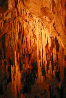 Paleoclimatology - Speleothem
This archived Paleoclimatology Study is available from the NOAA National Centers for Environmental Information (NCEI), under the World Data Service (WDS) for Paleoclimatology. The associated NCEI study type is Cave. The data include parameters of speleothems with a geographic location of Mexico. The time period coverage is from 62500 to 5100 in calendar years before present (BP). See metadata information for parameter and study location details. Please cite this study when using the data.
- Cite as: Wright, K.T.; Johnson, K.R.; Serrato Marks, G.; McGee, D.; Bhattacharya, T.; Goldsmith, G.; Tabor, C.; Lacaille-Muzquiz, J.-L.; Lum, G.; Beramendi-Orosco, L. (2023-03-06): NOAA/WDS Paleoclimatology - Geochemical Proxies from a Northeast Mexico Speleothem Covering 5.1 to 62.5 ka. [indicate subset used]. NOAA National Centers for Environmental Information. https://doi.org/10.25921/rfv2-v842. Accessed [date].
- Please refer to Credit tab for full citation information.
- doi:10.25921/rfv2-v842
- noaa-cave-37679
- NCEI DSI 1200_02
- NCEI DSI 1200_01
noaa-cave-37679
| Search Data |
|
| Download Data |
|
| Distribution Formats |
|
| Ordering Instructions | Contact NCEI for other distribution options and instructions. |
| Distributor | NOAA National Centers for Environmental Information
ncei.info@noaa.gov |
| Dataset Point of Contact | NOAA National Centers for Environmental Information
ncei.info@noaa.gov |
| Dataset Point of Contact | Data Center Contact
NOAA World Data Service for Paleoclimatology 828-271-4800 paleo@noaa.gov |
| Coverage Description | Date Range: 62500 cal yr BP to 5100 cal yr BP; |
| Time Period | -60550 to -3150 |
| Spatial Bounding Box Coordinates |
N: 23
S: 23
E: -99
W: -99
|
| Spatial Coverage Map | |
| General Documentation |
|
| Associated Resources |
|
| Publication Dates |
|
| Data Presentation Form | Digital table - digital representation of facts or figures systematically displayed, especially in columns
|
| Dataset Progress Status | Complete - production of the data has been completed |
| Data Update Frequency | Data update frequency not available |
| Supplemental Information |
ABSTRACT SUPPLIED BY ORIGINATOR: The timing and mechanisms of past hydroclimate change in northeast Mexico are poorly constrained, limiting our ability to evaluate climate model performance. To address this, we present a multiproxy speleothem record of past hydroclimate variability spanning 62.5 to 5.1 ka from Tamaulipas, Mexico. Our results demonstrate a strong influence of Atlantic and Pacific sea surface temperatures on orbital and millennial scale precipitation changes in the region. Multiple proxies show no clear response to insolation forcing, but strong evidence for dry conditions during Heinrich Stadials. While these trends are consistent with other records from across Mesoamerica and the Caribbean, the relative importance of thermodynamic and dynamic controls in driving this response is debated. An isotope-enabled climate model shows that cool Atlantic SSTs and stronger easterlies drive a strong inter-basin sea surface temperature gradient and a southward shift in moisture convergence, causing drying in this region.
|
| Purpose | Records of past temperature, precipitation, and other aspects of climate derived from mineral deposits found in caves. Parameter keywords describe what was measured in this dataset. Additional summary information can be found in the abstracts of papers listed in the dataset citations. |
| Dataset Citation |
|
| Cited Authors |
|
| Originators |
|
| Publishers |
|
| Theme keywords | Global Change Master Directory (GCMD) Science Keywords
|
| Data Center keywords | Global Change Master Directory (GCMD) Data Center Keywords
|
| Place keywords |
|
| Use Constraints |
|
| Access Constraints |
|
| Fees |
|
Last Modified: 2023-09-01
For questions about the information on this page, please email: ncei.info@noaa.gov