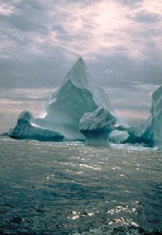
NOAA/WDS Paleoclimatology - Denmark Strait 2000 Year Multiproxy Sediment Data
 Paleoclimatology - Paleoceanography
This archived Paleoclimatology Study is available from the NOAA National Centers for Environmental Information (NCEI), under the World Data Service (WDS) for Paleoclimatology. The associated NCEI study type is Paleoceanography. The data include parameters of paleoceanography with a geographic location of North Atlantic Ocean. The time period coverage is from 2814 to -48 in calendar years before present (BP). See metadata information for parameter and study location details. Please cite this study when using the data.
- Cite as: Andrews, J.T.; Jennings, A.E. (2014-04-07): NOAA/WDS Paleoclimatology - Denmark Strait 2000 Year Multiproxy Sediment Data. [indicate subset used]. NOAA National Centers for Environmental Information. https://doi.org/10.25921/n0v2-6b70. Accessed [date].
- Please refer to Credit tab for full citation information.
- doi:10.25921/n0v2-6b70
- noaa-ocean-16398
- NCEI DSI 1200_02
- NCEI DSI 1200_01
noaa-ocean-16398
| Search Data |
|
| Download Data |
|
| Distribution Formats |
|
| Ordering Instructions | Contact NCEI for other distribution options and instructions. |
| Distributor | NOAA National Centers for Environmental Information
ncei.info@noaa.gov |
| Dataset Point of Contact | NOAA National Centers for Environmental Information
ncei.info@noaa.gov |
| Dataset Point of Contact | Data Center Contact
NOAA World Data Service for Paleoclimatology 828-271-4800 paleo@noaa.gov |
| Coverage Description | Date Range: -864 CE to 1998 CE; Date Range: 2814 cal yr BP to -48 cal yr BP; |
| Time Period | -864 to 1998 |
| Spatial Bounding Box Coordinates |
N: 68.26
S: 63.21
E: -23.85
W: -32.1
|
| Spatial Coverage Map | |
| General Documentation |
|
| Associated Resources |
|
| Publication Dates |
|
| Data Presentation Form | Digital table - digital representation of facts or figures systematically displayed, especially in columns
|
| Dataset Progress Status | Complete - production of the data has been completed |
| Data Update Frequency | Data update frequency not available |
| Supplemental Information |
STUDY NOTES: High resolution geochemical data from sediment cores in the Denmark Strait, North Atlantic covering the past ~2,000 years. Data are from figures from Andrews and Jennings 2014, as follows: Figure 5 JM96-1210 Nansen Fjord Figure 6A: BS1191-K7 Kangerlussuaq Fjord Figure 6B: BS1191-K8 Kangerlussuaq Fjord Figure 7: Sediment sources at site HU93030-019B/MD99-2322 Kangerlussuaq Trough. Figure 8: Calcite and quartz wt% data for BS1191-K7 HU93030-019B/MD99-2322 Kangerlussuaq Trough Figure 9: calcite and quartz data for North Iceland sites MD99-2263, MD99-2269 and B997-316PC Figure 10: Calcite and quartz data at 30-yr intervals for MD99-2269 and MD99-2322 All X-ray diffraction data for HU93030-019B and MD99-2322.
ABSTRACT SUPPLIED BY ORIGINATOR: In the area of Denmark Strait (~66° N), the two modes of the North Atlantic Oscillation (NAO) and Arctic Oscillation (AO) are expressed in changes of the northward flux of Atlantic water and the southward advection of polar water in the East Iceland current. Proxies from marine cores along an environmental gradient from extensive to little or no drift ice, capture low frequency variations over the last 2000 cal yr BP. Key proxies are the weight% of calcite, a measure of surface water stratification and nutrient supply, the weight% of quartz, a measure of drift ice transport, and grain size. Records from Nansen and Kangerlussuaq fjords show variable ice-rafted debris (IRD) records but have distinct mineralogy associated with differences in the fjord catchment bedrock. A comparison between cores on either side of the Denmark Strait (MD99-2322 and MD99-2269) show a remarkable millennial-scale similarity in the trends of the weight% of calcite with a trough reached during the Little Ice Age. However, the quartz records from these two sites are quite different. The calcite records from the Denmark Strait parallel the 2000 yr Arctic summer-temperature reconstructions; analysis of the detrended calcite and quartz data reveal significant multi-decadal-century periodicities superimposed on a major environmental shift occurring ca. 1450 AD. |
| Purpose | Records of past climate and ocean circulation derived from marine sediments. Parameter keywords describe what was measured in this dataset. Additional summary information can be found in the abstracts of papers listed in the dataset citations. |
| Dataset Citation |
|
| Cited Authors |
|
| Originators |
|
| Publishers |
|
| Theme keywords | Global Change Master Directory (GCMD) Science Keywords
|
| Data Center keywords | Global Change Master Directory (GCMD) Data Center Keywords
|
| Place keywords |
|
| Use Constraints |
|
| Access Constraints |
|
| Fees |
|
Last Modified: 2023-09-01
For questions about the information on this page, please email: ncei.info@noaa.gov