NOAA/WDS Paleoclimatology - Stambaugh - Burnt Mountain - PIRE - ITRDB MI019

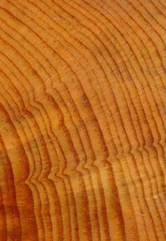
browse graphicPaleoclimatology - Tree Ring
This archived Paleoclimatology Study is available from the NOAA National Centers for Environmental Information (NCEI), under the World Data Service (WDS) for Paleoclimatology. The associated NCEI study type is Tree Ring. The data include parameters of tree ring with a geographic location of Michigan, United States Of America. The time period coverage is from 415 to 50 in calendar years before present (BP). See metadata information for parameter and study location details. Please cite this study when using the data.
  • Cite as: Stambaugh, M.C.; Guyette, R.P.; Marschall, J.M. (2013-09-06): NOAA/WDS Paleoclimatology - Stambaugh - Burnt Mountain - PIRE - ITRDB MI019. [indicate subset used]. NOAA National Centers for Environmental Information. https://doi.org/10.25921/as9h-xf43. Accessed [date].
  • Please refer to Credit tab for full citation information.
Search Data
Download Data
Distribution Formats
  • Native Format(s)
Ordering InstructionsContact NCEI for other distribution options and instructions.
DistributorNOAA National Centers for Environmental Information
ncei.info@noaa.gov
Dataset Point of Contact NOAA National Centers for Environmental Information
ncei.info@noaa.gov
Dataset Point of Contact Data Center Contact
NOAA World Data Service for Paleoclimatology
828-271-4800
paleo@noaa.gov
Coverage DescriptionDate Range: 1535 CE to 1900 CE; Date Range: 415 cal yr BP to 50 cal yr BP;
Time Period1535 to 1900
Spatial Bounding Box Coordinates
N: 46.83
S: 46.83
E: -87.93
W: -87.93
Spatial Coverage Map
General Documentation
Associated Resources
  • Predicting Fire Frequency with Chemistry and Climate
    • Associated Reference published 2012
      Richard P. Guyette, Michael C. Stambaugh, Daniel C. Dey, and Rose-Marie Muzika., 2012: Predicting Fire Frequency with Chemistry and Climate. Ecosystems, 15, 322-335, 10.1007/s10021-011-9512-0
Publication Dates
  • publication: 2013-09-06
Data Presentation Form Digital table - digital representation of facts or figures systematically displayed, especially in columns
Dataset Progress StatusComplete - production of the data has been completed
Data Update Frequency Data update frequency not available
Supplemental Information
STUDY NOTES: NOAA Template Raw Measurements file added 2019-02-08.
ABSTRACT SUPPLIED BY ORIGINATOR: Land managers developing fire management plans in the eastern and southern United States lack quantitative information on historic fire regimes. Twelve new fire histories were developed from dated fire scars on trees from regions where no fire scar history data had existed before in the states of Alabama, Louisiana, Kentucky, Iowa, Wisconsin, and Michigan. Sites represent highly variable climates from extreme cold (with long snow cover duration) to subtropical. All sites utilized oak or pine recorder species that were collected from closed forest to open savanna structures. Pre-industrial mean fire intervals ranged from 3 to more than 35 years at sites that typically encompassed less than 2 km2 in area. The most frequent fire regime was found in Louisiana's Kisatchie National Forest (MFI = 3 yrs) while the longest fire intervals were at inland sites near the shore of Lake Superior (MFI > 35 yrs) some 1900 kilometers to the north. The subtropical site in Louisiana is perhaps the only site in the U.S. where fires are documented to have occurred more than once a year. The history of fire at sites in Wisconsin, Louisiana, and Michigan showed distinct temporal progressions in changes in fire frequency that we attributed to changing human population. Sites in Wisconsin showed potential for very large fires associated with drought years. Fire history data analyses and summaries were presented at multiple venues (workshops, conferences) and have been published in scientific journals and reports to regional land managers. Fire history data has also been made publicly available through the International Multiproxy Paleofire Databank (IMPD). New fire history data from this project combined with previously collected fire history data from the Missouri Tree-Ring Laboratory and published fire histories in North America were used to parameterize and calibrate a continental fire frequency model based on climate. The most important contribution of this model is towards understanding climate forcing of fire regimes across the continental U.S. We have developed a suite of climate-based fire frequency models for the continental U.S. that show to be highly robust. Models and calibrations were validated with empirical fire history data during pre-industrial periods so to minimize non-climate influences associated with U.S. settlement (land conversion, changing cultures). Fire frequency models follow theoretical concepts from physical chemistry, utilize spatially-explicit fire and climate data, and were parameterized and validated using statistical methods. Data from fire history studies were accumulated from 37 states and include data based on fire scars (n = 168), expert estimates (n = 7) and charcoal (n = 3). Historic mean fire interval (MFI) models were parameterized using mean maximum temperature, precipitation, their interaction, and estimated population density (anthropogenic ignitions). Models are being used to: assess the role of climate in forcing fire frequency, map coarse-scale historic fire frequency for the continental U.S., and assess departures in fire regimes and smoke emissions.
PurposeTree ring data from the International Tree Ring Data Bank and World Data Center for Paleoclimatology archives. Most data sets include raw treering measurements (most are annual ring width, with some collections of earlywood or latewood width or wood density), plus chronologies (standardized growth indices for a site compiled from multiple treering samples). Reconstructions of climate variables are included with some of these data sets. Each data type is stored in a separate data file; the data type is coded into the file name. For details please see: http://www.ncei.noaa.gov/products/paleoclimatology/tree-ring
Dataset Citation
  • Cite as: Stambaugh, M.C.; Guyette, R.P.; Marschall, J.M. (2013-09-06): NOAA/WDS Paleoclimatology - Stambaugh - Burnt Mountain - PIRE - ITRDB MI019. [indicate subset used]. NOAA National Centers for Environmental Information. https://doi.org/10.25921/as9h-xf43. Accessed [date].
  • Please cite original publication, online resource, dataset and publication DOIs (where available), and date accessed when using downloaded data. If there is no publication information, please cite investigator, title, online resource, and date accessed. The appearance of external links associated with a dataset does not constitute endorsement by the Department of Commerce/National Oceanic and Atmospheric Administration of external Web sites or the information, products or services contained therein. For other than authorized activities, the Department of Commerce/NOAA does not exercise any editorial control over the information you may find at these locations. These links are provided consistent with the stated purpose of this Department of Commerce/NOAA Web site.
Cited Authors
  • Stambaugh, M.C.
  • Guyette, R.P.
  • Marschall, J.M.
Originators
  • Stambaugh, M.C.
  • Guyette, R.P.
  • Marschall, J.M.
Publishers
  • NOAA National Centers for Environmental Information
Theme keywordsGlobal Change Master Directory (GCMD) Science Keywords
  • Earth Science > Climate Indicators > Paleoclimate Indicators > Biological Records > Tree Rings
  • Earth Science > Paleoclimate > Land Records > Tree Rings
Global Change Master Directory (GCMD) Science Keywords
  • earth science > paleoclimate > tree ring
  • earth science > paleoclimate > tree ring
  • earth science > paleoclimate > tree ring
  • earth science > paleoclimate > tree ring
  • earth science > paleoclimate > tree ring
  • earth science > paleoclimate > tree ring
  • earth science > paleoclimate > tree ring
  • earth science > paleoclimate > tree ring
  • earth science > paleoclimate > tree ring
  • earth science > paleoclimate > tree ring
  • earth science > paleoclimate > tree ring
  • earth science > paleoclimate > tree ring
  • earth science > paleoclimate > tree ring
  • earth science > paleoclimate > tree ring
  • earth science > paleoclimate > tree ring
  • earth science > paleoclimate > tree ring
  • earth science > paleoclimate > tree ring
  • earth science > paleoclimate > tree ring
  • earth science > paleoclimate > tree ring
  • earth science > paleoclimate > tree ring
  • earth science > paleoclimate > tree ring
  • earth science > paleoclimate > tree ring
  • earth science > paleoclimate > tree ring
  • earth science > paleoclimate > tree ring
  • earth science > paleoclimate > tree ring
  • earth science > paleoclimate > tree ring
  • earth science > paleoclimate > tree ring
  • earth science > paleoclimate > tree ring
  • earth science > paleoclimate > tree ring
  • earth science > paleoclimate > tree ring
  • earth science > paleoclimate > tree ring
  • earth science > paleoclimate > tree ring
  • earth science > paleoclimate > tree ring
  • earth science > paleoclimate > tree ring
  • earth science > paleoclimate > tree ring
  • earth science > paleoclimate > tree ring
  • earth science > paleoclimate > tree ring
  • earth science > paleoclimate > tree ring
  • earth science > paleoclimate > tree ring
  • earth science > paleoclimate > tree ring
  • earth science > paleoclimate > tree ring
  • earth science > paleoclimate > tree ring
  • earth science > paleoclimate > tree ring
  • earth science > paleoclimate > tree ring
  • earth science > paleoclimate > tree ring
  • earth science > paleoclimate > tree ring
  • earth science > paleoclimate > tree-ring > width
  • PIRE
  • Pinus resinosa Aiton
  • red pine
Paleoenvironmental Standard Terms (PaST) Thesaurus
  • What: total ring width; Material: null
  • What: total ring width; Material: null
  • What: total ring width; Material: null
  • What: total ring width; Material: null
  • What: total ring width; Material: null
  • What: total ring width; Material: null
  • What: total ring width; Material: null
  • What: total ring width; Material: null
  • What: total ring width; Material: null
  • What: total ring width; Material: null
  • What: total ring width; Material: null
  • What: total ring width; Material: null
  • What: total ring width; Material: null
  • What: total ring width; Material: null
  • What: total ring width; Material: null
  • What: total ring width; Material: null
  • What: total ring width; Material: null
  • What: total ring width; Material: null
  • What: total ring width; Material: null
  • What: total ring width; Material: null
  • What: total ring width; Material: null
  • What: total ring width; Material: null
  • What: total ring width; Material: null
  • What: total ring width; Material: null
  • What: total ring width; Material: null
  • What: total ring width; Material: null
  • What: total ring width; Material: null
  • What: age; Material: null
  • What: total ring width; Material: null
  • What: total ring width; Material: null
  • What: total ring width; Material: null
  • What: total ring width; Material: null
  • What: total ring width; Material: null
  • What: total ring width; Material: null
  • What: total ring width; Material: null
  • What: total ring width; Material: null
  • What: total ring width; Material: null
  • What: total ring width; Material: null
  • What: total ring width; Material: null
  • What: total ring width; Material: null
  • What: total ring width; Material: null
  • What: total ring width; Material: null
  • What: total ring width; Material: null
  • What: total ring width; Material: null
  • What: total ring width; Material: null
  • What: total ring width; Material: null
Data Center keywordsGlobal Change Master Directory (GCMD) Data Center Keywords
  • DOC/NOAA/NESDIS/NCEI > National Centers for Environmental Information, NESDIS, NOAA, U.S. Department of Commerce
Place keywords
  • Continent > North America > United States Of America > Michigan > Burnt Mountain > LATITUDE 46.83 > LONGITUDE -87.93
Use Constraints
  • Cite as: Stambaugh, M.C.; Guyette, R.P.; Marschall, J.M. (2013-09-06): NOAA/WDS Paleoclimatology - Stambaugh - Burnt Mountain - PIRE - ITRDB MI019. [indicate subset used]. NOAA National Centers for Environmental Information. https://doi.org/10.25921/as9h-xf43. Accessed [date].
  • Use liability: NOAA and NCEI cannot provide any warranty as to the accuracy, reliability, or completeness of furnished data. Users assume responsibility to determine the usability of these data. The user is responsible for the results of any application of this data for other than its intended purpose.
  • Please cite original publication, online resource, dataset and publication DOIs (where available), and date accessed when using downloaded data. If there is no publication information, please cite investigator, title, online resource, and date accessed. The appearance of external links associated with a dataset does not constitute endorsement by the Department of Commerce/National Oceanic and Atmospheric Administration of external Web sites or the information, products or services contained therein. For other than authorized activities, the Department of Commerce/NOAA does not exercise any editorial control over the information you may find at these locations. These links are provided consistent with the stated purpose of this Department of Commerce/NOAA Web site.
Access Constraints
  • Distribution liability: NOAA and NCEI make no warranty, expressed or implied, regarding these data, nor does the fact of distribution constitute such a warranty. NOAA and NCEI cannot assume liability for any damages caused by any errors or omissions in these data. If appropriate, NCEI can only certify that the data it distributes are an authentic copy of the records that were accepted for inclusion in the NCEI archives.
  • None
Fees
  • In most cases, electronic downloads of the data are free. However, fees may apply for custom orders, data certifications, copies of analog materials, and data distribution on physical media.
Last Modified: 2024-04-17
For questions about the information on this page, please email: ncei.info@noaa.gov