NOAA/WDS Paleoclimatology - Cockrell - Carnifex Ferry Battlefield State Park - QUSP - ITRDB WV011
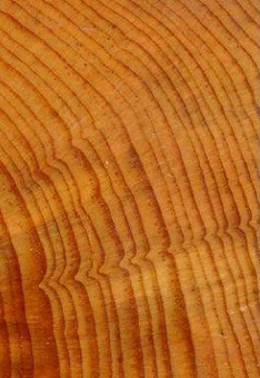 Paleoclimatology - Tree Ring
This archived Paleoclimatology Study is available from the NOAA National Centers for Environmental Information (NCEI), under the World Data Service (WDS) for Paleoclimatology. The associated NCEI study type is Tree Ring. The data include parameters of tree ring with a geographic location of West Virginia, United States Of America. The time period coverage is from 280 to -63 in calendar years before present (BP). See metadata information for parameter and study location details. Please cite this study when using the data.
- Cite as: Cockrell, S.W.; de Graauw, K.K.; Stetler, R.; Hessl, A.E. (2019-05-24): NOAA/WDS Paleoclimatology - Cockrell - Carnifex Ferry Battlefield State Park - QUSP - ITRDB WV011. [indicate subset used]. NOAA National Centers for Environmental Information. https://doi.org/10.25921/9zaw-3839. Accessed [date].
- Please refer to Credit tab for full citation information.
- doi:10.25921/9zaw-3839
- noaa-tree-26890
- NCEI DSI 1200_02
- NCEI DSI 1200_01
noaa-tree-26890
| Search Data |
|
| Download Data |
|
| Distribution Formats |
|
| Ordering Instructions | Contact NCEI for other distribution options and instructions. |
| Distributor | NOAA National Centers for Environmental Information
ncei.info@noaa.gov |
| Dataset Point of Contact | NOAA National Centers for Environmental Information
ncei.info@noaa.gov |
| Dataset Point of Contact | Data Center Contact
NOAA World Data Service for Paleoclimatology 828-271-4800 paleo@noaa.gov |
| Coverage Description | Date Range: 1670 CE to 2013 CE; Date Range: 280 cal yr BP to -63 cal yr BP; |
| Time Period | 1670 to 2013 |
| Spatial Bounding Box Coordinates |
N: 38.2114
S: 38.2114
E: -80.9372
W: -80.9372
|
| Spatial Coverage Map | |
| General Documentation |
|
| Associated Resources |
|
| Publication Dates |
|
| Data Presentation Form | Digital table - digital representation of facts or figures systematically displayed, especially in columns
|
| Dataset Progress Status | Complete - production of the data has been completed |
| Data Update Frequency | Data update frequency not available |
| Supplemental Information |
STUDY NOTES: NOAA Template Raw Measurements file added 2019-08-22.
ABSTRACT SUPPLIED BY ORIGINATOR: Dendroarchaeology can provide critical understanding of a structure built during key historic periods, such as the American Civil War (1861-1865), when historical documentation is likely to be sparse or incomplete. Cook's Mill is located in Greenville, West Virginia and extensive information derived from deeds, court records, wills, and oral history places the present mill's original construction in 1857. The American Civil War began shortly after its construction and military conflict in the area led to the burning of several key structures, one of which was an unknown mill in Greenville (formerly Centerville). Written history suggests the mill is original and survived the American Civil War, however we used dendroarchaeology to confirm its precise date of construction. We collected 46 samples from the mill and 6 cross sections from a nearby exhumed bridge for dendrochronological dating. The mill was constructed with white oak (Quercus alba) and tulip poplar (Liriodendron tulipifera) logs and the bridge samples were white oak. We visually and statistically crossdated 32 white oak samples from the mill and bridge by comparing them to a local chronology developed for this study and two regional oak chronologies from the International Tree-Ring Data Bank. Based on terminal ring attributes and cutting date years we were able to provide a suggested construction date of the spring or early summer of 1868. This date suggests Cook's Mill was the mill burned during military conflict in the area and that the current structure was subsequently rebuilt following the conclusion of the war. |
| Purpose | Tree ring data from the International Tree Ring Data Bank and World Data Center for Paleoclimatology archives. Most data sets include raw treering measurements (most are annual ring width, with some collections of earlywood or latewood width or wood density), plus chronologies (standardized growth indices for a site compiled from multiple treering samples). Reconstructions of climate variables are included with some of these data sets. Each data type is stored in a separate data file; the data type is coded into the file name. For details please see: http://www.ncei.noaa.gov/products/paleoclimatology/tree-ring |
| Dataset Citation |
|
| Cited Authors |
|
| Originators |
|
| Publishers |
|
| Theme keywords | Global Change Master Directory (GCMD) Science Keywords
|
| Data Center keywords | Global Change Master Directory (GCMD) Data Center Keywords
|
| Place keywords |
|
| Use Constraints |
|
| Access Constraints |
|
| Fees |
|
Last Modified: 2023-05-22
For questions about the information on this page, please email: ncei.info@noaa.gov