Geomorphosite Assessment at North Karangsambung -Karangbolong Geopark Kebumen, as Tools of Geotourism Development
DOI:
https://doi.org/10.25299/jgeet.2021.6.3.6753Keywords:
Geopark, Karangsambung, Geomorphosite, Pentulu Indah, Wagirsambeng, AsessmentAbstract
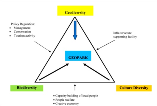
Geopark is a sustainable regional development concept that combines geological, biological, and cultural diversity through conservation and education activities to improve the community's welfare. Kebumen Regency has a National Geopark Karangsambung-Karangbolong (GNKK) covering 543,599 Km2 with 41 geosites, ten cultures, and eight biosite since 2018. The northern part of the area is a geological heritage that is widely used for field geological education.
The study aims to identify and assess geosites and geomorphosite in the north area, describing the region's geomorphological processes and geological evolution. Field research was conducted to get an overview of geological diversity, geomorphology, and geosite and determine the selected geomorphosite. Geomorphosite assessment is done quantitatively using the Kubalikova method by assessing five main parameters that include; Intrinsic and scientific value, the value of education, economic value, conservation value, and added value.
The scientific and intrinsic value of Pentulu Indah (PI) = 4, while Wagirsambeng = 3. Educational value of PI = 4, while Wagirsambeng = 2. Economic value is still not satisfactory, but P.I. = 2, while Wagirsambeng = 1.5. Conservation value of P.I. = 3.5, while Wagirsambeng = 2.5. Added value PI = 2.75 while Wagirsambeng = 1.5. Based on those, geomorphosite Pentulu Indah is 16,26 point or a good value (87.83 %) while Wagirsambeng is 10.5 point or fairly level (56.75 %).
Downloads
References
Ansori, C., Kumoro Y., Hastria D., W. K. (2016) Panduan Geowisata, menelusuri jejak dinamika bumi pada rangkaian Pegunungan Serayu dan pantai selatan Jawa, LIPI Press Jakarta. LIPI Press.
Ansori, C. (2018) “Geosite identification in karangbolong high to support the development of karangsambung-karangbolong geopark candidate, central java,” IOP Conference Series: Earth and Environmental Science, 118(1).
Ansori, C. et al. (2020) “Geomorphology and iron sand potential at coastal sediment morphology, Kebumen Regency,” E3S Web of Conferences, 200.
Asikin, S. (1974) Evolusi geologi jawa tengah dan sekitarnya ditinjau dari segi tektonik dunia yang baru., ITB.
Brilha, J. (2016) “Inventory and quantitative assessment of geosites and geodiversity sites: a review,” Geoheritage. Geoheritage, 8(2), pp. 119–134.
Brilha, J. (2018) “Geoheritage: Inventories and evaluation,” Geoheritage: Assessment, Protection, and Management, pp. 69–85.
Bruschi, V. M. and Cendrero, A. (2005) “Geosite evaluation; can we measure intangible values?,” Alpine and Mediterranean Quaternary, 18(1), pp. 293–306.
Carton, A., Cavallin, A. Francavilla, F., Mantovani, F., Panizza, M., Pellegrini, G. G. (1994) “Ricerche ambientali per l’individuazione e la valutazione dei beni geomorfologici metodi ed esempi. II.”
GGN, G. (2021) Global geopark network.
Gordon, J.E., Barron, H. F. (2011) “Scotland’s geodiversity: development of the basis for a national framework, scottish natural heritage,” Scotland’s geodiversity, (Scotland’s geodiversity).
Gordon, J.E.; Crofts, R.; Diaz-Martinez.E; and Woo, K. S. (2017) “Enhancing the role of geoconservation in protected area management and nature conservation,” Geoheritage.
Gordon, J. E. (2012) “Rediscovering a sense of wonder: geoheritage, geotourism, and cultural landscape experiences,” Geoheritage, 4–1, pp. 65–77.
Grandgirard, V. (1995) “M’ethode pour la r’ealisation d’un inventairre de g’eotopes g’eomorphologiques,” in. UKPIK, Cahiers de l’Institut de G’eographie de l’Universit’e de Fribourg 10, pp. 121–137.
Grandgirard, V. (1999) “L’evaluation des g’eotopes,” in Geol. Insubr 4 (1), pp. 66–69.
Gray, M. (2008) “Geodiversity: the origin and evolution of a paradigm,” in Burek, C.D., Prosser, C. . (ed.) The History of Geoconservation. Special Publication 300. The Geological Society, London, pp. 31–36.
Gray, Murray (2013) “Geodiversity: valuing and conserving abiotic nature, 2nd edition,” in Geodiversity. second edi. London: Wiley Blackwell, p. 512.
Gray, M. (2018) “Geodiversity: The backbone of geoheritage and geoconservation,” Geoheritage: Assessment, Protection, and Management, pp. 13–25.
Hoffmann, J. et al. (2019) “Age constraints on high-pressure/low-temperature metamorphism and sedimentation in the Luk Ulo Complex (Java, Indonesia),” Lithos. Elsevier B.V., 324–325, pp. 747–762.
Hooke, J. M. (1994) “Strategies for conserving and sustaining dynamic geomorphological sites,” in O’Halloran, D., Green, C., Harley, M., Knill, J. (ed.) Geological and Landscape Conservation. Geological. The Geological Society, London, pp. 191–195.
Ketner, K. B. et al. (1976) “Pre-Eocene rocks of Java, Indonesia,” Journal Research U.S. Geological Survey, 4(5), pp. 605–614.
Kubalíková, L. (2013) “Geomorphosite assessment for geotourism purposes,” Czech Journal of Tourism, 2(2), pp. 80–104. doi: 10.2478/cjot-2013-0005.
Miyazaki, K. et al. (1998) “A jadeite-quartz-glaucophane rock from Karangsambung, central Java, Indonesia,” Island Arc, 7(1–2), pp. 223–230.
Newsome, D. & Dowling, R. K. (2010) Geotourism: the tourism of geology and landscape.
Panizza, M., Piacente, S. (1993) “Geomorphological assets evaluation,” Zeitschr. fur Geomorphologie, 87, pp. 13–18.
Panizza, M., Piacente, S. (2009) “Cultural geomorphology and geodiversity,” in Reynard, E., Coratza, P., Regolini-Bissig, G. (ed.) Geomorphosites, pp. 35–48.
Panizza, M. (2001) “Geomorphosites: concepts, methods, and examples of the geomorphological survey,” Chinese Science Bulletin, 46–1, pp. 4–5.
Paola Coratza, and F. H. ea (2018) “The Specificities of geomorphological Heritage,” in Reynard E, B. J. (ed.) Geoheritage, Assessment, Protection and Management. Elsevier.
Parkinson, C. D. et al. (1998) “An overview and tectonic synthesis of the pre-Tertiary very-high-pressure metamorphic and associated rocks of Java, Sulawesi and Kalimantan, Indonesia,” Island Arc, 7(1–2), pp. 184–200.
Perpres, P. (2019) Perpres 9/2019, Pengembangan Taman Bumi(Geopark).
Pralong, J. P. (2005) “A method for assessing tourist potential and use of geomorphological sites,” Géomorphologie: Relief, Processus, Environnement, 11(3), pp. 189–196.
Prsetyadi, C. (2007) Evolusi Tektonik Paleogen Jawa Bagian Timur. ITB.
Quaranta, G. (1993) “Geomorphological assets: conceptual aspect and application in the area of Croda da Lago,” in Panizza, M., Soldati, M., Barani, D. (ed.) European Intensive Course on Applied Geomorphology Proceedings, pp. 46–60.
Reynard, E. (2005) “G’eomorphosites et paysages G’eomorphol,” Relief Proces. Environ, 3, pp. 181–188.
Reynard, E. and Coratza, P. (2007) “Geomorphosites and geodiversity: A new domain of research,” Geographica Helvetica, 62(3), pp. 138–139.
Reynard, E. and Coratza, P. (2016) “The importance of mountain geomorphosites for environmental education: examples from the italian dolomites and the swiss alps,” Acta geographica Slovenica, 56(2).
Reynard, E. and Giusti, C. (2017) “The landscape and the cultural value of geoheritage,” in Geoheritage: Assessment, Protection, and Management. Elsevier Inc., pp. 147–166.
Rivas, V., Rix, K., Frances, A. and Cendrero, A., Brunsden, D. (1997) “Geomorphological indicators for environmental impact assessment: consumable and non-consumable geomorphological resources,” Geomorphology, 18, pp. 169–182.
Serrano, E. and González-Trueba, J. J. (2005) “Assessment of geomorphosites in natural protected areas: the Picos de Europa National Park (Spain)Évaluation des géomorphosites dans les espaces naturels protégés: le Parc National des Picos de Europa (Espagne),” Géomorphologie : relief, processus, environnement, 11(3), pp. 197–208.
Suparka, E. (1988) Studi Petrologi dan Pola Kimia Kompleks Ofiolit Karangsambung Utara Luh Ulo, Jawa Tengah. ITB.
UNESCO, U. (2016) Operational guidelines for the implementation of the world heritage convention.
Wakita, K., Munasri and Bambang, W. (1994) “Cretaceous radiolarians from the Luk-Ulo Melange Complex in the Karangsambung area, central Java, Indonesia,” Journal of Southeast Asian Earth Sciences, 9(1–2), pp. 29–43.
Zouros, N. (2005) “Assessment, protection, and promotion of geomorphological and geological sites in the Aegean area, GreeceÉvaluation, protection et promotion des sites géomorphologiques et géologiques de la région égéenne, Grèce,” Géomorphologie : relief, processus, environnement, 11(3), pp. 227–234.
Downloads
Published
Issue
Section
License
Copyright @2019. This is an open-access article distributed under the terms of the Creative Commons Attribution-ShareAlike 4.0 International License which permits unrestricted use, distribution, and reproduction in any medium. Copyrights of all materials published in JGEET are freely available without charge to users or / institution. Users are allowed to read, download, copy, distribute, search, or link to full-text articles in this journal without asking by giving appropriate credit, provide a link to the license, and indicate if changes were made. All of the remix, transform, or build upon the material must distribute the contributions under the same license as the original.