Reports of Investigations
-
Books & Reports
- Reports of Investigations
- Guidebooks
- Udden Series
- Geological Circulars
- Down To Earth
- Atlases of Major Oil and Gas Reservoirs
- Texas Memorial Museum Publications
- Environmental Geologic Atlas of the Texas Coastal Zone
- Mineral Resource Circulars
- Other Reports
- Seminars and Workshops
- Handbooks
- Submerged Lands of Texas
- Symposia
- Annual Reports
- Open File Reports
-
Maps & Cross Sections
- Thematic Maps
- Miscellaneous Maps, Charts & Sections
- Geologic Atlas of Texas
- STATEMAP Project Maps
- Geologic Quadrangle Maps
- Cross Sections
- Highway Geology Map
- Energy and Mineral Resource Maps
- Shoreline Change and Other Posters
- Wilcox Group, East Texas, Geological / Hydrological Folios
- Bouguer Gravity Atlas of Texas
- River Basin Regional Studies
- Featured Maps
- Posters
- Teachers & the Public
-
Geological Society Publications
- Gulf Coast Association of Geological Societies
- Alabama Geological Society
- Austin Geological Society
- Corpus Christi Geological Society
- Houston Geological Society
- Lafayette Geological Society
- Mississippi Geological Society
- New Orleans Geological Society
- South Texas Geological Society
- GCS SEPM Publications
- Historic BEG & UT Series
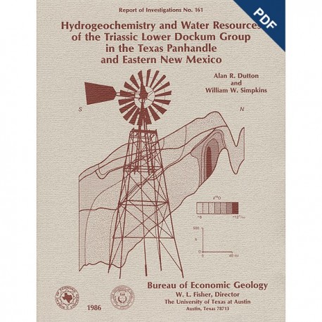
Hydrogeochemistry and Water Resources of the Triassic Lower Dockum Group...Texas Panhandle... Digital Download
RI0161D
For a print version: RI0161.
RI0161D. Hydrogeochemistry and Water Resources of the Triassic Lower Dockum Group in the Texas Panhandle and Eastern New Mexico, by A. R. Dutton and W. W. Simpkins. 51 p., 19 figs., 4 tables, 2 appendices, 1986. doi.org/10.23867/RI0161D. Downloadable PDF.
To purchase this publication in book format, please order RI0161.
ABSTRACT
Topographically controlled ground-water-basin divides, established during the Pleistocene by erosion of the Pecos and Canadian River valleys, prevent ground-water recharge in the outcrop of the Triassic Dockum Group from entering the confined part of the aquifer in the Dockum Group beneath the Southern High Plains in the Texas Panhandle and eastern New Mexico. Ground water in the confined aquifer was probably recharged from precipitation at higher elevations in eastern New Mexico before thick deposits of Dockum Group sandstones were eroded. The confined aquifer in the Lower Dockum Group is separated from the overlying, heavily pumped High Plains aquifer in the Neogene Ogallala Formation and Cretaceous Edwards/ Trinity Groups by thick mudstones in the Upper Dockum Group. Hydrologic separation beneath most of the Southern High Plains is indicated by (1) hydraulic heads of Lower Dockum Group ground water that are 300 to 700 ft (90 to 200 m)lower than the water table of the High Plains aquifer, (2) δ18O and δD values of Lower Dockum Group ground water that are 2 to 3 ‰ and 15 to 25 ‰ lighter, respectively, than ground water in the Ogallala Formation, and (3) different associations of hydrochemical facies in the two aquifer systems. The significant differences in hydraulic head between the two aquifer systems reflect the Pleistocene cutoff of recharge and the continuation of discharge during the Holocene, which have caused a decrease in ground-water storage. The δ18O and δD values suggest that Dockum Group ground water was recharged in a cool climate at elevations above approximately 5,900 ft (1,800 rn) in eastern New Mexico.
Chemical composition of Dockum Group ground water is controlled by reactions with Dockum Group minerals, including calcite, chalcedony, dolomite, feldspar, kaolinite, opal, pyrite, and smectite. Accounting for salinity greater than 20,000 mg/L in Na-CI facies are (I) discharge of ground water that dissolved halite in underlying Permian strata or (2) Cretaceous seawater that was incompletely flushed from low-permeability mudstones in the Dockum Group. Spatially variable water quality occurs in unconfined parts of the Dockum Croup where ground water from adjacent formations mixes with Dockum Group ground water.
Ground water in the Lower Dockum Group beneath the Southern High Plains in the Texas Panhandle and eastern New Mexico has not proved to be a substitute for Ogallala Formation ground water everywhere. Development of Dockum Group water resources for irrigation and municipal supply will continue to be limited to areas having thick sandstone deposits, moderate head lift of less than 500 ft (150 m), and fresh to slightly brackish salinity as great as 3,000 mg/L. Production of Dockum Group ground water beneath the Southern High Plains will deplete stored water because the recharge rate to the confined Dockum Group is negligible.
Keywords: hydrogeology, hydrogeochemistry, water resources, chemical composition, isotopic composition, specific capacity tests, Dockum Croup, Southern High Plains, Texas Panhandle, eastern New Mexico
CONTENTS
ABSTRACT
INTRODUCTION
HYDROGEOLOGIC SETTING
DATA AND METHODS
RESULTS
Potentiometric surface
Hydrogeochemistry
Water resources
DISCUSSION
Origin of ground water in the Lower Dockum Group
Mineralogic controls on chemical composition
CONCLUSIONS
ACKNOWLEDGMENTS
REFERENCES
APPENDIX A. Estimated hydraulic properties of the Dockum Group, Texas Panhandle
APPENDIX B. Chemical composition of Dockum Group ground water
Figures
1. Geologic map of the study area
2a. lsopach map of the lower Dockum Group
2b. lsopach map of the Upper Dockum Group
3. North-south stratigraphic cross section through the Texas Panhandle showing hydraulic-head profiles of aquifers in the Ogallala Formation, Edwards/TrinityGroups, and Dockum Group
4a. Regional map of percent sandstone in the lower Dockum Group
4b. Regional map of percent sandstone in the Upper Dockum Group
5. Potentiometric surface map of Lower Dockum Group ground water
6. Plot of δD and δ18O values of Dockum Group ground water along the meteoric water line
7. Map of δD values of Lower Dockum Group ground water
8. North-south stratigraphic cross section showing inferred profile of δ18O values of ground water in the Ogallala Formation and Dockum Group
9. Piper diagrams of hydrochemical facies
10a. Hydrochemical facies of lower Dockum Group ground water
10b. Total dissolved solids in lower Dockum Group ground water
11. Relation between δ34S and sulfate concentration
12. Dockum water wells drilled in the Texas Panhandle, 1950–1978
13. Mean value of sodium adsorption ratio by county
14. Hypothetical regional flow paths of ground water in the Ogallala Formation and Dockum Group before and after development of the Pecos River valley
15. Diagram showing chemical composition of Lower Dockum Group ground water relative to stability fields of minerals in the NaO-SiO2-H2O system
16. Diagram showing chemical composition of lower Dockum Group ground water relative to stability fields of minerals in the NaO-CaO- SiO2-H2O-CO2 system
17. Diagram showing chemical composition of Lower Dockum Group ground water relative to stability fields of minerals in the MgO-CaO- SiO2-H2O-CO2 system
18. Plot of saturation indices relative to halite and gypsum
19. Plot of sodium and chloride concentrations in Lower Dockum Group ground water
Tables
1. Mineral reactions and equilibrium reaction constants
2. Chemical and isotopic composition of lower Dockum Group ground water
3. Municipal water-supply use of Dockum Group ground water
4. Estimation of carbon-14 age of water from the SWEC Mansfield No. 2 well
Appendix Figures
A1. Data from pumping test at the City of Hereford No. 18 well
A2. Data from pumping test at the City of Tulia No. 13 well
A3. Average transmissivity of Lower Dockum Group sandstones by county
Appendix Tables
A1. Transmissivity estimates from specific capacity tests
A2. Comparison of transmissivity estimates from pumping and specific capacity tests
Citation
Dutton, A. R., and Simpkins, W. W., 1986, Hydrogeochemistry and Water Resources of the Triassic Lower Dockum Group in the Texas Panhandle and Eastern New Mexico: The University of Texas at Austin, Bureau of Economic Geology, Report of Investigations No. 161, 51 p.
