Volcán de Fuego lives up to its name. Not only does Guatemala's “Volcano of Fire” blast columns of ash skyward several times every hour, it also becomes a true inferno about once a month, when larger eruptions hurl menacing lava and debris down its slopes. This cyclic behavior is intensifying, making scientists wonder if a more explosive eruption is imminent. In a massive 1974 outburst the mountain shot an ash cloud four miles into the sky and sent a huge amount of debris racing down its sides. Another such eruption would be a nightmare scenario for the 100,000 people now living in the volcano's shadow.
But without the ability to peek into its dangerous and inaccessible crater, scientists have struggled to predict what is next. So earlier this year a team of volcanologists and engineers dispatched drones to capture unprecedented images of the crater's activity. “From a volcanology point of view, we never imagined we'd see explosions this close,” says team member Emma Liu, a volcanologist at the University of Cambridge. “It's spectacular.”
The pilotless flights revealed a gigantic cone that had formed within the crater days before one of Volcán de Fuego's monthly eruptions. Liu and her colleagues suspect the cone kept growing higher until—much like a precarious Jenga tower—it became unstable and partially collapsed, triggering the larger lava and debris flows as part of a pattern that repeats semiregularly.
On supporting science journalism
If you're enjoying this article, consider supporting our award-winning journalism by subscribing. By purchasing a subscription you are helping to ensure the future of impactful stories about the discoveries and ideas shaping our world today.
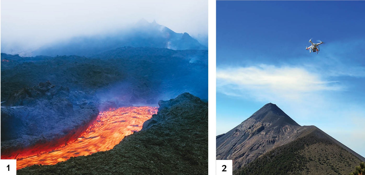
Researchers surveyed Volcán de Pacaya (1) and Volcán de Fuego (2) using remotely operated aircraft. Credit: Jeremy Woodhouse Getty Images (1); Courtesy of University of Cambridge, University of Bristol, and National Institute of Seismology, Volcanology, Meteorology and Hydrology (2)
By building on this idea, volcanologists could help predict more precisely when those cyclic eruptions will come. Einat Lev, a volcanologist at the Lamont-Doherty Earth Observatory, who was not involved in the research, calls the work “a superb demonstration of new knowledge about volcanoes in general, and Guatemalan volcanoes specifically, that [drones] have been providing.” The findings have not yet been published.
The team members plan to return to Guatemala this November to test their hypothesis by observing the crater throughout an entire cycle. This time their drones will be equipped with new instruments that will also let them sample the ash column directly—which may help them determine whether Volcán de Fuego is about to have another catastrophic eruption.