Vessel Detection Events Recorded at SanctSound Site GR03_03

browse graphic
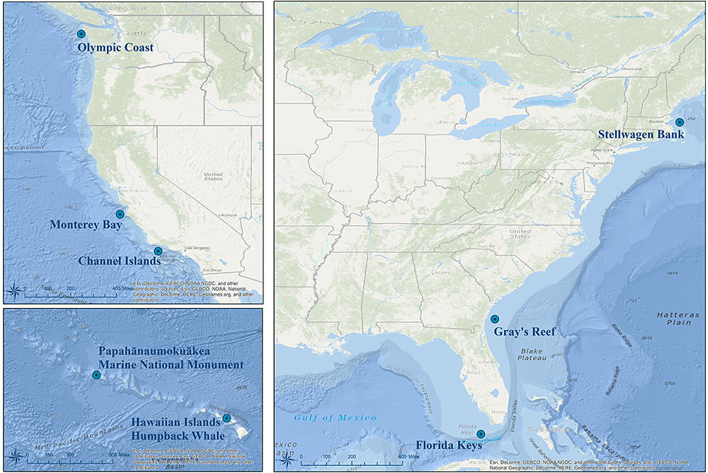
Monitoring locations for the SanctSound project. Credit: NOAA
This record represents the individual vessel events detected from raw passive acoustic data. Events are identified from the long-term spectral average (LTSAs) created for each site with a 5 s, 48 kHz resolution. The LTSA is analyzed in blocks where the calibrated power spectral density estimates are averaged in user-defined low, medium and high frequency bands. These data were recorded at SanctSound Site GR03_03 between October 17, 2019 and December 02, 2019.
  • Cite as: NOAA Office of National Marine Sanctuaries and U.S Navy. 2021. Vessel Detection Events Recorded at SanctSound Site GR03_03, SanctSound Data Products. NOAA National Centers for Environmental Information. https://doi.org/10.25921/ngwa-c422. [access date].
  • 10.25921/ngwa-c422
  • NCEI Metadata ID: gov.noaa.ncei.pad:NOAA-Navy-SanctSound_GR03_03_ships
gov.noaa.ncei.pad:NOAA-Navy-SanctSound_GR03_03_ships
Search Data
Download Data
Distribution Formats
  • CSV, netCDF
Ordering Instructions Contact NCEI for other distribution options and instructions.
Distributor NOAA National Centers for Environmental Information
ncei.info@noaa.gov
Dataset Point of Contact NOAA National Centers for Environmental Information
ncei.info@noaa.gov
Dataset Point of Contact Carrie Wall
NCEI Passive Acoustic Archive Lead
NOAA National Centers for Environmental Information
pad.info@noaa.gov
Coverage Description Site GR03_03
Time Period 2019-10-17T19:00:00Z to 2019-12-02T23:00:00Z
Spatial Bounding Box Coordinates
West:-80.8949
East:-80.8949
South:31.367517
North:31.367517
Spatial Coverage Map
General Documentation
Associated Resources
  • NOAA-Navy Sanctuary Soundscapes Monitoring Project (SanctSound)
    • Sound Monitoring
      NOAA and the U.S. Navy are working to better understand underwater sound within the U.S. National Marine Sanctuary System. From 2018 to 2021, these agencies will work with numerous scientific partners to study sound within seven national marine sanctuaries and one marine national monument, which includes waters off Hawai'i and the east and west coasts. Standardized measurements will assess sounds produced by marine animals, physical processes (e.g., wind and waves), and human activities. Collectively, this information will help NOAA and the Navy measure sound levels and baseline acoustic conditions in sanctuaries. This work is a continuation of ongoing Navy and NOAA research, including efforts by NOAA's Office of National Marine Sanctuaries This dataset represents the derived products from the raw acoustic data that are archived at NOAA National Centers for Environmental Information.
Publication Dates
  • publication: 2023-06-15
Edition Final SanctSound Data Product
Dataset Progress Status Complete - production of the data has been completed
Data Update Frequency As needed
Purpose These data are available to the public for a wide variety of uses including scientific research and analysis.
Dataset Citation
  • Cite as: NOAA Office of National Marine Sanctuaries and U.S Navy. 2021. Vessel Detection Events Recorded at SanctSound Site GR03_03, SanctSound Data Products. NOAA National Centers for Environmental Information. https://doi.org/10.25921/ngwa-c422. [access date].
Cited Authors
  • NOAA Office of National Marine Sanctuaries
  • U.S. Navy
Principal Investigators
  • Simone Baumann-Pickering
    Scripps Institution of Oceanography
  • Leila Hatch
    NOAA Stellwagen Bank National Marine Sanctuary
  • John Joseph
    U.S. Naval Postgraduate School
  • Anke Kuegler
    Hawai'i Institute of Marine Biology, University of Hawai'i at Manoa
  • Marc Lammers
    NOAA Hawaiian Islands Humpback Whale National Marine Sanctuary
  • Tetyana Margolina
    U.S. Naval Postgraduate School
  • Karlina Merkens
    NOAA Pacific Islands Fisheries Science Center
  • Lindsey Peavey Reeves
    NOAA Channel Islands National Marine Sanctuary
  • Timothy Rowell
    NOAA Northeast Fisheries Science Center
  • Jenni Stanley
    Woods Hole Oceanographic Institution
  • Alison Stimpert
    Moss Landing Marine Laboratories
  • Sofie Van Parijs
    NOAA Northeast Fisheries Science Center
  • Eden Zang
    NOAA Hawaiian Islands Humpback Whale National Marine Sanctuary
Collaborators
  • Alba Solsona Berga
    Scripps Institution of Oceanography
Publishers
  • NOAA National Centers for Environmental Information
Acknowledgments
  • This project received funding from the U.S. Navy.
Theme keywords Global Change Master Directory (GCMD) Science Keywords
  • Earth Science > Biological Classification > Animals/Vertebrates > Fish
  • Earth Science > Biological Classification > Animals/Invertebrates
  • Earth Science > Biological Classification > Animals/Vertebrates > Mammals > Cetaceans
  • Earth Science > Oceans > Ocean Acoustics
  • Earth Science Oceans > Aquatic Sciences > Fisheries
  • Earth Science > Oceans > Marine Environment Monitoring
  • Earth Science > Oceans > Ocean Acoustics > Ambient Noise
  • Earth Science > Biosphere > Aquatic Ecosystems
  • Earth Science > Biosphere > Aquatic Ecosystems > Marine Habitat
Data Center keywords Global Change Master Directory (GCMD) Data Center Keywords
  • DOC/NOAA/NESDIS/NCEI > National Centers for Environmental Information, NESDIS, NOAA, U.S. Department of Commerce
  • DOC/NOAA/NMFS > National Marine Fisheries Service, NOAA, U.S. Department of Commerce
  • DOD/USNAVY > U.S. Navy, U.S. Department of Defense
  • DOC/NOAA/NOS/NMS > National Marine Sanctuaries, National Ocean Service, NOAA, U.S. Department of Commerce
Platform keywords Global Change Master Directory (GCMD) Platform Keywords
  • Fixed Observation Stations
Instrument keywords Global Change Master Directory (GCMD) Instrument Keywords
  • Recorders/Loggers > Passive Acoustic Recorder
  • Acoustic Sounders > Hydrophones
Place keywords Global Change Master Directory (GCMD) Location Keywords
  • Ocean > Atlantic Ocean > North Atlantic Ocean
  • Vertical Location > Water Column
Project keywords Global Change Master Directory (GCMD) Project Keywords
  • SanctSound > NOAA-Navy Sanctuary Soundscapes Monitoring Project
Use Constraints
  • Use liability: NOAA and NCEI cannot provide any warranty as to the accuracy, reliability, or completeness of furnished data. Users assume responsibility to determine the usability of these data. The user is responsible for the results of any application of this data for other than its intended purpose.
Access Constraints
  • Distribution liability: NOAA and NCEI make no warranty, expressed or implied, regarding these data, nor does the fact of distribution constitute such a warranty. NOAA and NCEI cannot assume liability for any damages caused by any errors or omissions in these data. If appropriate, NCEI can only certify that the data it distributes are an authentic copy of the records that were accepted for inclusion in the NCEI archives.
Other Constraints Cite as: NOAA Office of National Marine Sanctuaries and U.S Navy. 2021. Vessel Detection Events Recorded at SanctSound Site GR03_03, SanctSound Data Products. NOAA National Centers for Environmental Information. https://doi.org/10.25921/ngwa-c422. [access date].
Fees
  • In most cases, electronic downloads of the data are free. However, fees may apply for custom orders, data certifications, copies of analog materials, and data distribution on physical media.
Lineage information for:dataset
Processing Steps
  • Vessel events (individual events) were detected using Triton's Ship-Detector Remora. An LTSA is created for each site with a 5 s, 48 kHz resolution; events are identified from these LTSAs. Individual site settings are tested using the Interactive Detector and most conservative settings are run using the Batch Detector. The LTSA is analyzed in blocks of data (windows), where the calibrated sound pressure spectral density (PSD) estimates are averaged in three frequency bands; low, medium and high (defined by user). Start and end times of the events are detected and stored if the three averaged PSDs meet three conditions (all values set by user): 1. Amplitude is above a user-defined, time-dependent amplitude threshold computed using a histogram method of the averaged PSDs; 2. The event duration is above a user-defined time in the three bands. The duration in the higher band must be shorter that the medium band, or the event duration above the threshold in the lower and medium band must be longer than the user specified time, and the duration in the medium band must be shorter than the lower band; 3. Events are distinguished from weather events when averaged received levels of the event in the lower band are above a user specified percentage of the background sound in the window. The window length and the overlapping time with the next consecutive window is defined by the user. Once Batch Detector is run, user reviews results and corrects labelled events to either Ambient (non-ship source) or Ship. Low band limit (Hz): 100-2,000, Medium band limit: 2,000-3,000, High band limit: 3,000-4,000, Close passage duration threshold (s): 40, Distant passage duration threshold (s): 45, Received level threshold (%): 0.03, Time between passages (h): 0.1, Buffer time (min): 4, Window Size (h): 1, Sliding Time Overlapping Windows (h) 0.5.
  • Data were processed with Triton - Soundscape Metrics Remora (Github commit '44f0f20'; Feb 9, 2020) and Matlab (2016b and newer; statistics toolbox).
Acquisition Information (collection)
Instrument
  • SoundTrap ST500
Platform
  • Fixed Observation Stations
Last Modified: 2023-06-15
For questions about the information on this page, please email:ncei.info@noaa.gov