
Abstract
The Duna-Tisza Interfluve, Hungary has an agricultural economy but is plagued by severe problems of soil and wetland salinization despite 200 years of intensive research. The study’s objective was to determine the origin of salts and the mechanisms of salinity distribution. To this end, flow-patterns and chemistry of groundwater were evaluated in a 100 km × 65 km area, with emphasis on the Kolon- and Kelemenszék Lakes region. The lakes are located 13 km apart and have chemically contrasting water and soil types. Two groundwater flow-domains were identified: a gravity-drive meteoric fresh water and an over-pressured deeper domain of saline water. The waters are channeled by a highly permeable gravel aquifer to the surface and may merge near Kelemenszék Lake, causing it to be saline. Kolon Lake receives meteoric groundwater only, hence its fresh chemical character. The cross-formational ascent of the deep waters, combined with the gravitational systems’ geometry and the flow-channeling effect of the near-surface rocks, explains the contrasting chemistry between lakes, and the origin and pattern of soil salinization. The scheme is proposed as a generally valid hydrogeological profile for the interfluve, and has been named the Duna-Tisza Interfluve Hydrogeological Type Section.
Résumé
L’interfluve de Duna-Tisza (Hongrie) est soumise à une économie base sur l’agriculture; elle fait face à de nombreux problèmes de salinization des sols et des zones humides, malgré des recherches intenses menées depuis plus de 200 ans. L’objectif de cette étude était de déterminer l’origine des sels ainsi que les mécanismes en jeux permettant d’expliquer la distribution spatiale de la salinité. Afin d’atteindre cet objectif, les modalités d’écoulements souterrains et d’acquisition du chimisme des eaux souterraines ont été évaluées sur une zone de 100 km × 65 km, comprenant notamment la région des lacs Kolon et Kelemenszék. Les lacs sont situés à 13 km les uns des autres ; ils sont caractérisés par des eaux de composition chimique contrastée et différents types de sol. Deux domaines d’écoulements des eaux souterraines ont été identifiés : des écoulements associés aux écoulements gravitaires d’eau douce d’origine météoritique et des écoulements en milieu profond en charge avec des eaux salines. Les eaux s’écoulent au sein de chenaux existants au sein d’un aquifère graveleux à perméabilité élevée vers la surface ; elles peuvent émerger à proximité du lac Kelemenszék, et pouvant causer la salinisation de ce dernier. Le Lac Kolon est alimenté par les eaux souterraines d’origine météoritique uniquement, comme en témoigne les propriétés chimiques d’eau douce. Les remontées d’eaux profondes associées à des écoulements souterrains au sein de systèmes aquifères dont la géométrie est influencée par la présence de chenaux à proximité de la surface, permettent d’expliquer le chimisme contrasté entre les lacs ainsi que l’origine et les modalités de la salinisation des sols. Un modèle conceptuel est proposé, reposant sur un profil hydrogéologique validé pour l’interfluve. Cette section constitue une section hydrogéologique type de l’interfluve de Duna-Tisza.
Resumen
El interfluvio Duna – Tisza en Hungría tiene una economía agrícola pero está plagada por severos problemas de salinización de suelo y del humedal, a pesar de 200 años de investigaciones intensivas. El objetivo del estudio fue determinar el origen de las sales y los mecanismos de distribución de la salinidad. Para este fin se evaluaron los esquemas de flujo y química del agua subterránea en un área de 100 km × 65 km, con énfasis en la región de los lagos Kolon y Kelemenszék. Los lagos distan 13 km entre sí y tienen tipos de agua y suelo que contrastan químicamente. Se identificaron dos dominios de flujos de agua subterránea: agua dulce meteórica gobernada por la gravedad y un dominio más profundo bajo presión de agua salina. Las aguas están canalizadas por un acuífero de gravas altamente permeables hacia la superficie y pueden mezclarse cerca del Lago Kelemenszék, provocando su salinización. El lago Kolon recibe agua subterránea meteórica solamente, de ahí su carácter químico de agua dulce. El ascenso a través de las formaciones de las aguas profundas, combinada con la geometría del sistema gobernado por la gravedad y el efecto del flujo de canalización en las rocas cercanas a superficie, explican el contraste químico entre ambos lagos, y el origen y el esquema de la salinización del suelo. El esquema es propuesto como un perfil hidrogeológico generalmente válido para el interfluvio y ha sido denominado Sección Hidrogeológica Tipo del Interfluvio Duna-Tisza.
摘要
匈牙利多瑙河-蒂萨河河间有一个农业经济区, 尽管200年来进行了大量研究, 仍然遭受着土壤和湿地严重盐渍化的危害。本研究的目的是确定盐分来源和盐化分布机理。为此, 评估了100km×65km范围内, 特别是Kolon和Kelemenszék湖区地下水流场和水化学特征。两湖相距13km, 其水和土壤的化学类型不同。识别出两个地下水流场 : 重力驱动的淡大气水和深部承压咸水。这些水为一个高渗透性砾石含水层导通而到达地表, 并可能在Kelemenszék湖附近出露, 导致其盐化。Kolon湖只接受大气降水补给, 因而水质较淡。深部水的越层上升与重力系统的几何形态和近地表岩石的流动-管道化效应一起, 解释了两湖的化学差异, 及土壤盐渍化的原因和类型。建议采用该模式为河间地块的普适性水文地质剖面, 将其并命名为多瑙河-蒂萨河河间水文地质典型剖面。
Resumo
O interflúvio Duna-Tisza (Hungria) tem uma economia agrícola, mas, e apesar dos 200 anos de intensa investigação, encontra-se afectado por graves problemas de salinização do solo e das zonas húmidas. O objectivo deste estudo foi a identificação da origem dos sais e dos mecanismos de distribuição da salinização. Até ao momento, foram avaliados os padrões de fluxo e a composição química da água subterrânea numa área de 100 km × 65 km, dedicando especial atenção à região dos lagos Kolon e Kelemenszék. Os lagos estão separados entre si por 13 km e apresentam composição química das suas águas e tipos de solos contrastantes. Foram identificados dois domínios de fluxo de água subterrânea: um de água doce meteórica recarregada por gravidade e um domínio mais profundo contendo água salgada. As águas são direccionadas para a superfície através de um aquífero de seixo muito permeável, onde se podem misturar, perto do lago Kelemenszék, provocando a sua salinização. O lago Kolon recebe apenas água subterrânea meteórica, e portanto apresenta um quimismo de água doce. A ascensão das águas profundas, cruzando as formações geológicas, e combinada com a geometria gravitacional do sistema e com o efeito de canalização da água subterrânea exercido pelas rochas mais superficiais, explica o quimismo contrastante de ambos os lagos, bem como a origem e padrão de salinização do solo. Este esquema foi proposto como perfil hidrogeológico geralmente válido para o interflúvio e, foi designado por Secção Hidrogeológica Tipo do Interflúvio Duna-Tisza.


Notes
Values given for Na+ ion include K + also. K + contents determined separately are shown consistently to be less than 1.5 % of Na+ ion concentration, thus are considered negligible in the present context.
References
Arany S (1956) A szikes talaj és javítása [The salt-affected soil and its amelioration]. Mezőgazdasági Kiadó, Budapest, 407 pp
Balogh J (1840) A magyarországi szikes vidékek [The salt-affected soil regions of Hungary]. Természettudományi Pályamunkák, A Magyar Tudós Társaság, Budapest, 123 pp
Bíró M (2003) A Duna-Tisza köze aktuális élőhelytérképe [The map of the present bio-habitat of the Duna-Tisza Interfluve]. In: Molnár ZS (ed) A Kiskunság száraz homoki növényzete [Sand dunes in Hungary, Kiskunság]. Természet BÚVÁR Alapítvány Kiadó, Budapest
Erdélyi M (1976) Outlines of the hydrodynamics and hydrochemistry of the Pannonian Basin. Acta Geol Acad Sci Hung 20:287–309
Horváth F, Cloething SAPL (1996) Stress-induced late-stage subsidence anomalies in the Pannonian Basin. Tectonophysics 266:287–300
Juhász GY (1991) Lithostratigraphic and sedimentological framework of the Pannonian (s.l.) sedimentary sequence in the Hungarian Plain (Alföld), eastern Hungary. Acta Geol Hung 34:53–72
Kiss I (1979) Vízfeltörések szerepe a szikes talajok “tarkasága” kialakításában [The role of groundwater outbreaks in the “variegation” of salt-affected soils]. Botanikai Közlemények 66(3):177–184
Kiss I (1990) A vízfeltörések formái és szerepük a szikes területek kialakulásában [The forms and roles of water outbreaks in the genesis of salt-affected areas]. Hidrol Közlöny 70(5):281–287
Koritár ZS (1999) Felszín alatti vízáramkép a Kolon-tó környezetében [Groundwater flow-pattern around Kolon Lake]. MSc Thesis, Eötvös Loránd University of Sciences, Hungary
Kovács GY (1960) A szikesedés és a talajvízháztartás kapcsolata [Relation between soil-salinization and the groundwater budget]. Hidrol Közlöny 40(2):131–139
Kovács-Láng E, Molnár Gy, Kröel-Dulay S, Barabás (eds) (1999) Long term ecological research in the Kiskunság, Hungary. KISKUN LTER. Institute of Ecology and Botany, Hungarian Academy of Sciences, Vácrátót, 64 pp
Kuti L (1977) Az agrogeológiai problémák és a talajvíz kapcsolata az Izsáki térképlap területén [Relation between agricultural problems and groundwater in the area of the Izsák mapsheet] In: Magyar Állami Földtani Intézet Évi Jelentése az 1977. évről, Budapest, pp 121–130
Kuti L, Kőrössy L (1989) Az Alföld Földtani Atlasza: Dunaújváros-Izsák [The geological atlas of the Hungarian Great Plain: Dunaújváros-Izsák] Magyar Állami Földtani Intézet, Budapest
Mészáros E (2005): Hidrogeológiai célú szeizmikus értelmezés a Duna-völgy északkeleti részén [Seismic interpretation for hydrogeological purposes at the NE part of the Duna Valley]. MSc Thesis, Eötvös Loránd University of Sciences, Hungary
Molnár B, Kuti L (1978) A Kiskunsági Nemzeti Park III. sz. területén található Kisréti-, Zabszék-, és Kelemenszék-tavak környékének talajvízföldtani viszonyai [Shallow groundwater conditions around Kisrét-, Zabszék-, and Kelemenszék-lakes in area No. III of the Kiskunsági National Park]. Hidrol Közlöny 58(8):347–355
Molnár B, Iványosi-Szabó A, Fényes J (1979) A Kolon-tó kialakulása és limnogeológiai fejlődése [The origin and limnogeological evolution of Kolon Lake]. Hidrol Közlöny 59(12):549–560
Nemčok M, Pogácsás GY, Pospíšil L (2006) Activity timing of the main tectonic systems in the Carpathian–Pannonian Region in relation to the rollback destruction of the lithosphere. In: Golonka J, Picha FJ (eds) The Carpathians and their foreland: geology and hydrocarbon resources. Am Assoc Petrol Geol Mem 84:743–766
Royden L, Horváth F (eds) (1988) The Pannonian Basin: a study in basin evolution. Am Assoc Petrol Geol Mem 45:394
Rumpler J, Horváth F (1988) Some Representative Seismic Reflection Lines and Structural Interpretation from the Pannonian Basin. Am Assoc Petrol Geol Mem 45:153–170
Scherf E (1925-28) Alföldünk pleisztocén és holocén rétegeinek geológiai és morfológiai viszonyai és ezeknek összefüggése a talajkialakulással, különösen a sziktalajképződéssel [The morphological and geological conditions of the Great Plain’s Pleistocene and Holocene formations and their relations to the evolution of salt-affected soils]. A Magyar Királyi Földtani Intézet Évi Jelentése, Budapest, pp 265–273
Sigmond E (1923) A hidrológiai viszonyok szerepe a szikesek képződésében [The role of hydrological conditions in the genesis of saline soils]. Hidrol Közlöny 3(1):5–9
Simon SZ (2003) Tó és felszín alatti víz közötti kölcsönhatás vizsgálata a Duna-Tisza közi Kelemen-szék tónál [Study of the interaction between lake water and groundwater at Kelemen-szék Lake of the Duna-Tisza Interfluve]. MSc Thesis, Eötvös Loránd University of Sciences, Hungary
Tessedik S (1804) A tiszavidéki szikes földek műveléséről, hasznosításáról [About the culture and beneficiation of saline soils in the Tisza region] Patriot Wochenblatt Ungarn 27:6
Tóth J (1999) Groundwater as a geologic agent: an overview of the causes, processes, and manifestations. Hydrogeol J 7(1):1–14
Tóth J, Almási I (2001) Interpretation of observed fluid potential patterns in a deep sedimentary basin under tectonic compression: Hungarian Great Plain, Pannonian Basin. Geofluids 1(1):11–36
Tóth T (1999) Dynamics of salt accumulation in salt-affected soils. In: Kovács-Láng E, Molnár Gy, Kröel-Dulay S, Barabás (eds ) Long term ecological research in the Kiskunság, Hungary. KISKUN LTER. Institute of Ecology and Botany, Hungarian Academy of Sciences, Vácrátót, 64 pp
Treitz P (1924) A sós és szikes talajok természetrajza [Nature study of the saline and salt-affected soils] Stádium, Budapest, 311 pp
Várallyay GY (1967) A dunavölgyi talajok sófelhalmozódási folyamatai [Salinization processes of the Duna Valley soils]. Agrokémia és Talajtan 16(3):327–349
Varga R (2001) Hidraulikai feldolgozás és felszín alatti vízáramkép értelmezése egy Duna-Tisza közi tanulmányterületen [Processing of hydraulic data and interpretation of groundwater flow in a study area of the Duna-Tisza Interfluve, Hungary]. MSc Thesis, Eötvös Loránd University of Sciences, Hungary
Winter TC (ed) (2003) Hydrological, chemical, and biological characteristics of a prairie pothole wetland complex under highly variable climate conditions: the Cottonwood Lake area, east-central North Dakota. US Geol Surv Prof Pap 1675, 109 pp
Winter TC, Harvey JW, Franke OL, Alley WM (1998) Ground water and surface water a single resource. US Geol Surv Circ 1139, 77 pp
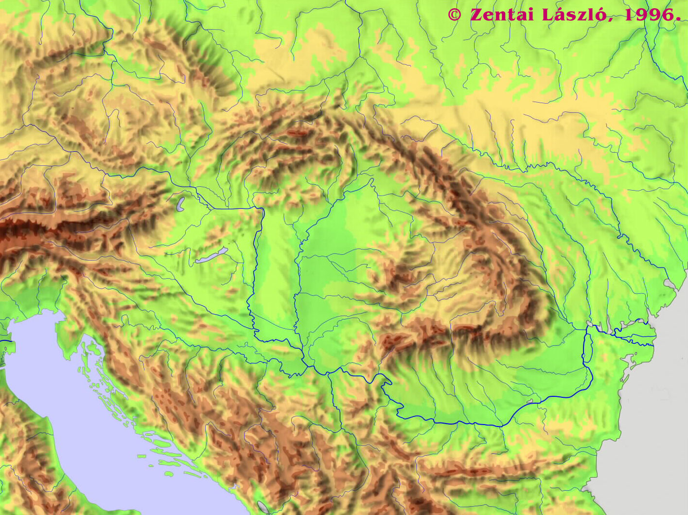
Zentai L (1996) A Kárpát-medence domborzata [Topography of the Carpathian Basin]. http://lazarus.elte.hu/hun/summer.jpg. December 2008
Zsemle F (2000) A hidraulikai rezsimjelleg terepi észlelésen alapuló értelmezése az izsáki Kolon-tó környezetében [Evaluation of the hydraulic regime-character of groundwater-based field observations]. MSc Thesis, Eötvös Loránd University of Sciences, Hungary
Acknowledgements
The authors gratefully acknowledge the assistance and contributions received from the following agencies and individuals during the course of their research. Data and logistical support were provided by: the Kiskunság National Park (A. Iványosi-Szabó); Lower-Danube Valley Environment-Protection and Water-Resources Directorate; Institute of Environment Protection and Water-Resources Research Ltd; Hungarian Geological Survey (A. Bartha); and the Institutes for Soil Science and Agricultural Chemistry, and Ecology and Botany (Zs. Bakacsi and Zs. Molnár, respectively) of the Hungarian Academy of Sciences. Chemical data interpretation contributions are acknowledged from: I. Varsányi, University of Szeged; Gy. Pogácsás, Eötvös Loránd Science University (ELTE) in analysis of tectonic structures along HD2–HD2′. L. Máté; K. Nyúl; Sz. Simon; R. Varga, and F. Zsemle, former students of ELTE, kindly contributed results from their graduate theses. The above research would not have been possible without the financial support from Grant No. T 047159 of the Hungarian Scientific Research Fund (OTKA) to the first author, and Research Grant No. A-8504 from the Natural Sciences and Engineering Research Council of Canada (NSERC) to the second author.
Author information
Authors and Affiliations
Corresponding author
Rights and permissions
About this article
Cite this article
Mádl-Szőnyi, J., Tóth, J. A hydrogeological type section for the Duna-Tisza Interfluve, Hungary. Hydrogeol J 17, 961–980 (2009). https://doi.org/10.1007/s10040-008-0421-z
Received:
Accepted:
Published:
Issue Date:
DOI: https://doi.org/10.1007/s10040-008-0421-z